PORTLAND, Ore. (KOIN) – It was this time last month when we started to make some headway on the snow water equivalent across the state.
The Snow Water Equivalent (SWE) is a snowpack measurement used by hydrologists as a running indicator for the amount of liquid water tucked into the snowpack. It is equal to the amount of water when the snowpack melts.
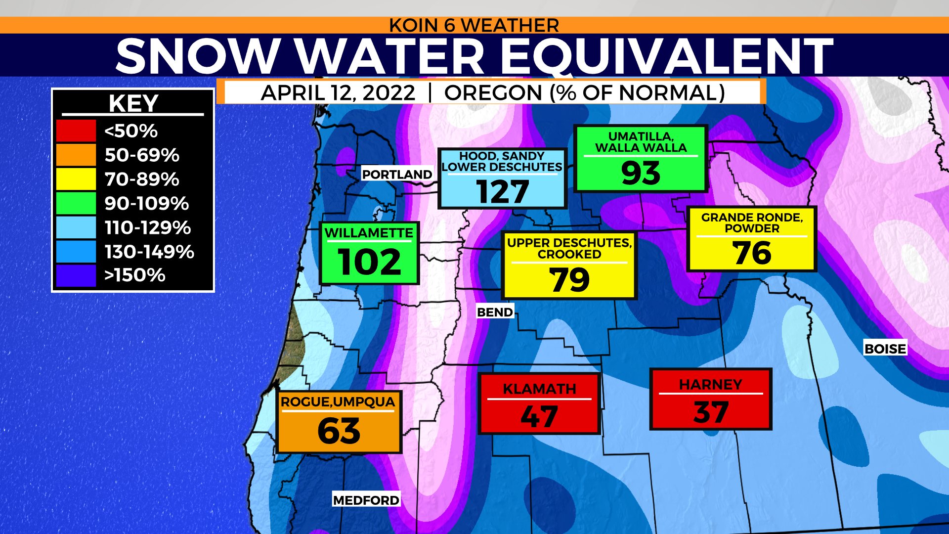
We know how the story has unfolded from that moment. We have continued to bring in cool and wet weather. This has helped bring a massive resurgence to our snow water equivalent across the state in just three to four weeks. You can view the slide below to see what the SWE was as of April 12, compared to where we are currently.
We’re seeing a significant increase for each basin, with serious improvements to the southern basins across the state (check out Harney). We have strengthened the SWE around our local basins that were already doing better than the surrounding terrain.
There are currently three basins that are greater than 150 percent, including the nearby Willamette basin. It has been a lucrative spring!

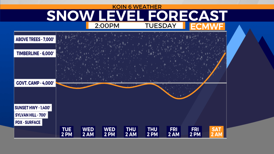
There is room to buttress this whole scenario with even more spring snow. The snow level will remain around 4,000 feet through the remainder of this week. This is going to help prevent any snowmelt and it also means any water that comes cruising in the area should help produce even more snow for the state. The more we can get before the weekend, the better.
We have one good soaker coming across Thursday, which will spread beyond the mountains and into some of the drought-impacted heavy spots in Oregon.
Due to a neighboring area of high pressure, we are going to likely see the snow levels jump by Saturday. It will be a close call on how warm we actually jump, but there will be some mild air in the vicinity. There is a chance that the forecast continues to trend cooler by the weekend, leading to lower snow levels than weather models are advertising early this week.
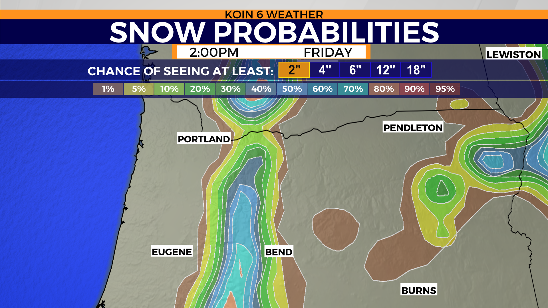
As we look at the snow probabilities for the area, you can see that the central Cascades and the Wallowa mountains are going to be targeted for the most success. This is only portraying the snow probability for at least two inches of snow. Some of these locations will pick up much more than that (above 5,000 feet).
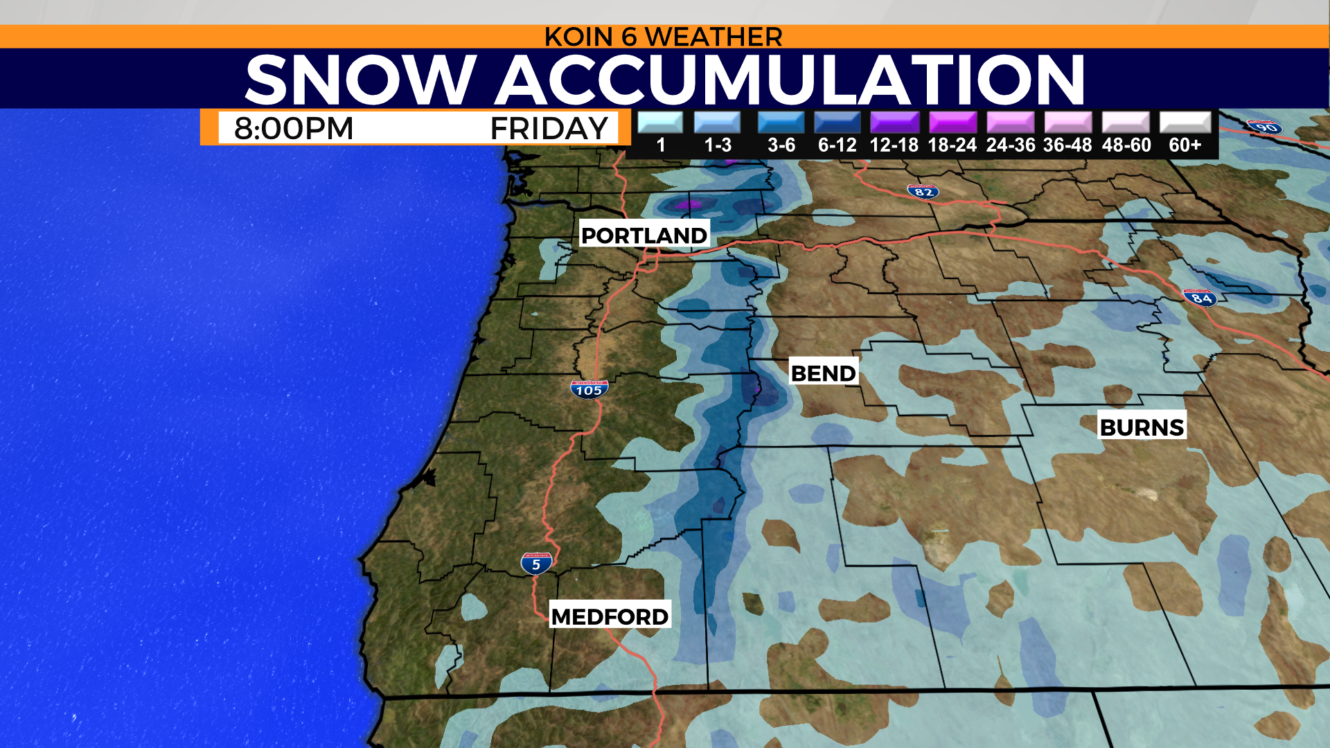
The snow accumulation map has some hints of a half-foot to even a whole foot of snow for the Cascades in Washington. The tracking of this system should once again help out the southern basins in Oregon. You can see how there will be some minor snowfall from the Rogue basin, east.
The question is now how long will we keep this weather going and will we see ongoing improvements. We will continue to keep up with the weather pattern as we push through spring.