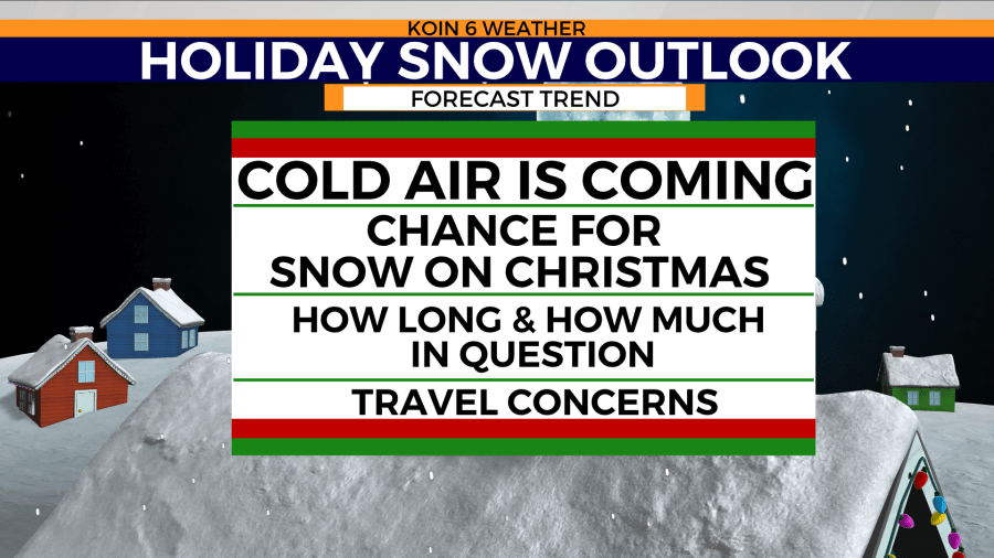
PORTLAND, Ore. (KOIN) – Mother Nature may give us the gift of snow this holiday season.
One percent is usually the chance for snow on Christmas in Portland (1940-2019). That doesn’t sound promising, but this year, our chances are looking much better.
We had a trace of snow in 2017, but you may remember in 2008 when Portland brought in 0.9 inches of snow. That makes this year special because we have a chance to join the shortlist of snow on Christmas Day in Portland.
What we know right now is that the cold air is going to be coming in to finish up December and to start the New Year. That cold air is expected to move into Oregon on Christmas day. This will ramp up the chance for snow, especially by Christmas night. How much snow is out of the question right now, and I should also state that it could hold off until Sunday. Let me explain why we are going to have a better chance this year.
WEATHER PATTERN
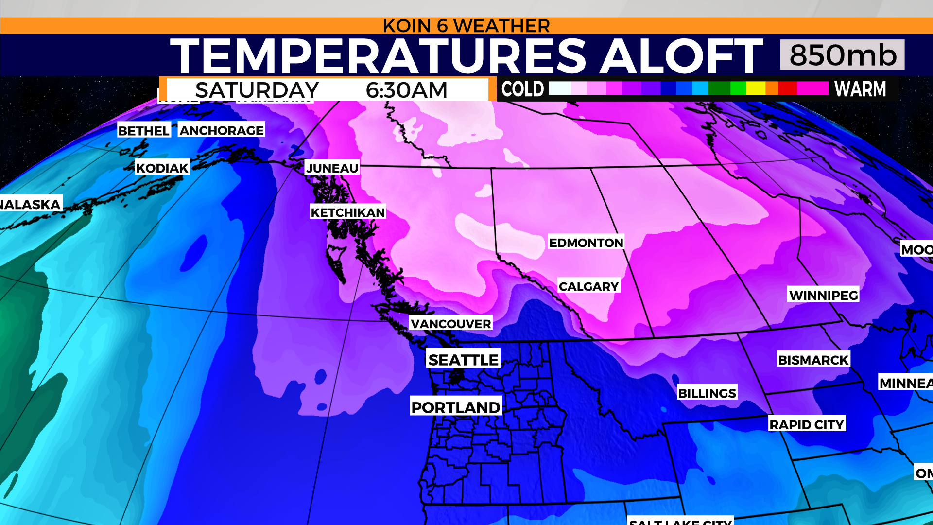
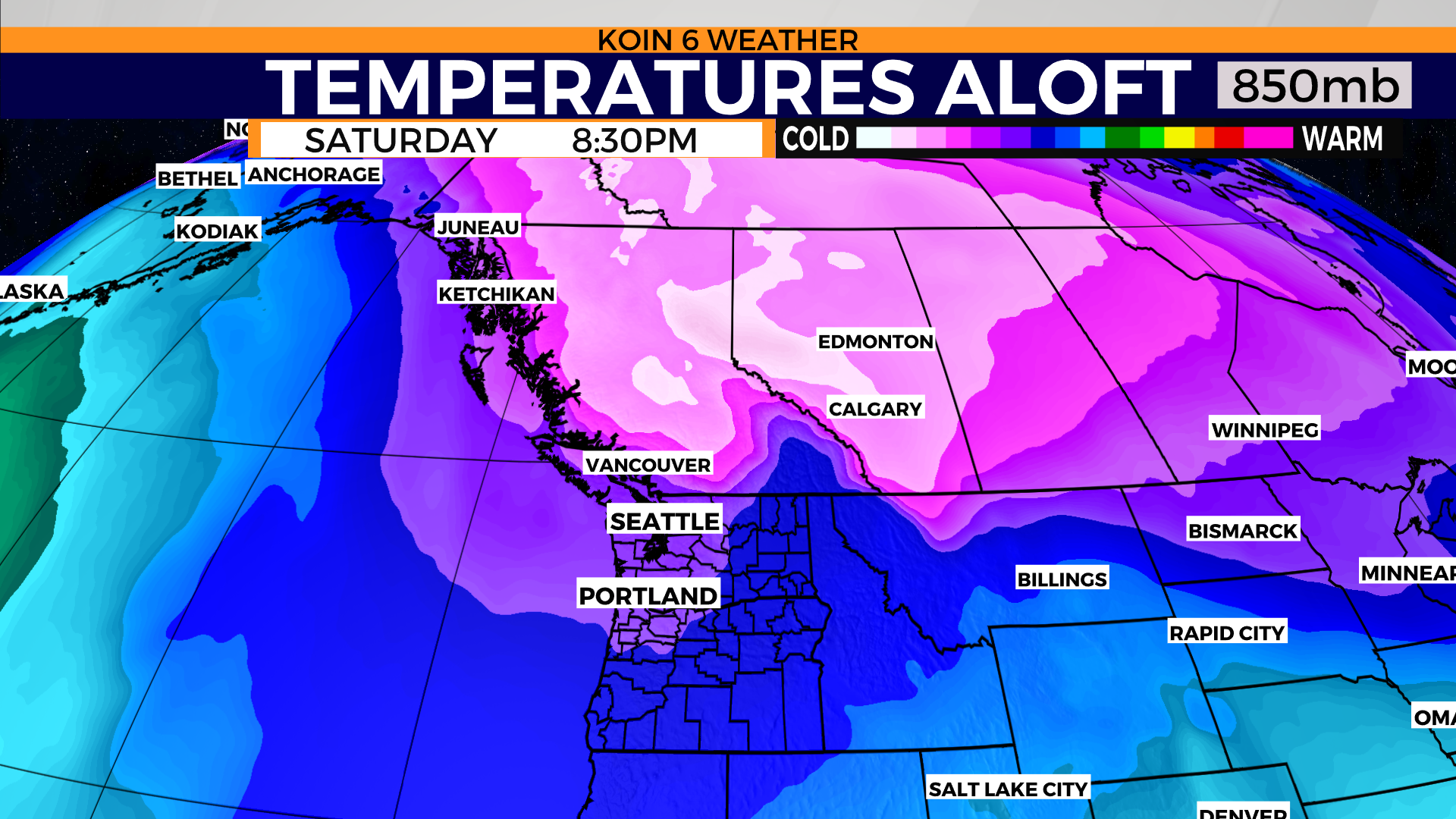
The weather pattern that is expected to develop over the Pacific Northwest (PNW) is the pattern we look for to support snow. Arctic air will start to move in during the day on Christmas, dropping temperatures quickly. The timing of this is going to be a close call since it won’t be quite cold enough on Christmas morning, however, the nighttime hours could be cold enough.
Right now, I wouldn’t expect snow on the ground for the morning, or even an afternoon celebration, but you may get to wrap up the night with snowflakes. This is promising because the hard part for Portland is definitely the cold air. We know that we can have plenty of water in December, but it doesn’t always translate to snow for the valley floor. We use temperatures aloft to show the cold air advection, which is a way to track the transportation of air.
Futurecast is calling for mountain snow, coast range snow, and snow traveling south out of Oregon to California during the morning hours. If you’re traveling outside of the Willamette Valley, you will want to be prepared for snow by morning. I won’t rule out some snow mixing in with rain, but it is not expected at this time (we have a few more days to fine-tune this forecast). By afternoon, there isn’t much of a change.
We start seeing signs of a wintry mix out towards the Oregon coast and over the ocean. If you cycle to the final futurecast graphic, you can see how most of the precipitation turns over to snow. This does mean the Oregon coast could pick up snow as well. It’s an aggressive outlook at the moment, but there is definitely an opportunity for it.
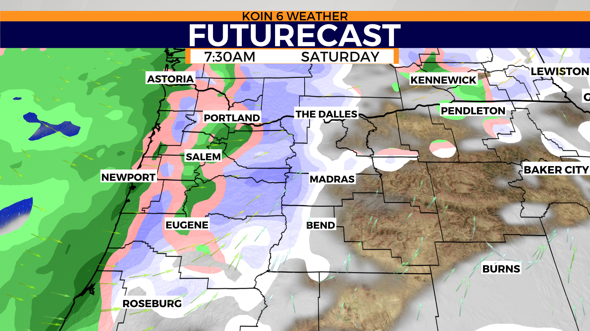
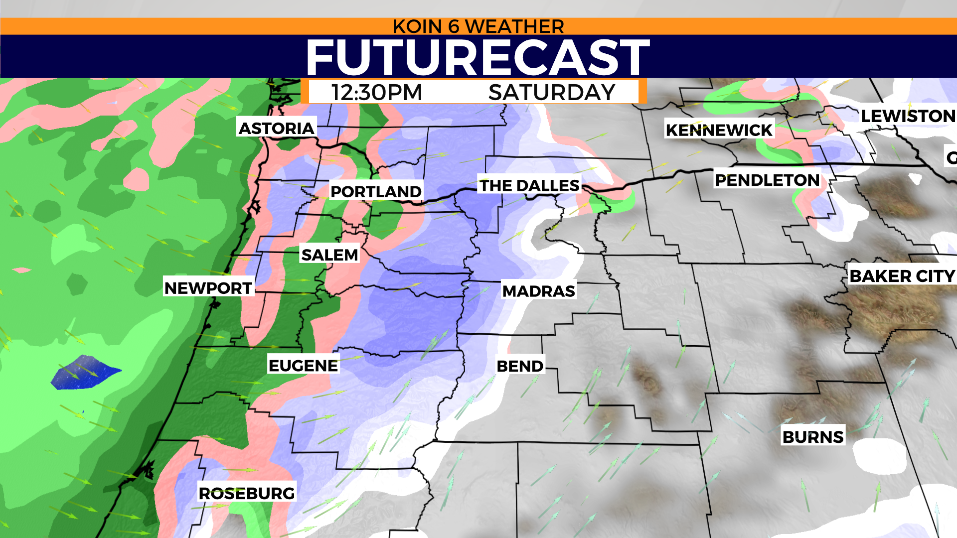
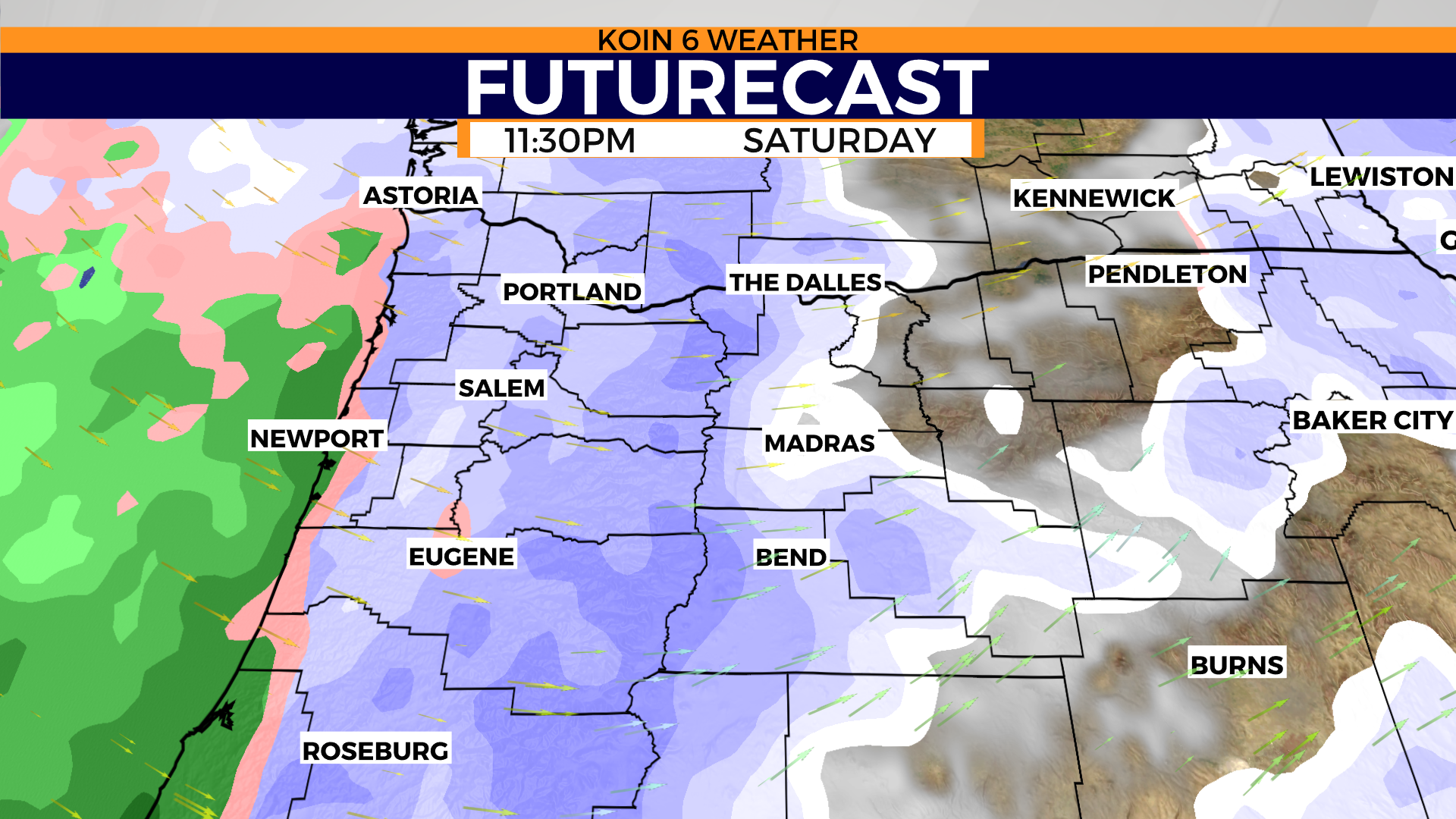
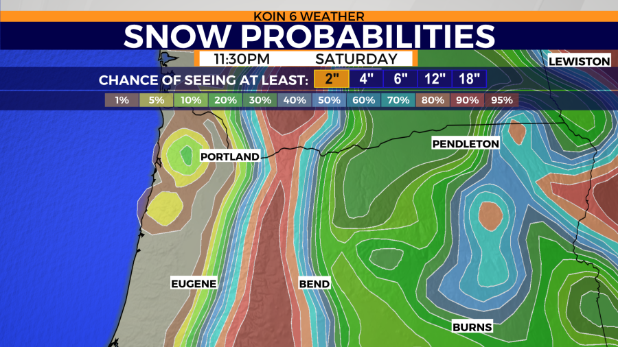
The snow probability chart is favoring snow for the east side of the Willamette Valley compared to those banked up near the coast range. I would take it for a grain of salt at the moment. I do believe the chance for snow will increase for those on the west side based on the information that we have above. There is no doubt we are in store for plenty of mountain snow though.
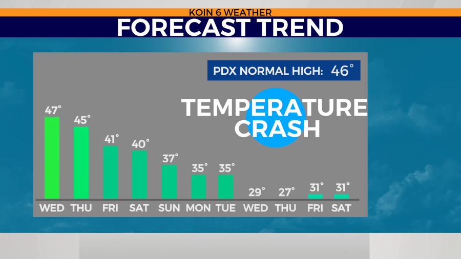
Check out the forecast trend for the next 11 days. Temperatures are expected to hover in the mid to upper 40s before falling abruptly next week. Although the forecast high for Saturday is 40 degrees, we know that it can cool down quickly. In fact, when we had snow on Saturday night, the daytime high was 54 degrees. Again, the weather models are still trying to figure it out, but this may be an aggressive forecast for next week. I would expect conditions to be in the 30s, we will see about the upper 20s. This is a sign that if we get snow, it will stay on the ground for a while. It would be tough for us to hit a cold spell and not have any moisture move in. Sometimes we do have an arctic high that sets up, but the moisture generally finds a way into the PNW during the winter.
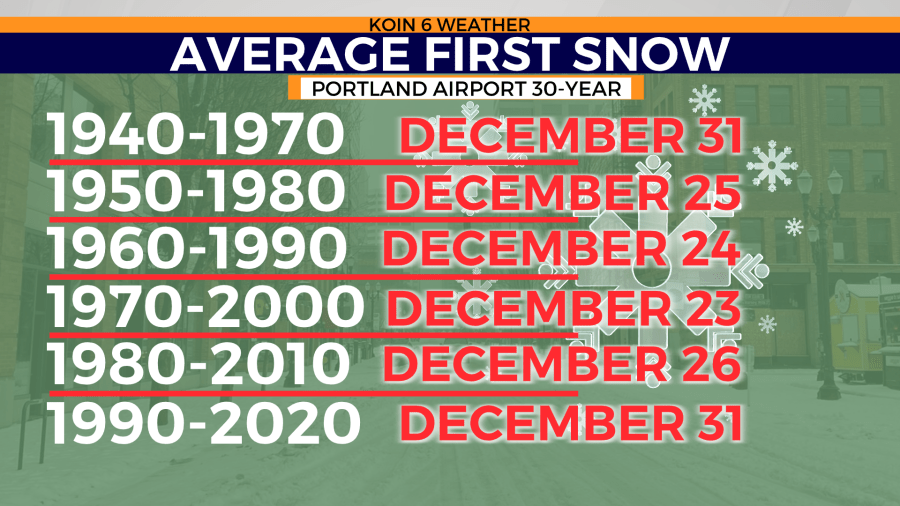
Lastly, this is the window of the year that we tend to see our first snow. Now we already had that on Saturday night, but this is to show that the end of December can be an active part of our winter. If you look at the 30-year average going back through the last six sets, you can see that snow around Christmas or New Year’s Eve is more common than we may think. Yes, actual snow for Portland on Christmas is low, but snow in Portland, in general, is tough. This is more of a sign that we tend to find cold air around the end of December compared to earlier in the month.
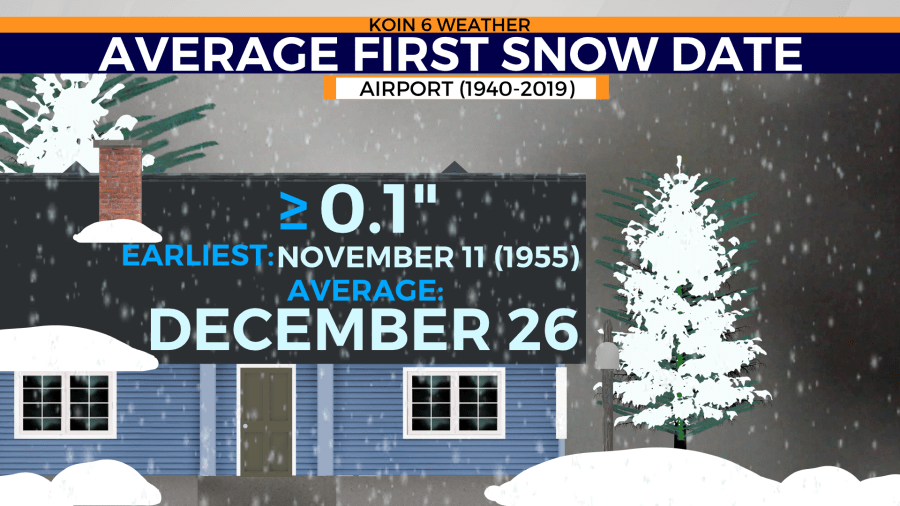
The average first snow date for Portland is Dec. 26, which may be the day we need to focus on this year because that is when the cold air really moves in.