PORTLAND, Ore. (KOIN) — Spring-like weather continues to find its way into the Portland metro area this weekend.
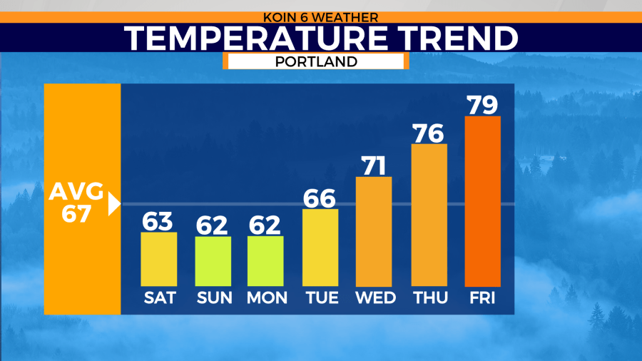
Afternoon highs will warm into the low to mid-60s Saturday as mostly cloudy skies remain. It’s that cloud coverage that will keep temperatures below average through Sunday.

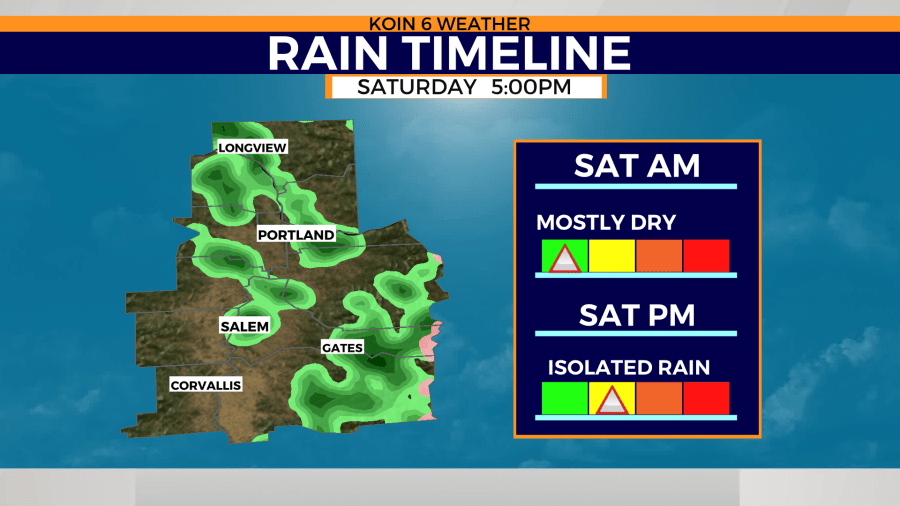
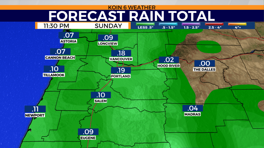
A few hit and miss showers will start to bubble up over western Oregon and Washington during the afternoon hours. Additional rainfall will be limited through the week as rain chances decrease slightly Sunday. Nearly a quarter of an inch of rain is possible through the weekend with the greatest amounts found along Interstate five.

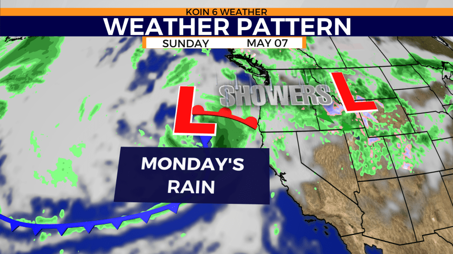
This wet weather trend will likely continue through the start of the new week. This comes as a strong low pressure system grows over the Pacific Northwest. Portland’s next storm will swing through the Pacific Northwest Monday.

Monday’s storm is the last chance to see heavy, widespread rain next week. A warming trend begins to take shape over much of the country. Some forecast models are sending Portland into summer-like territory by the end of next week.

It will be a gradual climb until Portland sees those highs return to above average conditions.
