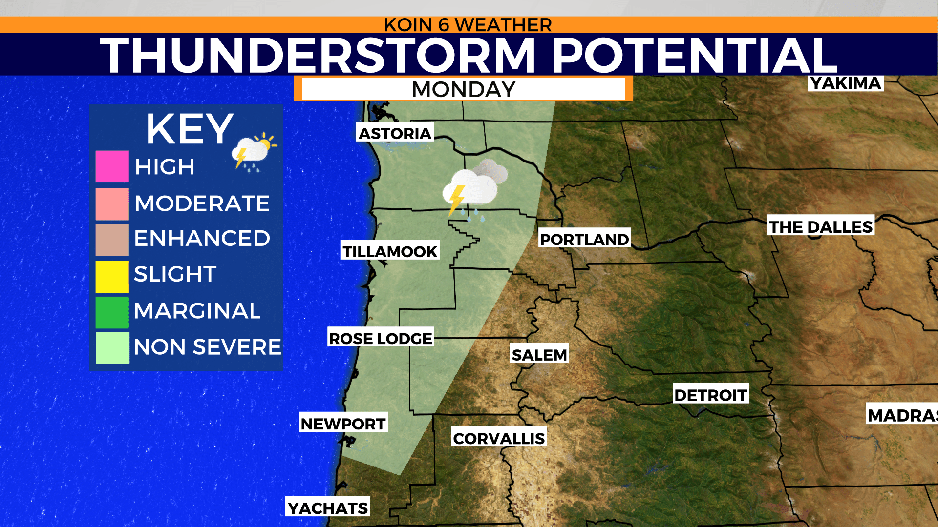
PORTLAND, Ore. (KOIN) — Storms will continue to bubble up Monday afternoon as the atmosphere remains unstable due to strong wind, surface warming, and that cold air aloft, increasing the thunderstorm potential that started during the day and concentrating on the Oregon Coast and coast range hills by evening and night.
This adjustment will take the risk of storms out of areas east of Interstate 5. However, that does not mean we won’t have an isolated downpour with some small hail around Portland. The adjustment eliminates the storm threat from The Dalles region, which was under that potential earlier Monday morning.
You can find the updated zone in the slideshow below. Areas around the Columbia River between Wahkiakum County in Washington state and Columbia County in Oregon are open to storm development. That storm chance will skim part of Washington County, including communities like Forest Grove and potentially areas of Hillsboro.
The delineation for storms will not be confined directly to the zone, depicted below, and there will be enough energy for some storms to pass that line over into areas near downtown Portland too.

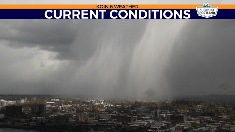
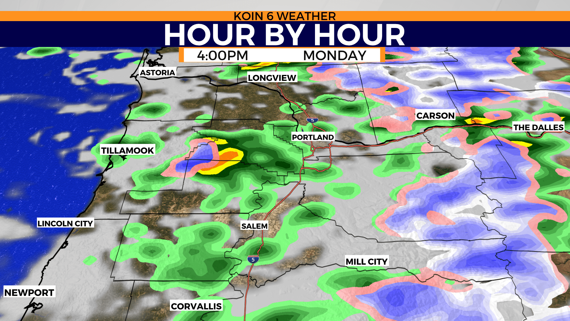
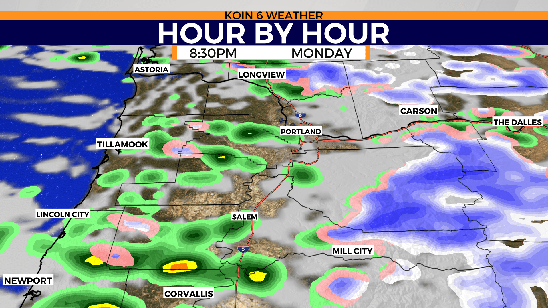
The hour-by-hour forecast is suggesting more development from late afternoon into the evening hours on Monday. What has been most evident from these storms has been a brief moment of heavy rain and lightning.
You may find some billowing clouds in the distance followed by a period of gusty wind and then heavy rain as the storms hit the valley. If you hear thunder or see any lightning, make sure to spend about 20 to 30 minutes inside if possible as the storm passes.
Most of the storms have been developing over the coast range. It is also possible that there is a funnel cloud or two on Monday afternoon. We will have to monitor conditions to see if anything more significant can come to fruition. As a side note, there will be plenty of snow to come out of this event too.
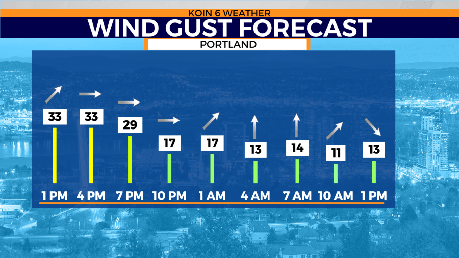
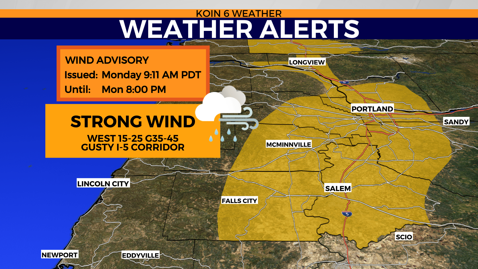
Outside of the storms, we will have a strong west wind for most of the afternoon and evening. A wind advisory will hold until 8 p.m. Monday. The I-5 corridor and surrounding hills will be breezy until sundown. Conditions will ease up a bit Monday night into Tuesday. It’s possible for the wind to gust around 35 to 45 mph through the evening commute.
For those of you that are thinking about getting out for an evening walk or ride, make sure you have your rain gear ready. You will also have to work around the wind too. You may want to hold off if you don’t have the gear. We will have some really nice weather coming in by midweek. If not, early Tuesday morning should have a fairly light wind that will be running around 5 to 15 mph. The wind will shift back to the south overnight, eventually turning out of the northwest by Tuesday afternoon.
A strong wind will hold until late tonight for central and eastern Oregon. Although not as stormy, the wind will be enough to cause some issues. We still may have a few power outages or just blowing dust out there. A high wind warning for Pendleton and the I-84 corridor until 11 p.m. A wind advisory for Madras and The Dalles until late tonight too.
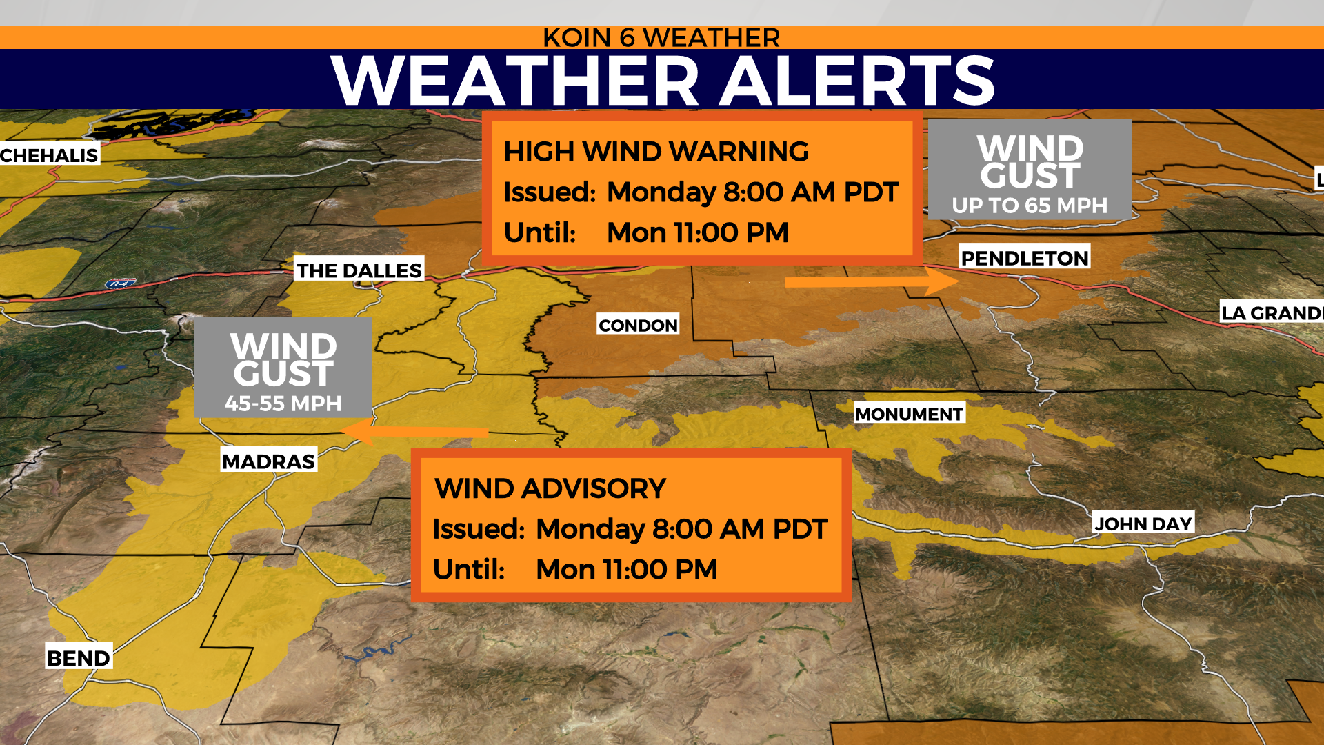
Wind may gust to the 55 mph range at its most vigorous moments.