PORTLAND, Ore. (KOIN) – There comes a time of the year when the rain slows down and the water takes a back seat to the summer parched ground… That time doesn’t appear to be here just yet.
The KOIN 6 Weather team is tracking a potential strong atmospheric river (AR) near the end of the week. Just like all AR events, the rain totals are expected to be high, but the exact location is in flux. An AR is essentially the gauge of horizontal water vapor transportation that can vary from situation to situation. Some conveyor belts of moisture are weaker than others, due to the strength of wind and the amount of water vapor.
What does this mean for Portland and our surrounding communities? Rainy moments are once again possible for the weekend.
CHAPTER 1 – WATER
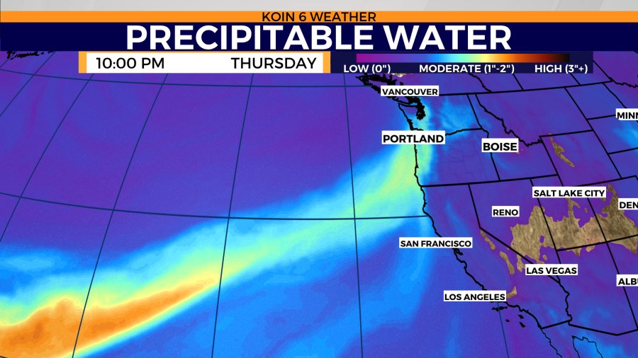
A serious plume of moisture is expected to reach the Pacific Northwest Thursday night. This will be the starting point of what is expected to be an extended period of rainy moments.
That will hit the coast by the evening, expecting to saturate the skies by Thursday night for Portland. It takes more than just a lot of moisture to trigger the rain. A rush of low-level moisture is one way to do it. However, we need some other lifting mechanisms and that will be the help of a frontal boundary or two.
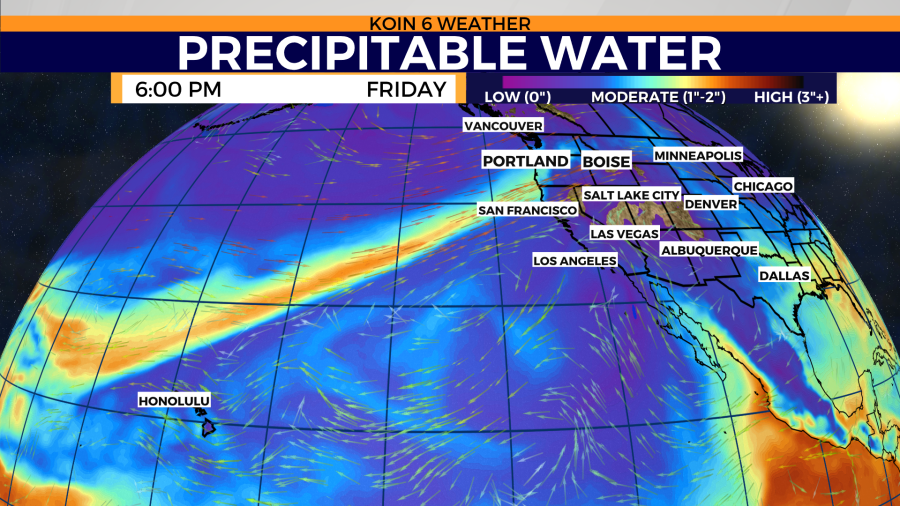
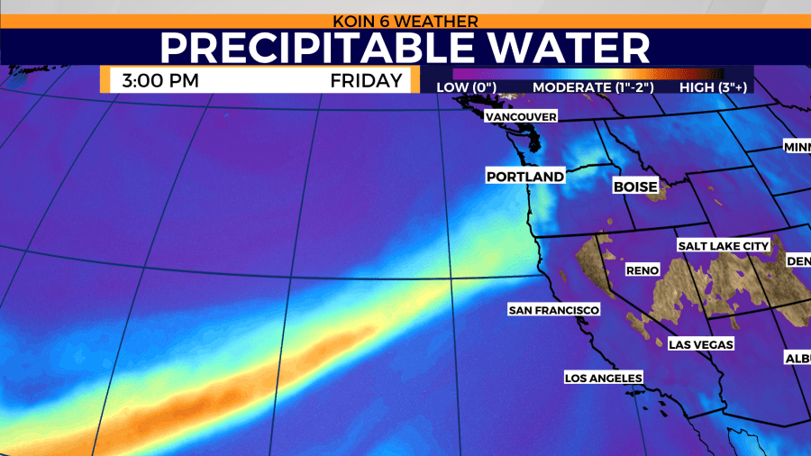
The stream of moisture is expected to “hang out” well into Saturday if all plays out as model data is pushing. You can swipe through the graphics below, which will show a wide and close version of the incoming moisture (in this case, precipitable water). This stream will be rich with moderate levels of precipitable water, based on the scale.

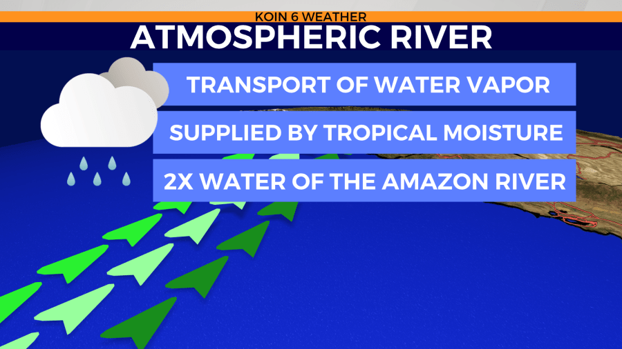
ATMOSPHERIC RIVER INFORMATION
ARs are very significant for the PNW and the west coast. This is when we bring in a large majority of the water that we use. In the winter it may come in the form of rain and mountain snow. In the late spring, it may just be rain. ARs are exactly what they suggest, they are a river of moisture in the atmosphere.
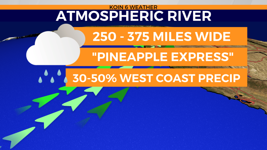
If they trace southwest around the Hawaii region, we refer to them as a “Pineapple Express”. Not all ARs come back to that region, but the ARs that do, tend to have a decent amount of tropical or extratropical moisture. According to NOAA, they account for 30-50%of the west coast precipitation (for now).
CHAPTER 2 – TIMING
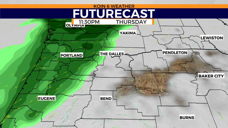
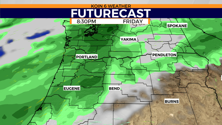
Let’s dive in and look at the futurecast as Thursday approaches. Light rain is expected to begin before midnight. This is when the initial push of that AR is expected to arrive and it should be accompanied by a front. It will be muggy before that rain arrives and it will feel like we have some rain coming in. A building ridge to the southeast is still in the near vicinity, which will keep conditions warm too. That will impact more of the southern portions of the state, which is something to keep in mind as we near the weekend for changes.
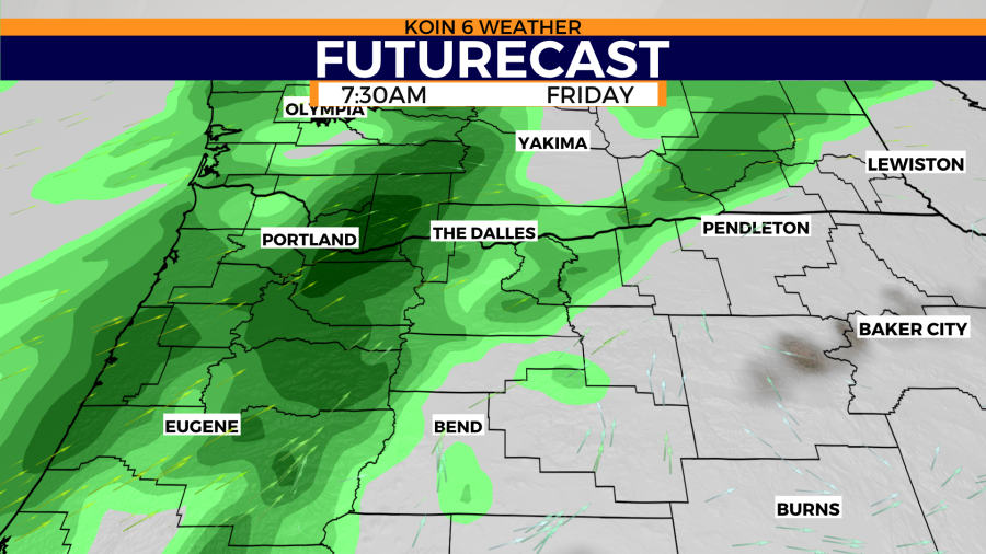
By Friday morning, we should have steady rain around the northern Willamette Valley. Rain out for the Oregon coast. At this point in time, we may start to have rain through the lower Columbia Basin as well. It may be light at times throughout the day, with even a chance for just showers. It seems to pick back up Friday night with more forcing available.
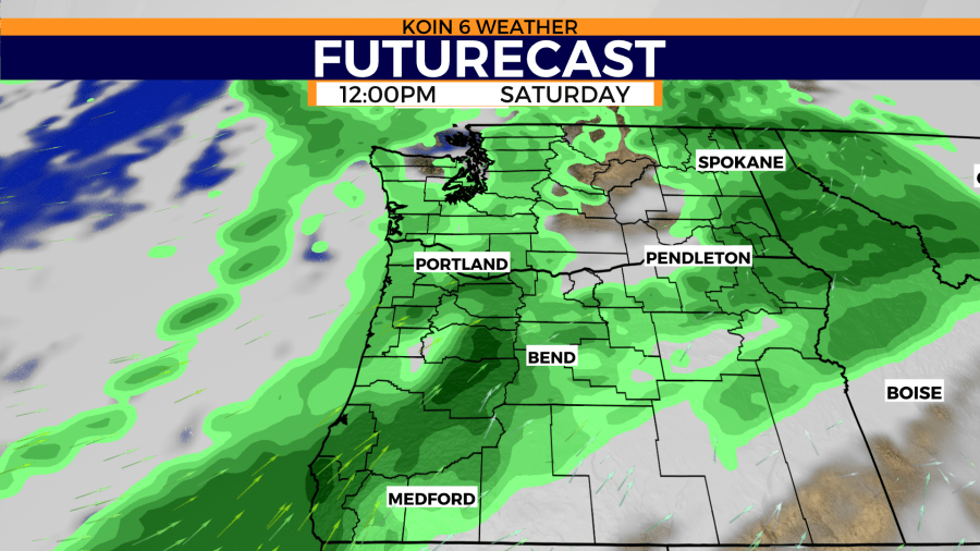
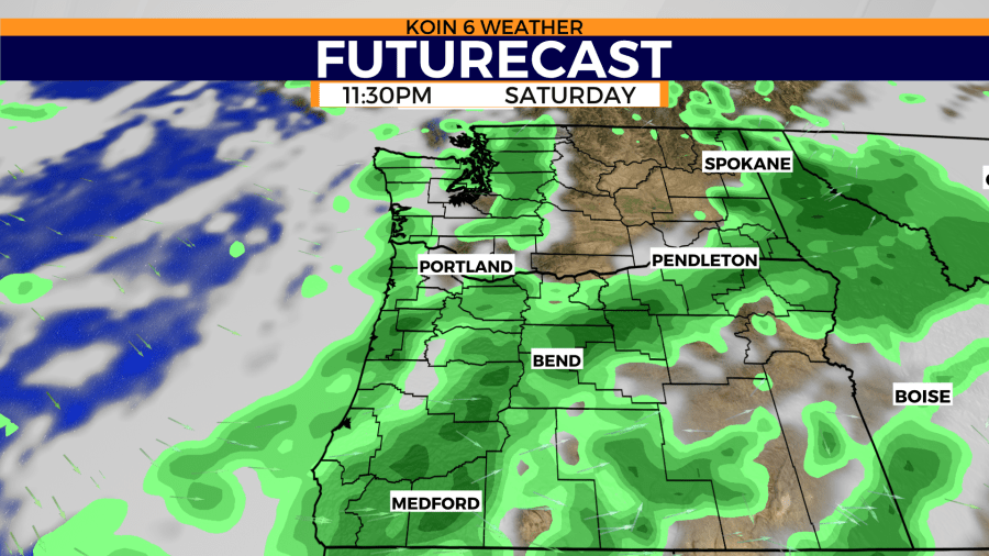
The futurecast is driving the rope of moisture south through the day on Saturday. Expect Saturday to start wet and to likely have showers through the day before the deeper moisture and starts to dive south.
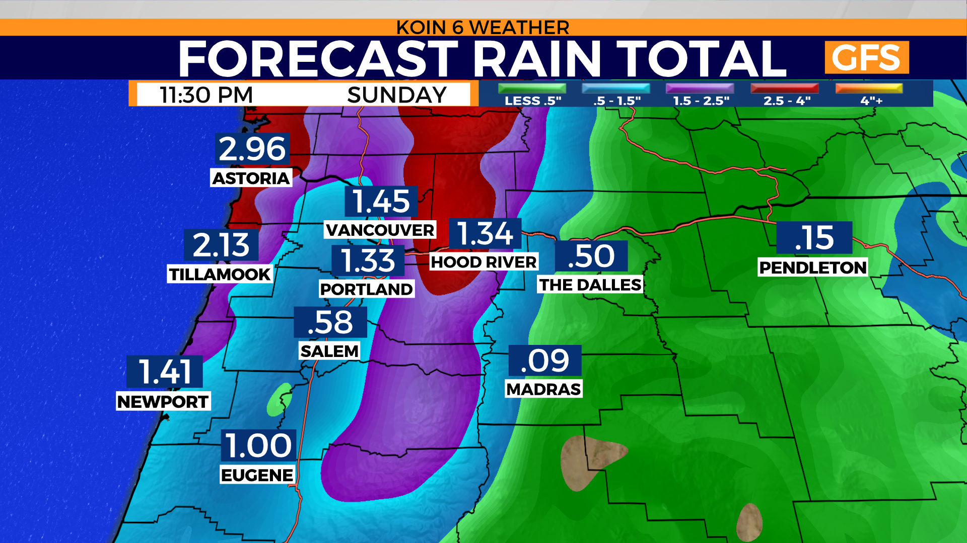
FINAL CHAPTER – ESTIMATED RAIN TOTALS
You can imagine that multiple days of rain can spell large rain totals. There have been major discrepancies across the weather models on estimated rain totals through the weekend into Sunday night. It is possible that many locations see at least one inch of rain through the course of this event. Some weather data is projecting even more than that, with the higher side in the two-inch range.
On the contrary, we have another major advertised weather model that has rain totals slightly lower for the valley and points east of the Cascades. What I would expect as of Tuesday, is that 1-1.5 inches of rain over the course of a few days is possible. The ground may be saturated enough for low-lying areas to have some flooding issues and ponding on the roads will be evident.
We may have some problems around the region. You should plan on wet travel if you are planning to drive. If you’re going to be out at the parade, you will want a rain jacket. You can use the slider below to see the difference between the two weather models. Find all the updates you need at the link below.