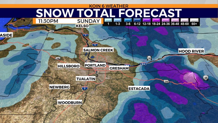
PORTLAND, Ore. (KOIN) — Commuters should expect slick roads, disruptions and the chance for snow Monday morning as a winter weather advisory will be in place for the Portland metro area from 3 to 10 a.m.
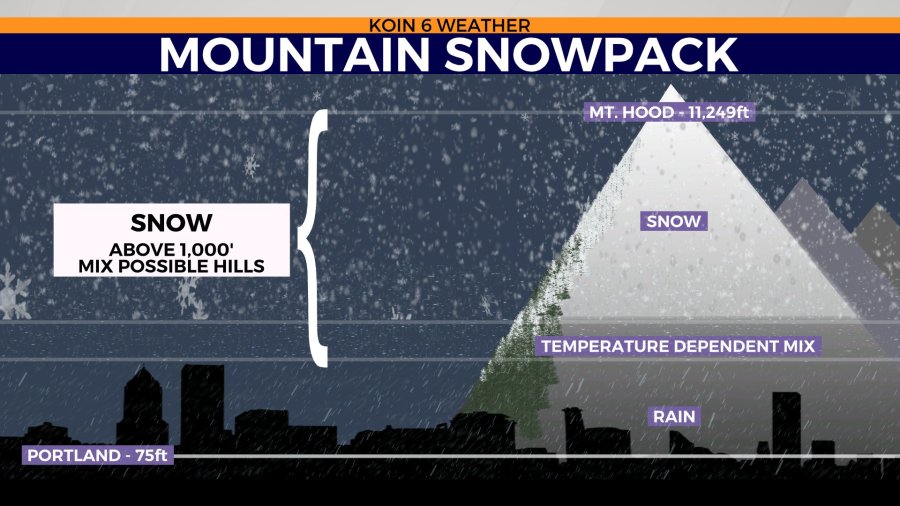
Between half an inch and 2 inches of snow are expected for Monday morning around the metro area and nearby communities. Multiple inches of snow are expected for the hills between 500 and 1,000 feet.
While temperatures will likely be too warm for snow in the I-5 corridor south of Wilsonville, the mountains will receive heaps of it.
By the afternoon, temperatures are expected to rise enough to melt away most, if not all, of the snow.
There are days in the spring that feel more like summer and then there are days in the spring that feel more like winter. We have a stint of cold, wet weather that is going to feel like we are moving in in the wrong direction.
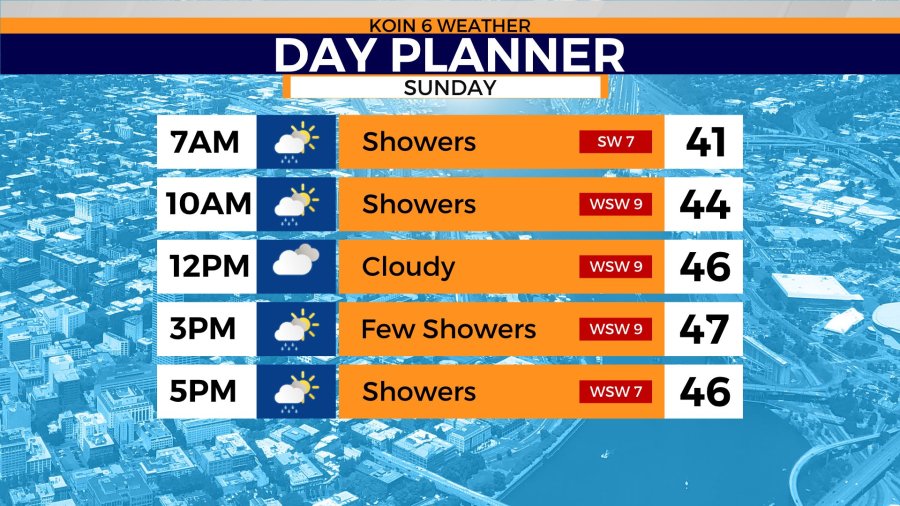
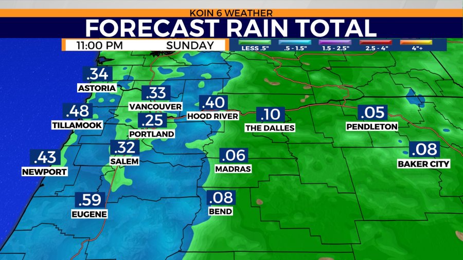
As for Sunday afternoon and evening, it’s going to be chilly out there. You will want to grab a heavy jacket if you’re going to be spending an extended amount of time outdoors on Sunday. Snow levels expected to drop to around 1,000 feet. Rain totals may jump to about a quarter of an inch today, with isolated pockets seeing a bit more or a little less.
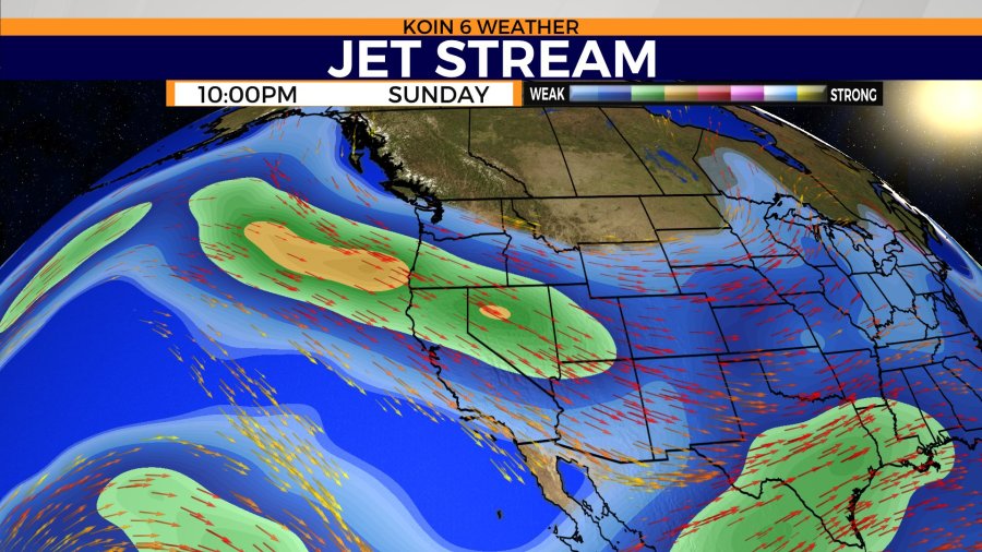
We are experiencing the cold shoulder from Mother Nature right now. If you cycle through the slideshow below, you can get a visual idea of the forecast, too. You will see a graphic that is labeled “jet stream”, which will show the strength of the wind aloft and what will be driving the unsettled weather Sunday.
We have plenty of strong wind aloft that will keep the snow coming for the mountains and that will help continue to produce the snow. Due to the nature of the conditions aloft, and the cold air, we have winter alerts through the coast range and Cascades. Those are in place until Monday.