PORTLAND, Ore. (KOIN) – With spring comes flowers and showers, but it’s also a fairly active time of the season for us when it comes to our weather. We can have a meandering jet stream that brings us multiple waves of moisture, but more often, we are just trying to balance out the cold winter air and the spring sunshine.
At times those clash before the atmosphere can find harmony, so we end up with spring thunderstorms, bringing all types of weather for Portland. One thing that is useful to look at each day is the jet stream, which helps spell out the larger pattern over a stretch of a week and potentially longer. We will monitor the jet stream to search for ridges and troughs; it is also a tool to monitor trends, wind, etc. Let’s talk about the trend that we are picking up on as we wrap up the month of March.
THE JET STREAM
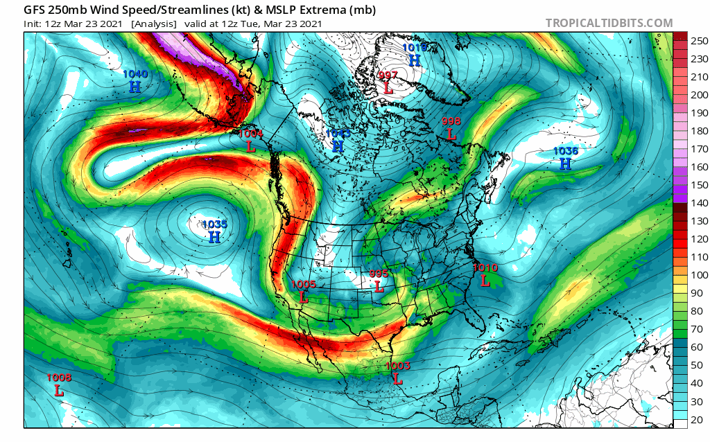
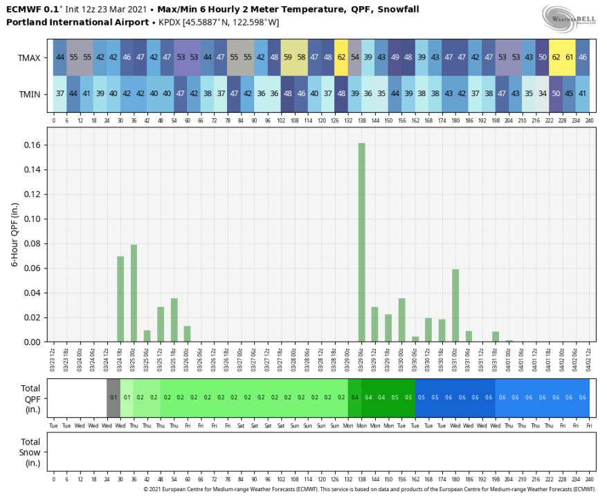
If you follow along with the moving image above, you can watch the next 144 hours, which shows there are two important things coming up. When you are watching the fluid dance of the jet stream you’ll first find a steady drop come Wednesday. That puts that jet almost straight north to south right into the Pacific Northwest (PNW). This is going to be the system that arrives on Wednesday, bringing our next chance for rain. We then have a massive ridge of high pressure take over until Monday. That means we stay dry for nearly three days. There will be one more opportunity for rain on Monday (tentatively), before drying out for the start of April. You can see the spike for rain in the graphic below for Wednesday and then Monday morning (March 29).
Here is an idea of that rain moving through on Wednesday. It’s possible that we have some light rain by morning, increasing through the day. This is going to bring in more snow for the Cascades, both in Washington and Oregon, and plenty of rain for the coast range, with that moisture finding a way all the way down the Willamette Valley. This system will bail by Thursday, leaving a few scattered showers until fully drying out by Friday.
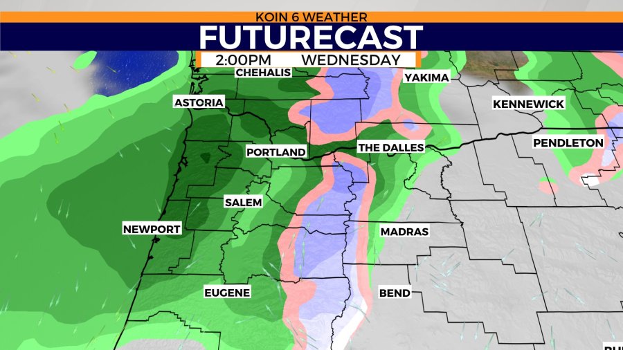
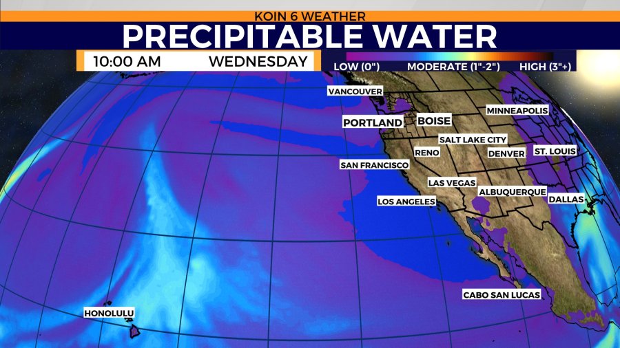
We will take a look at that rope of moisture that is extending north and bending right into the PNW by early Wednesday. It’s not very deep, but it is likely enough to help squeeze out somewhere around a quarter of an inch through the valley and a for the Oregon coast, somewhere closer to half an inch.
However, with an orographic lift and a stronger jet, the mountains may be able to push 8 inches to a foot of snow. When we are looking at atmospheric river events that will bring in heavy rain, they usually have more of that blue hue, which will bring in moderate moisture all the way from the tropics. The route isn’t as ideal in this case. With an overall dry finish to the month, it’s likely we fall short for the month of March. We are already about one and a half inches below our average for the month.
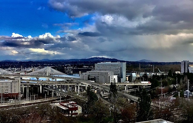
I’d like to leave you with this lovely photo of Portland from Monday, when both sun breaks and showers moved through the city. A representation of spring weather here in Portland.