PORTLAND, Ore. (KOIN) — Today feels very fall-like. Let’s call it Sepguster or Augtember.
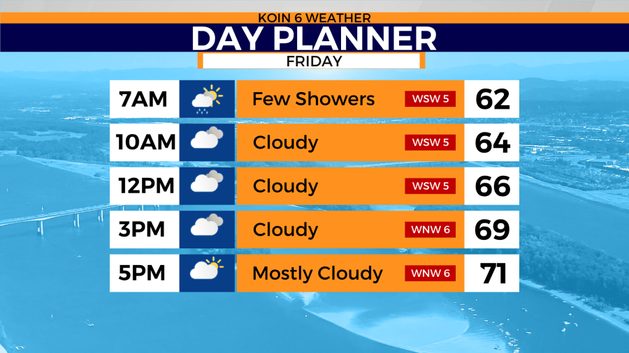
Don’t sit around and wait for a huge warm-up. Morning temps start in the upper 50s to low 60s. It will be cloudy and many locations from the coast to the valley will experience some drizzle or light rain. By the afternoon we’re still mostly cloudy — highs reach a whopping 72-75. That’s about 10 degrees below normal.
So is this a start to a wetter period? Will it be enough to stamp out our severe drought? No. The best chance for real rain accumulations will be at the coast or higher terrain, otherwise not expecting much for Portland – maybe 0.05 inches.
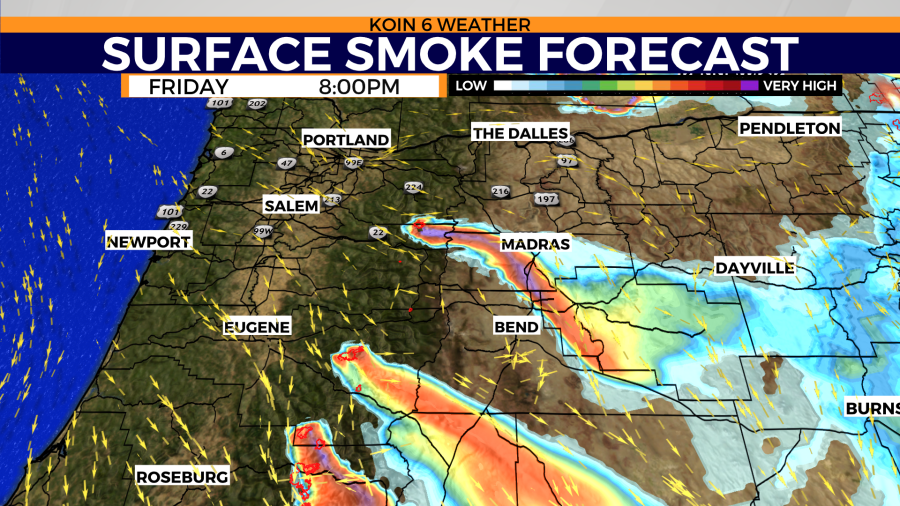
The wind is in our favor west of the Cascades, so Portland expects good air quality for the next couple of days. Smoke blows mostly to the east southeast.
Elsewhere, air quality is still a concern. An air quality alert is in effect through the afternoon for Deschutes, Bend, Redmond, Sunriver, Sisters, La Pine and Brothers.
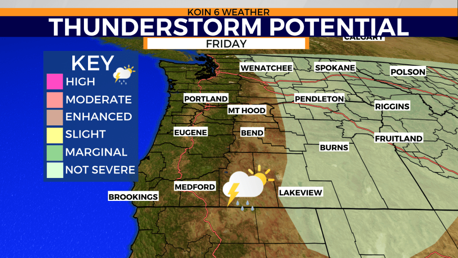
As this cold front transitions east today, you’ll want to pay attention to the forecast before you travel. Plan to see areas of drizzle again by tonight from the coast to the valley. Eastern Oregon and Washington will see the most unsettled weather for the day. Thunderstorms are expected to impact those areas by the afternoon.
If you’re heading towards Spokane — be aware that a flash flood watch will be in effect.
The National Weather Service in Spokane has issued a Flash Flood Watch for Portions of North Idaho, including the following areas, Benewah, Bonner, Boundary, Kootenai, Latah and Shoshone. Portions of Washington, including the following areas, Chelan, Ferry, Okanogan, Pend Oreille and Stevens.
* From Friday afternoon through Saturday afternoon.
* Scattered to numerous showers and thunderstorms will develop Friday afternoon and continue through Saturday. These showers will be slow moving and contain moderate to heavy rain.
* Locally heavy rain in a short amount of time over steep terrain or recently burned areas heightens the risk of dangerous flash flooding and debris flows. Sudden rushes of water in creeks and stream drainages could wash away anyone or thing nearby. Debris flows can cause considerable damage to structures in its way. Road washouts or rockslides are also possible from the localized heavy rain.
https://forecast.weather.gov/wwamap/wwatxtget.php?cwa=otx&wwa=flash%20flood%20watch
“The most intense period of drought occurred the week of August 17, 2021, where D4 (exceptional drought) affected 25.58% of Oregon land.“
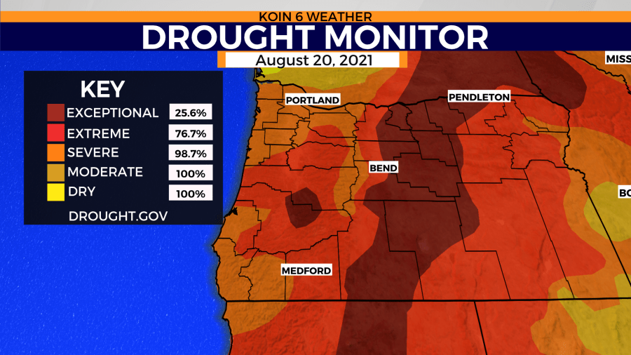
The U.S. Drought Monitor (USDM) is a national map released every Thursday, showing parts of the U.S. that are currently in drought. The USDM relies on drought experts to synthesize the best available data and work with local observers to interpret the information. The USDM also incorporates ground truthing and information about how drought is affecting people, via a network of more than 450 observers across the country, including state climatologists, National Weather Service staff, Extension agents, and hydrologists.
https://www.drought.gov/states/oregon
