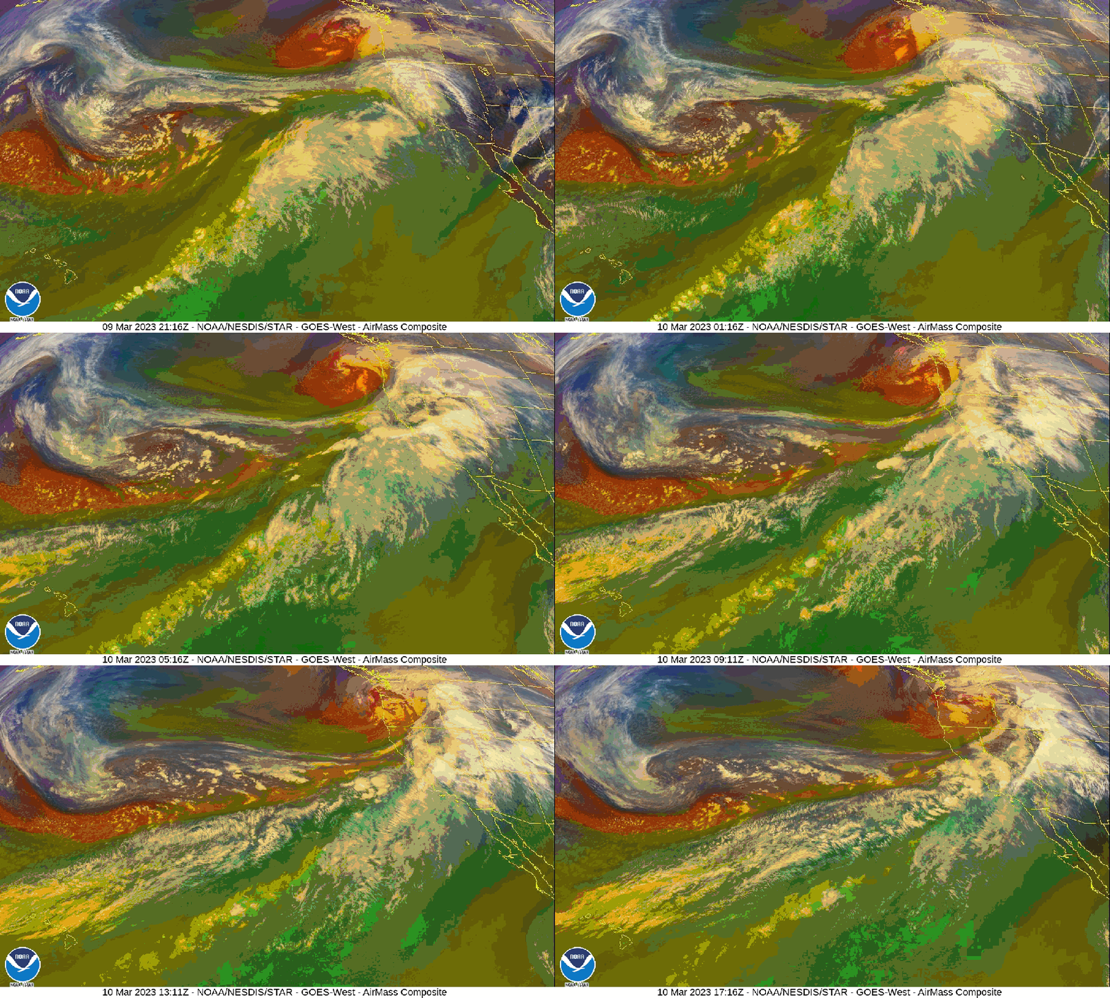
PORTLAND, Ore. (KOIN) — A pair of atmospheric rivers teamed up to hose down the entire Western U.S. on Thursday and Friday, bringing several inches of rain to parts of the region.
A time-lapse of the storms recorded using satellite imagery shows a powerful atmospheric river known as a “pineapple express” bringing heavy rainfall to the Southwest. The time-lapse also shows a smaller, milder atmospheric river funneling moisture into parts of Northern California and Southern Oregon, bringing less than half an inch of rain to the Portland area.

While Portland saw milder rainfall than other parts of the West on Thursday and Friday, KOIN 6 Meteorologist Kelley Bayern reports that a more significant atmospheric river is forecast to move into the area Sunday. The next atmospheric river is forecast to drop as much as two inches of rain on the Portland area by Tuesday.
“We’re back under heavy rain Sunday night with an atmospheric-river-fueled storm coming Monday,” Bayern said. “Monday looks like a soggy day in the city with potential for flooding around the region. We’ll be watching this forecast closely.”
Ahead of the next atmospheric river, the Portland area is expected to remain mostly cloudy with chances of light rain and highs in the lower 50s into Saturday.
