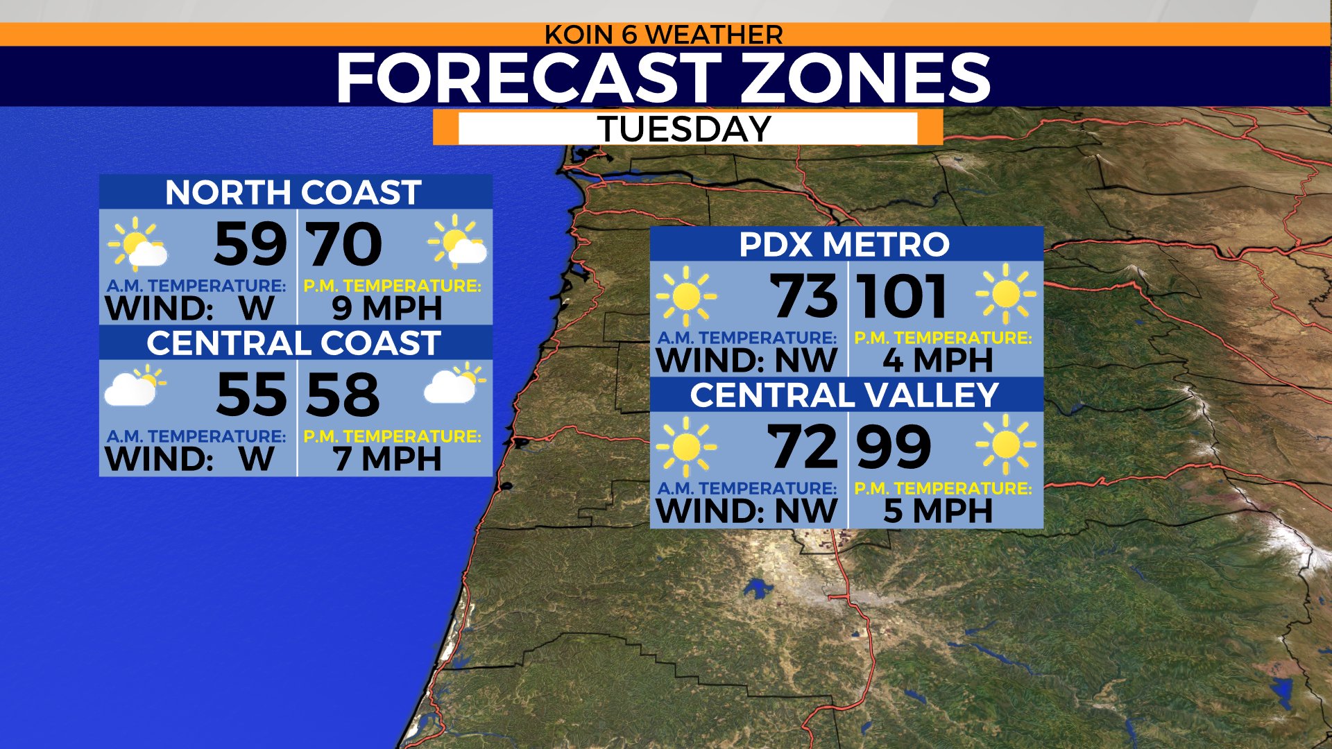
PORTLAND, Ore. (KOIN) – We are back on track for another scorcher of a forecast on Tuesday. Expect the sun to be out in full force and the temperatures to be warming quickly.
This is the type of heat that will be pressing and can cause plenty of things to slow down around here. Expect the temperature to jump into the lower 90s around Portland and the metro area by early afternoon. Portland is expected to hit the triple-digits, which will be right around the record high. The current record high for Portland is 100 degrees, which was set in 2020.
KOIN Coverage: PNW July 2022 Heat Wave
Temperatures are just as warm to the south as the surface continues to warm. This may end up being the warmest day of the year!
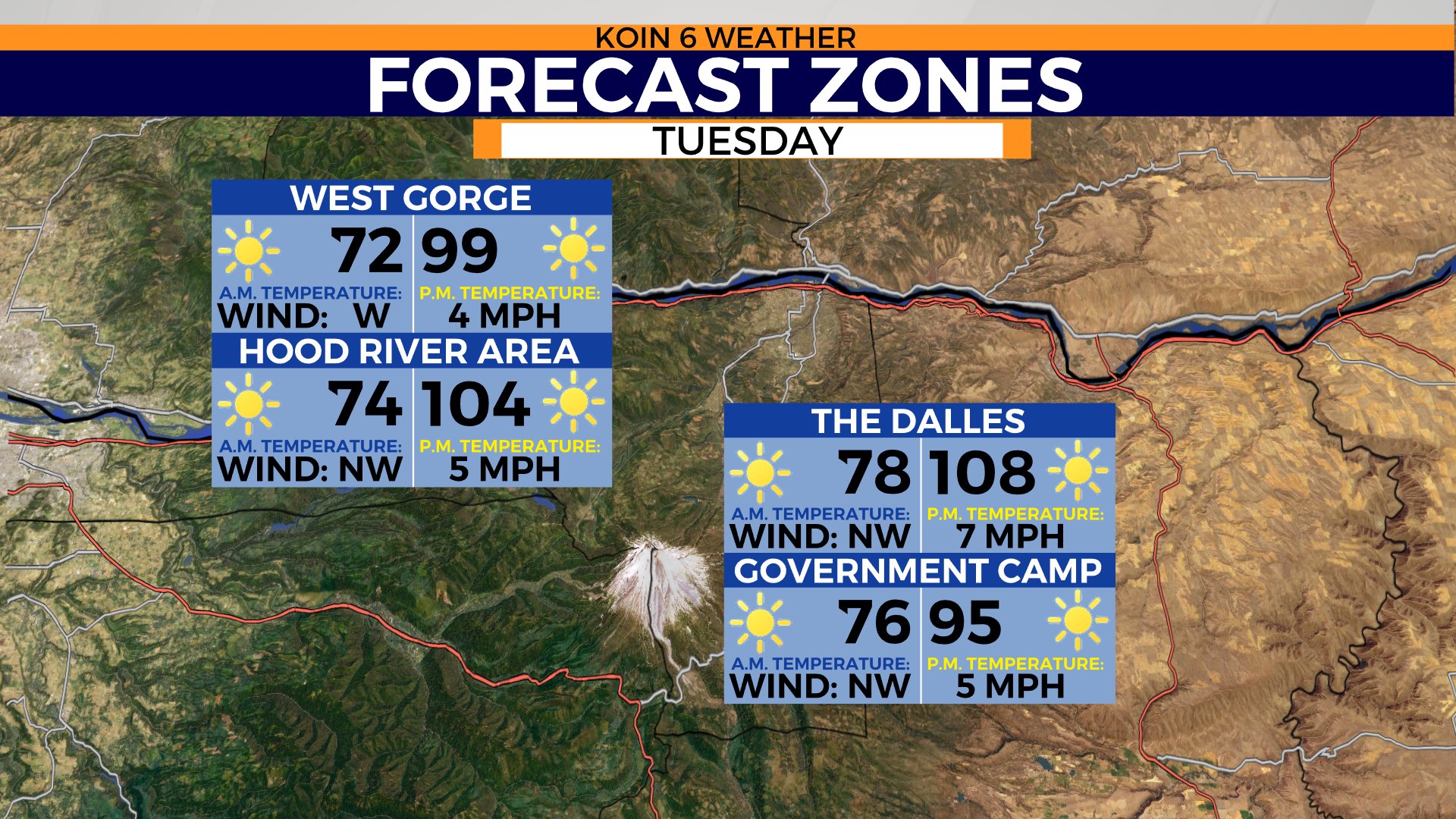
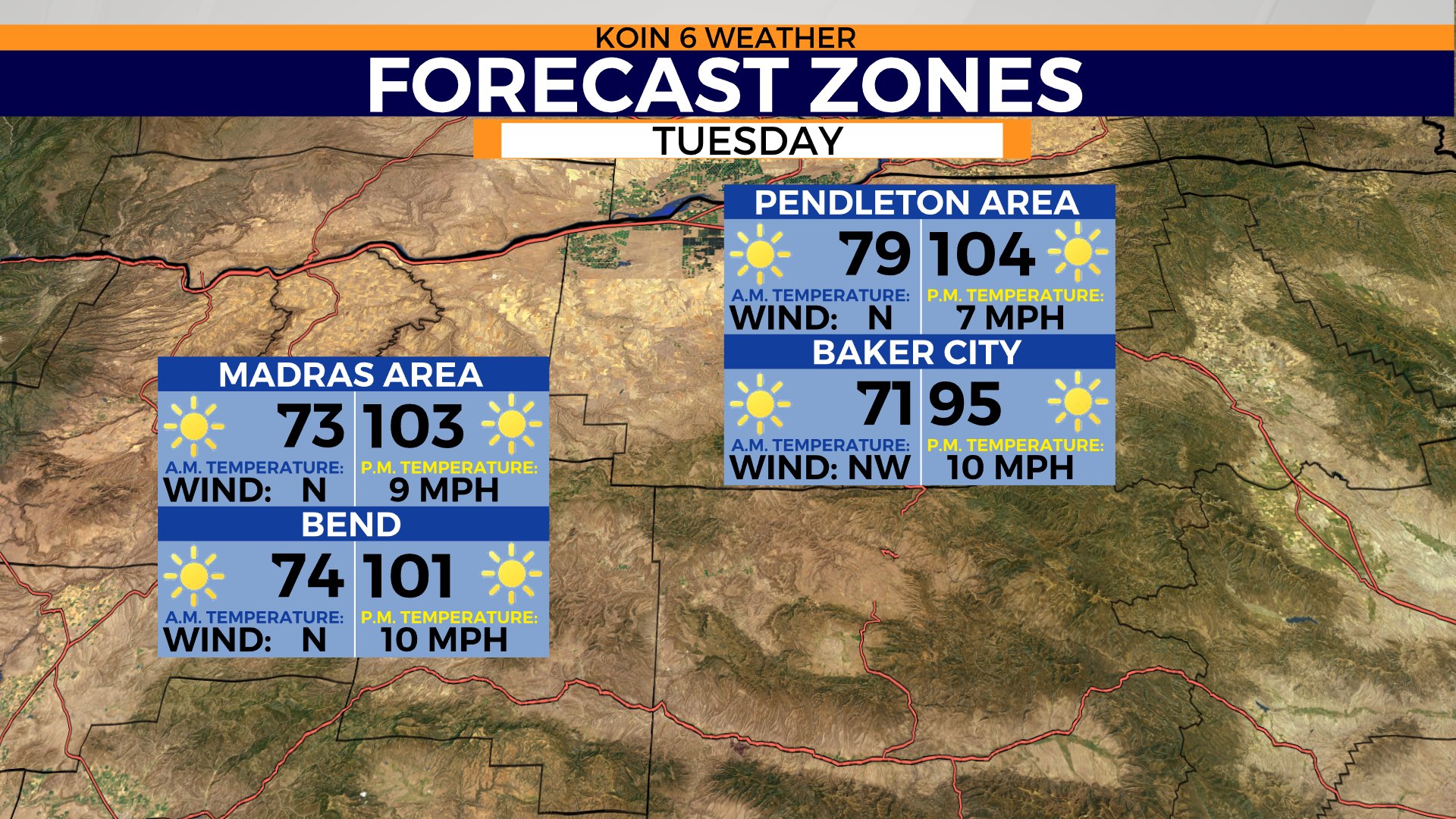
Make sure you have that water bottle filled up and a backup plan if you have any issues with staying cool. Do not expect temperatures to be much cooler if you are going east. Temperatures expected to be near the triple-digits or warmer from Troutdale to Pendleton. The Dalles may jump up to the 108 range for a second day in a row.
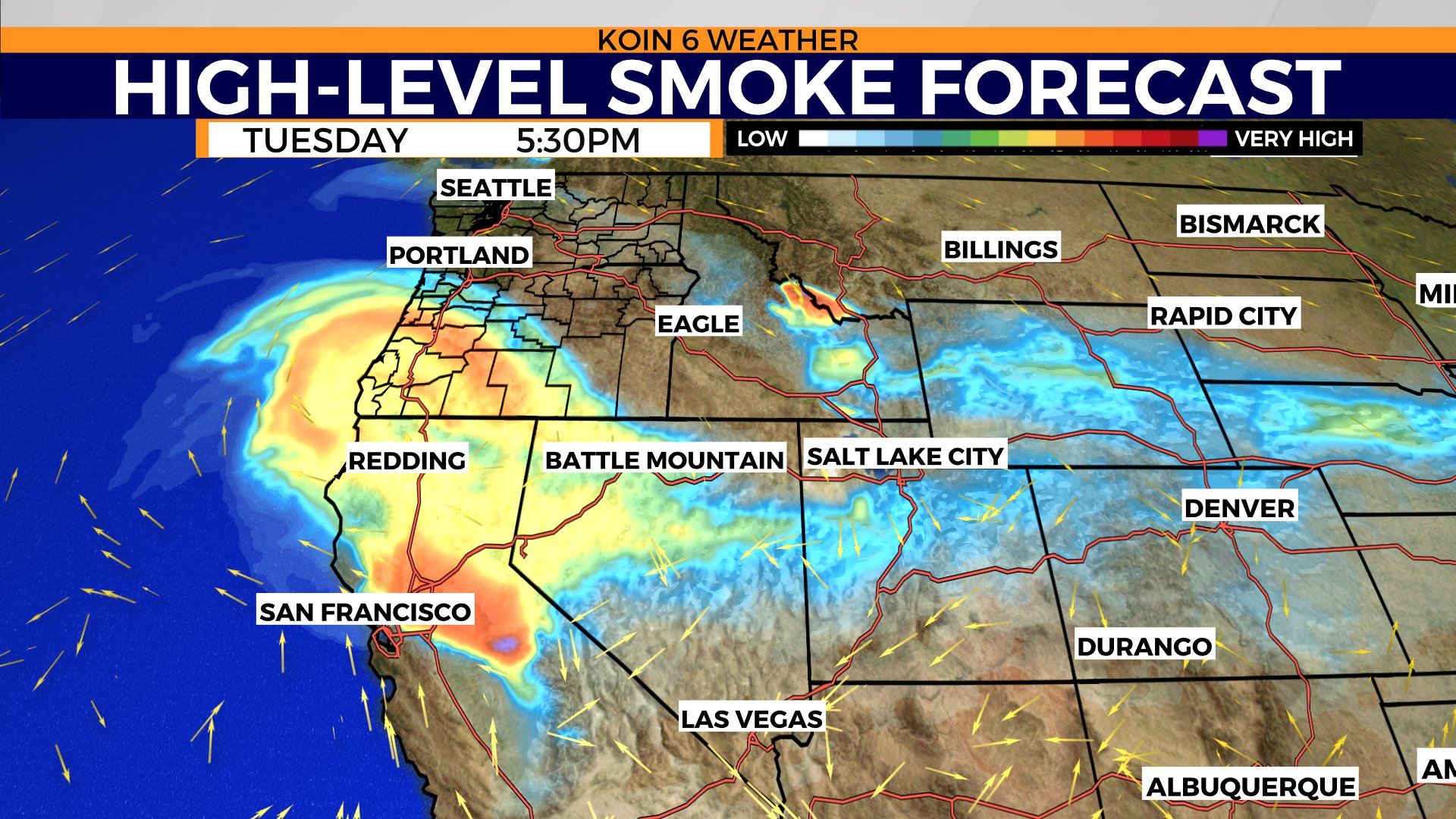
Lastly, there is a chance that we have high-level wildfire smoke moving in from the California wildfires Tuesday afternoon. This may alter the temperatures slightly, but it shouldn’t be significant. The smoke will be thickest to the south. This smoke may hang around through Wednesday as well.