PORTLAND, Ore. (KOIN) – We officially broke the all-time record three days in a row in Portland. We will not make it four days in a row.
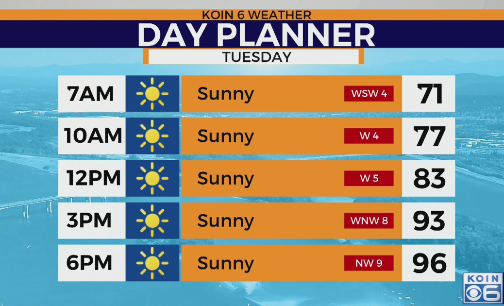
It’s still going to be a hot forecast, but it will be more manageable than the dangerously hot enduring days we just came through. In fact, you will notice a slightly cooler start to your Tuesday. Temperatures may actually fall to the upper 60s by Tuesday morning. We have been above 70 going back to Friday.
If you’re thinking about sneaking in that morning run, you will likely be dealing with temperatures around 70 degrees as early as 6 a.m. or 7 a.m. Those of you out along the Oregon coast, enjoy the morning breeze, which will be running out of the southwest around 5 to 10 mph, with temperatures hovering around the upper 50s to lower 60s after sunrise. It will still be very warm for those of you east of the Cascades to start the morning. Many in the mid 70s and potentially even warmer than that.
For Portland, I think we are going to be topping off in the mid to upper 90s on Tuesday. This beats 115, but it is still very hot. This is going to be temperatures that are closer to 20 degrees above average instead of 35.
What we do notice is that the heat takes a little more time. It will jump by the afternoon, but it won’t be 100 by 11 a.m. like it was Monday. Temperatures topping off in the mid 90s around 3 p.m. to 6 p.m. The west wind, turning more northwest later in the day, should be blowing around 5 to 10 mph. We aren’t expecting that powerful east wind like we had experienced Monday. You should be able to keep those windows open a bit longer than you have been able to in the last 48 hours.
The difference in temperatures Tuesday from the Oregon coast to the Blue Mountains is going to be quite significant.
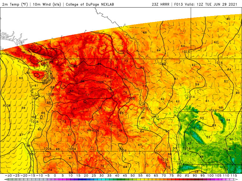
Highs will be in the upper 60s to 70 degrees for the northern Oregon coast. Locations like Cannon Beach and Seaside will bring in rather comfortable temperatures. Those temperatures increase to the east and by the time you get to the Willamette Valley, you’re likely feeling temperatures into the 90s. Cooler to the south near Eugene. From Skamania county to the east, temperatures are back to the triple-digits. The excessive heat warning continues until Thursday for you folks. Temperatures expected jump back to the 110 range. Still very warm for you folks down in Madras and into areas of Deschutes county. This is all because of that dome of heat that is still hanging around our region. Temperatures soaring up in British Columbia on Tuesday, too, with high temperatures in record territory again.

There will be a stronger marine push later Tuesday into Wednesday. This should help carry our temperatures down near the upper 80s on Wednesday. That will also open the door for some cooler overnight temperatures, somewhere down in the lower 60s.
The story doesn’t change much this week. We will have no rain and temperatures will remain 10-20 degrees above average. Keep up the water intake and do your best to stay cool.