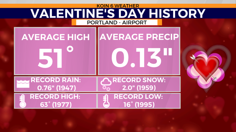
PORTLAND, Ore. (KOIN) — Snow is taking aim at Portland this Valentine’s Day. The old record for single day snowfall on the holiday of love is 2.0 inches set back in 1959.
The amount of snow accumulation expected for Tuesday remains uncertain at this time, but some models are leaning towards a dusting to an inch at the Portland airport.
Your Portland weather forecast
Snow accumulation numbers will be impacted by melting. The sunny and mild days seen in the Pacific Northwest over the last few days will impact surface temperatures. Grassy areas will lose heat much faster than paved surfaces. So, snow is more likely to accumulate on the grass than roadways.
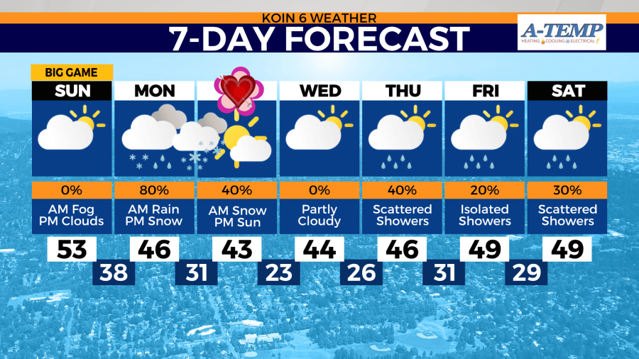
Some roads may become slick if temperatures drop lower than the forecast of 31 degrees Tuesday morning. Any snow that may accumulate Monday night into Tuesday is short-lived. Afternoon highs might be nearly 10 degrees below normal, but they will remain warm enough to melt any fallen snow.
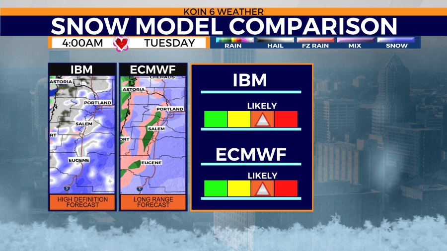
The chance of a white Valentine’s Day is becoming more apparent in Portland due to weather model agreement.
If this trend continues, Portland could potential near, tie, or even break the record for most snowfall accumulation in one day on Tuesday.