PORTLAND, Ore. (KOIN) – We’re sinking our teeth into new mountain snow, while the rest of Oregon is staying dry.
February hasn’t done any favors to mountain snowpack and it surely hasn’t brought in much rain in the weather forecast for the Willamette Valley and Portland. The Oregon drought will remain a problem through the winter and it is likely not going anywhere by the summer, although there could be potential improvements during the spring rinse.
As of February 15, we have over 95% of the state in some level of drought. Due to a stretch of wet weather in the fall and a robust atmospheric river in late December and early January, some locations to the northwest have improved. We know the mountains are a barrier to moisture for those in central Oregon, which has left that section of the state in continuous need of precipitation. The summer makes it even more difficult for rain to find a way to the high desert.
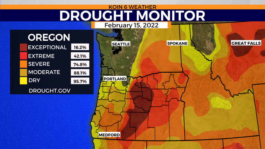
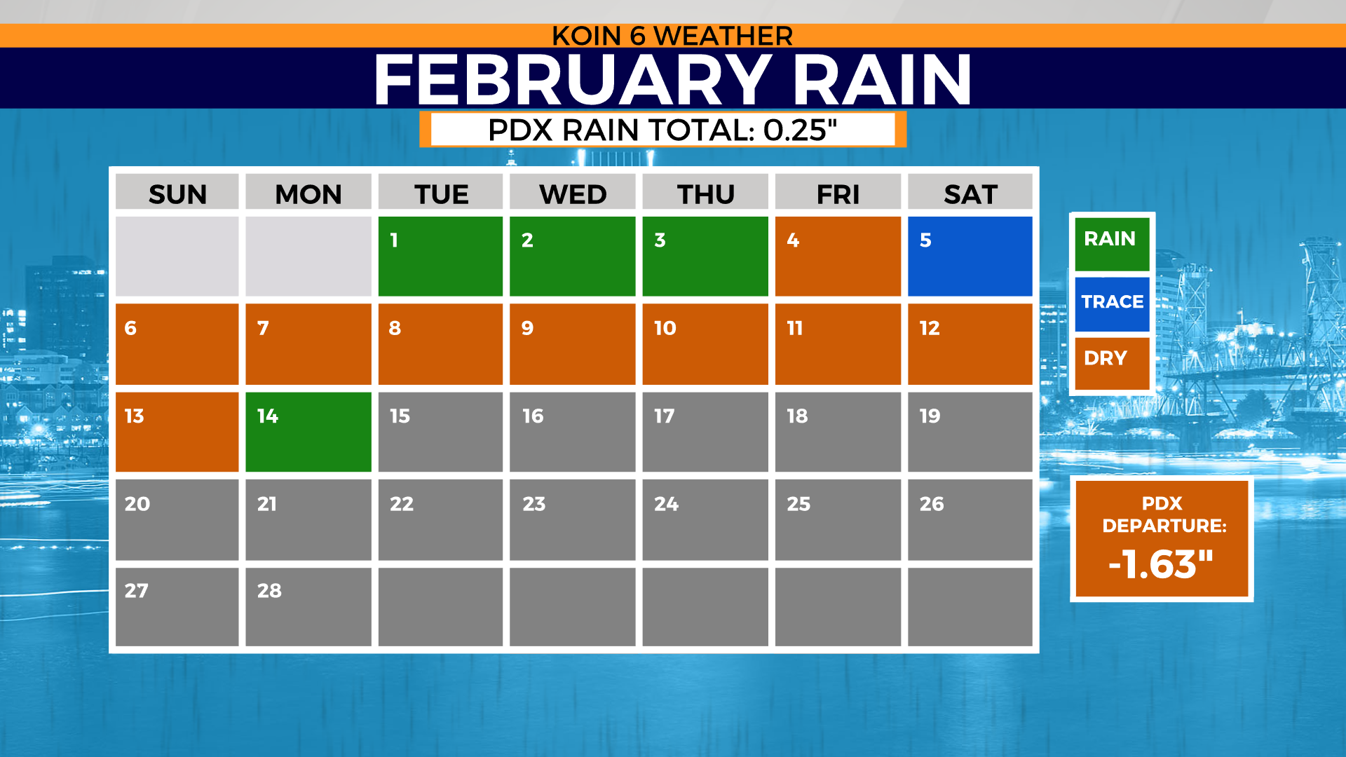
Five months of above-average rain isn’t enough to push the drought conditions into a state of comfort. With only a quarter-inch of rain so far this February, now more than halfway through the month, we are looking at our first winter month that will likely finish below average. We are crossing our fingers that this will not be the trend heading into spring.
Last spring, we had only brought in 2.52 inches of rain from the start of March to the end of May. That was more than 6.85 inches below the spring normal. That is the type of situation that buries your region into a massive hole for the dry summer. If you cycle through the slideshow below, you will find the February calendar for measurable rain. There are a lot of dry days this month (nine of 15).

WHAT IS GOING ON ABOVE OUR HEADS?
Consistent ridging, with little opportunity for movement in the weather pattern. This has been an ongoing issue since the second week of January. You can read more about this setup here.
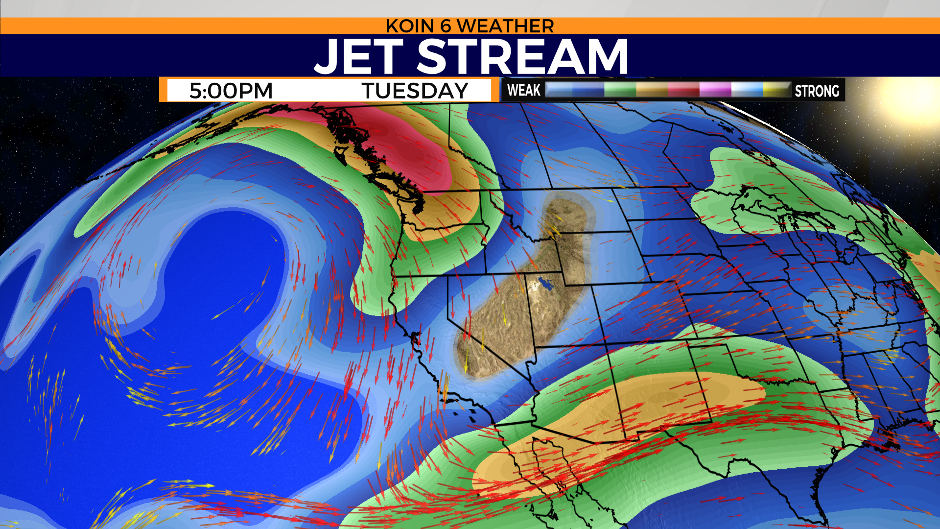
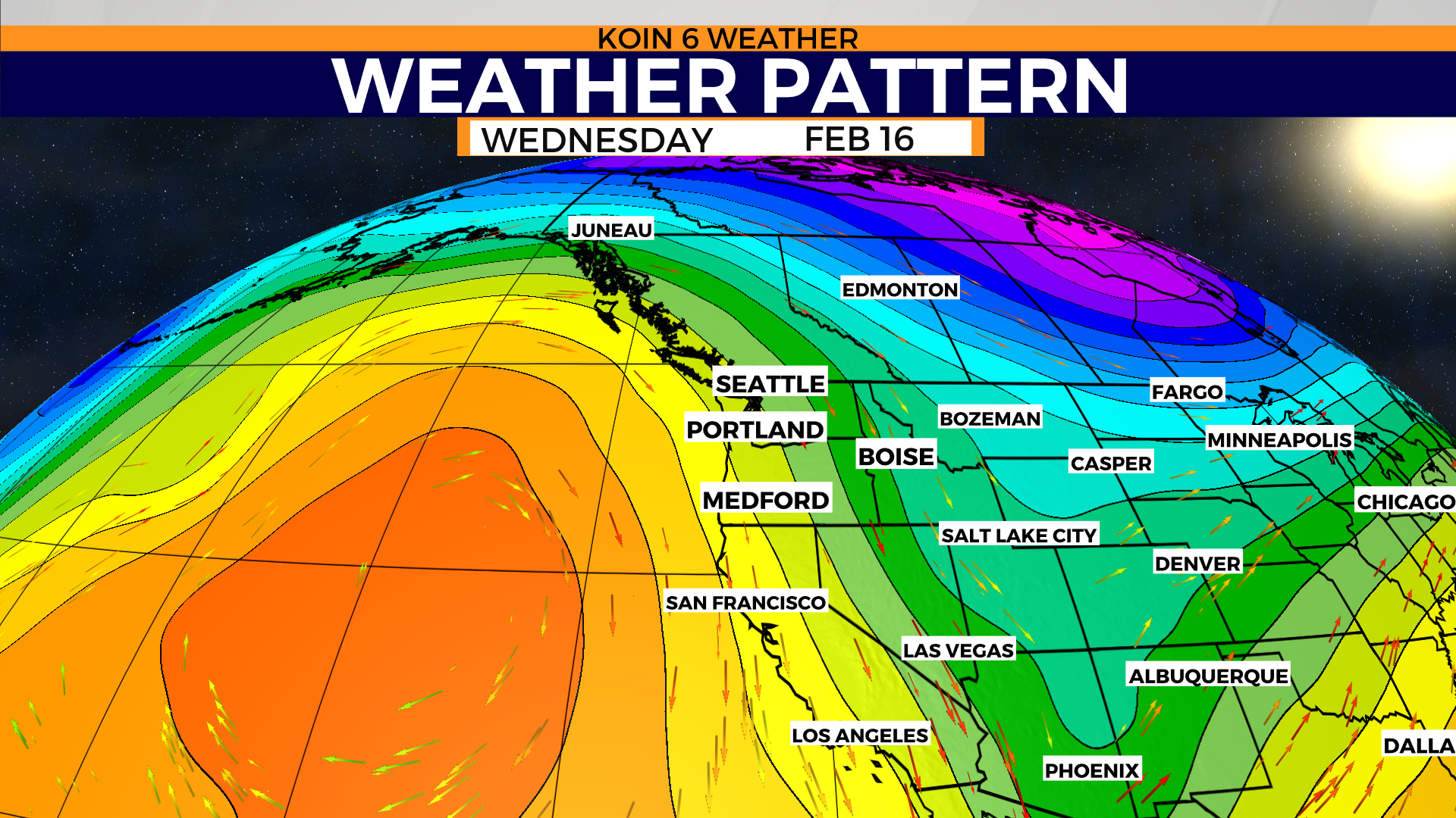
Let’s take a look at what is going on above our heads for a minute. We have a jet stream that is being directed by the conductor out west. This is the ridge of high pressure of the Pacific Ocean. It’s the location of that ridge that is really hurting our chances. If the high pressure was shifted farther to the west, we would be in the line of our favorite La Niña slide.
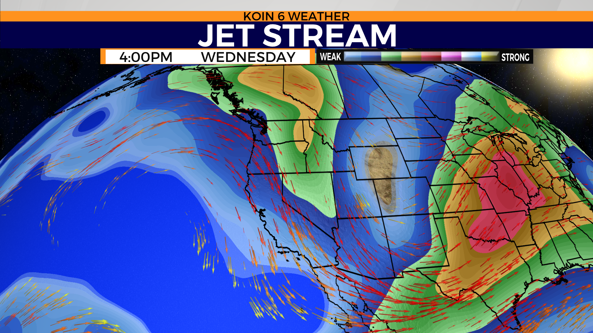
Unfortunately, it’s hovering closer to the west coast, pushing the storm track north of the Pacific Northwest (PNW), taking all the cold air, rain, and mountain snow in that direction. Swipe through the graphics below to get a visual idea of the wind pattern. Focus your attention on the jet stream graphic from Tuesday and then Wednesday. There isn’t much organization over the PNW and by Wednesday most of the convergence and strength of the jet is now on vacation. We keep a northwest flow, but it’s only enough to keep some clouds and minor activity around the region. The weather pattern graphic shows that massive ridge of high pressure to the west. This has destroyed our chances for winter weather. This is the reason why we aren’t promised any more winter weather in the next five days.
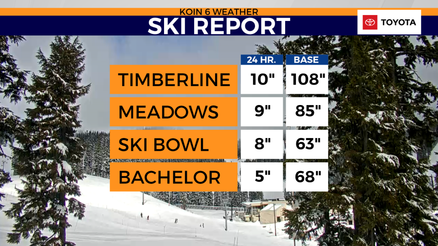
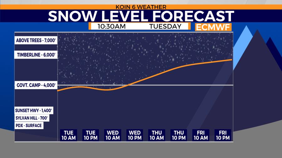
For now, we finally had our first February snow event for the mountains. It took 14 days, but we managed to scrape together nearly a foot of snow for some of the higher elevations. Mt. Hood Meadows collected 9 inches of snow from the front that moved across the state on Monday. The onshore flow will help keep conditions cool this week. That should help with snowmelt. The snow level will increase above the passes by the time we get to Friday, which means there will not be any more snow in the forecast that will slow things down this week.
We will keep an eye on Friday for a passing system that appears fairly weak. That may drop the snow levels a bit going into the weekend. The weekend does appear to bring in more snow, especially on Sunday. If we can pull two or three more modest snowfalls this month, that will keep the snow water equivalent up for the Cascades.
We need more of the snow to reach the basins to the south.