PORTLAND, Ore. (KOIN) — Monday is Portland’s warm before the next storm. That latest storm is expected to bring snow and record-breaking cold back to the Pacific Northwest. So, Monday is the day to soak up the warmer weather. Strong winds will help push the next colder air mass into the region Monday night.
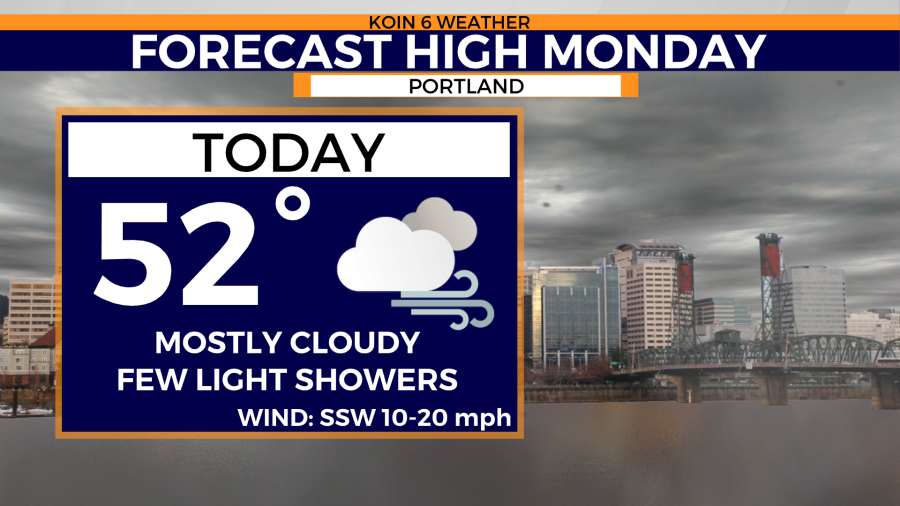
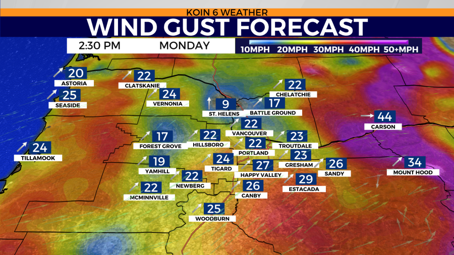
Afternoon highs will warm into the low 50s Monday in Portland. Temperatures might feel slightly cooler because of the breezy conditions expected. Wind gusts in Portland could near 30 mph during the afternoon. Even stronger winds are expected along the Columbia River Gorge as high wind warnings remain in effect late Monday night through Tuesday morning. That’s where wind gusts could reach near 60 mph.
A few light rain showers are possible in the Portland metro area throughout the day Monday. Rain accumulation will be limited. Dry but cloudy conditions will remain south of Portland Monday. It’s not until after sunset that the chance of rain becomes more widespread along the coast.
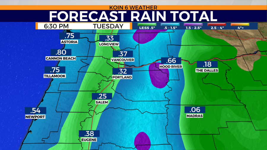
Rain accumulation will quickly start to add up Tuesday as rain showers become more widespread and frequent.
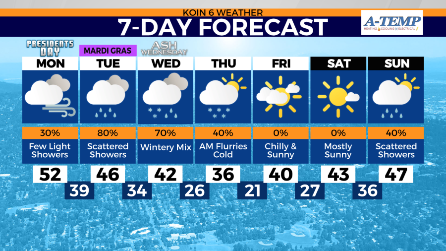
Portland’s snow potential doesn’t start to increase until Wednesday. Near record-breaking cold will follow with drier skies.