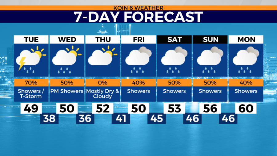
PORTLAND, Ore. (KOIN) — We love our sunshine but rain is still necessary to keep us out of a major statewide drought. We’ll see more of that rain just about every day this week, including this morning. We’ll have similar showery bursts of rain like we did Monday. Thunderstorms are still part of the program today, albeit isolated. We had several lightning strikes Monday coupled with some respectable-sized hail. Take a look at the hail from Battle Ground Monday evening. A downpour of those icy nuggets could cause some damage. Compare that to the more commonly seen pea-size hail, which fell over Salmon Creek.


How do we know to expect thunderstorms when they seem to appear so randomly? A number of features get our attention. I’ll just name a few. 1) Moisture 2) Instability 3) Lift.
More specifically, we look at a SKEW-T to examine all of the elements including CAPE, convective available potential energy. High CAPE means storms will build vertically quickly. In the CAPE forecast below you can see that the value given for Tuesday at 1:30p shows 750 to 1,000 J/kg. We know there is positive CAPE.
Satellite images also provide good clues in the short term. Convective outlooks highlight areas to watch for severe weather. Although, there are plenty of times when we get thunderstorms that were never forecast in the SPC outlook. Our weather is especially dynamic because terrain can change the course, which is hard for a lot of forecast models to identify.


Notice the increase in lightning strikes Monday afternoon associated with the warmest part of the day.
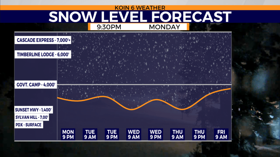
Snow levels Tuesday may be as low as 2,000′. Accumulations near passes could range from 1″ to 3″, expect more snow the higher you go. A longer dry period should start Wednesday night/Thursday. More rain for this weekend forecast.