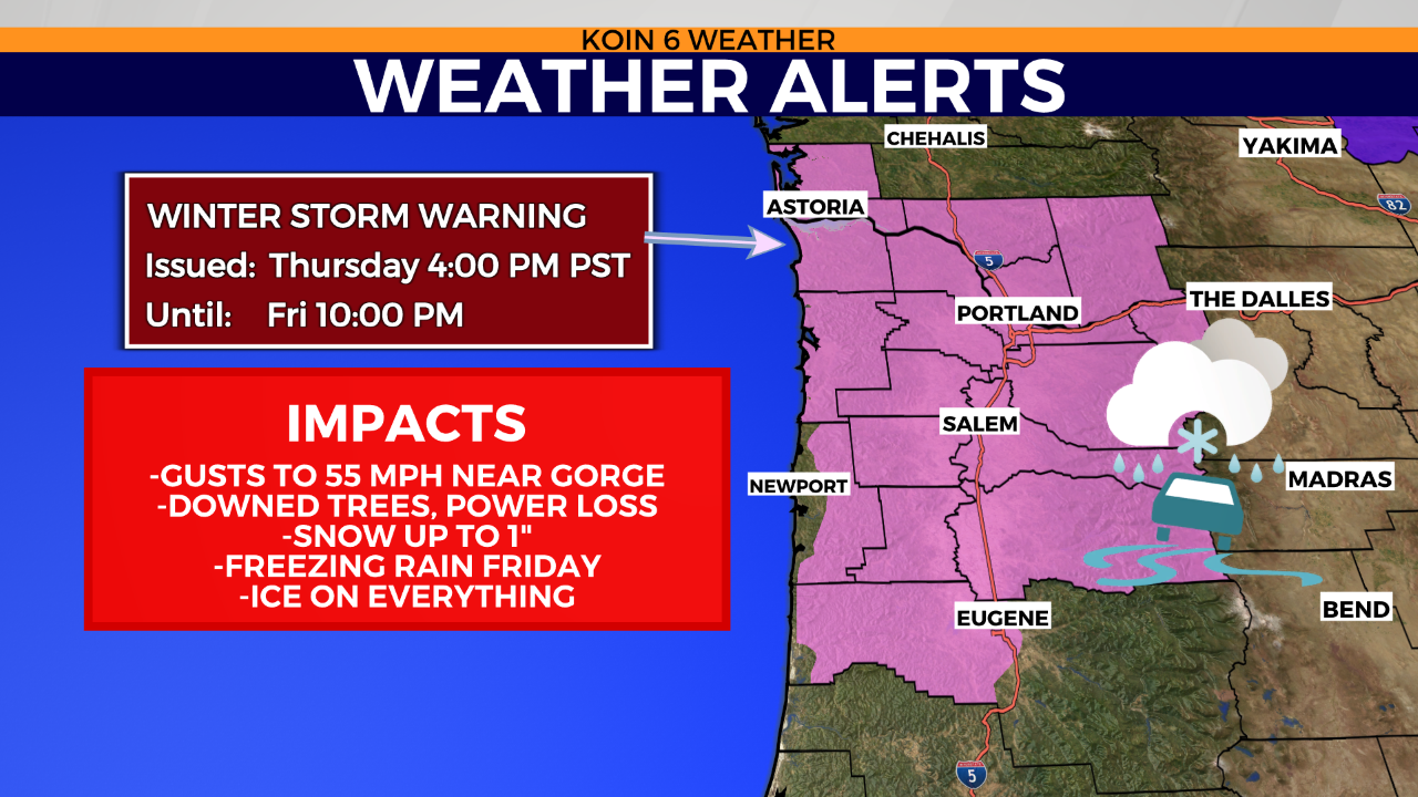
PORTLAND, Ore. (KOIN) — A Winter Storm Warning has been issued by the National Weather Service for the Willamette Valley, the Oregon Coast and western Columbia River Gorge starting Thursday afternoon and lasting until Friday evening.
Impacts will include wind gusts of up to 55 mph near the Gorge, downed trees and power loss. Snow is also forecasted for an inch for most, followed by freezing rain on Friday and ice on everything.
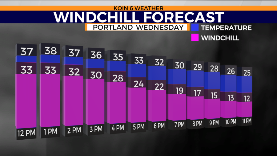
The Arctic front moves in on Wednesday, with temperatures in the low- to mid-30s starting the day for Portland and a high of 38.
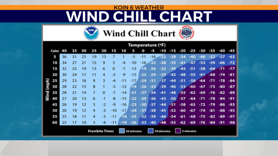
An easterly wind increases by the afternoon with gusts reaching 40-50 mph by nighttime. Evening temperatures plummet to the 20s with wind chill values in the single digits. Skin exposed to those temperatures may encounter frostbite in just 30 minutes.
A Wind Chill Advisory is issued for the east side of the Gorge, Eastern and Central Oregon for wind chill -20° below zero Wednesday night to Friday. You have 10 minutes before frostbite sets in, uncovered.

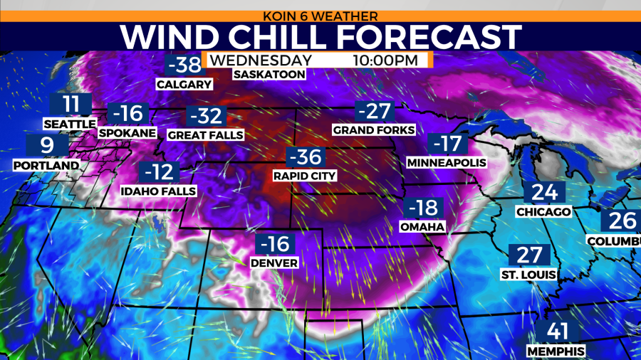
On Thursday, conditions will be dry in the morning while temperatures will sit in the teens. Life-threatening wind chill, downed trees or power lines are some of the impacts you may encounter. Gusts range from 30-50 mph. Wind chill values drop to zero. Daytime highs only reach the low 20s.
A Winter Storm Watch starts at 1 p.m. Thursday for the Oregon coast, Willamette Valley and western Gorge, with a Winter Storm Warning in effect for the same region starting at 4 p.m. on Thursday until Friday evening at 10 p.m.
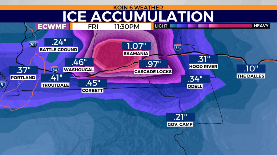
East gusts will reach 35-50 mph by the afternoon or evening Thursday. Wind chill values will range from single digits to zero. Expect snow to start sometime in the late afternoon, possibly 1 inch or less. The Gorge will see accumulating snow before freezing rain, possibly 1 to 2 inches.