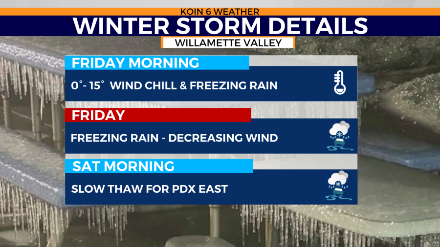
PORTLAND, Ore. (KOIN) — We could be dealing with frozen roads in Portland and the Columbia River Gorge through at least Saturday morning. Here’s what you need to know to get you through Friday.
The Wind Chill Advisory ends at 6 a.m. Friday.
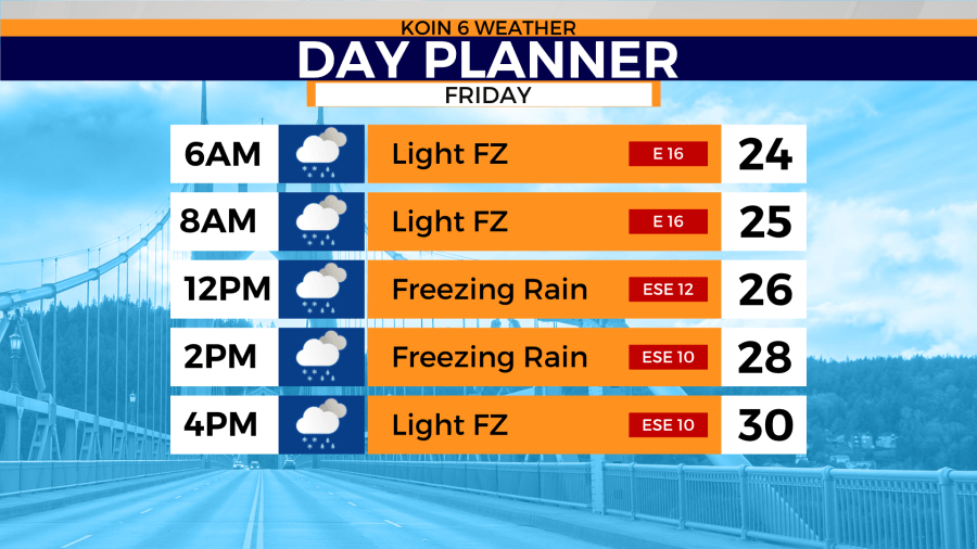
We’ll have the bitter, cold east flow going all day but wind speed significantly backs off in the morning and should be slightly more tolerable by the afternoon.
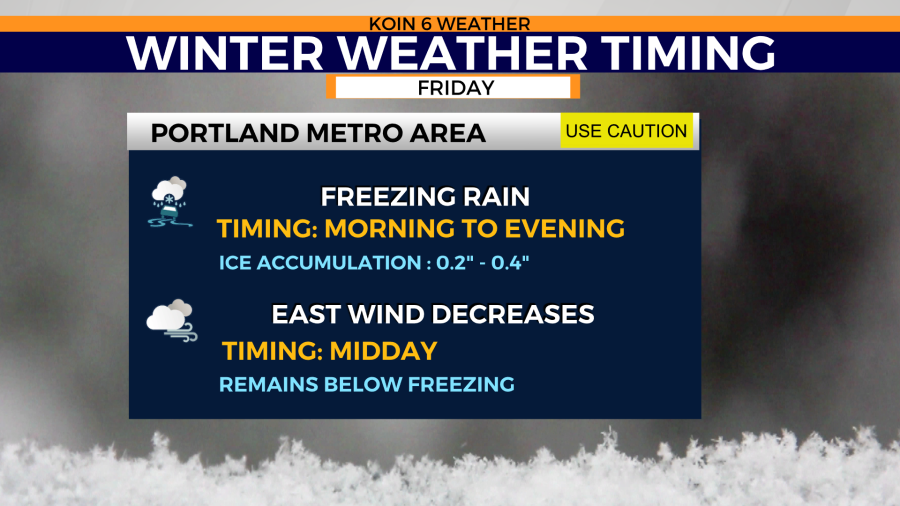
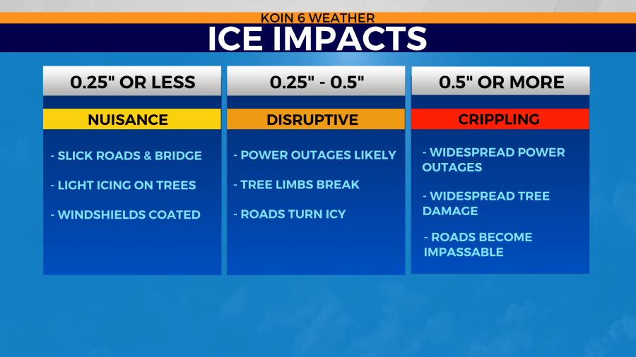
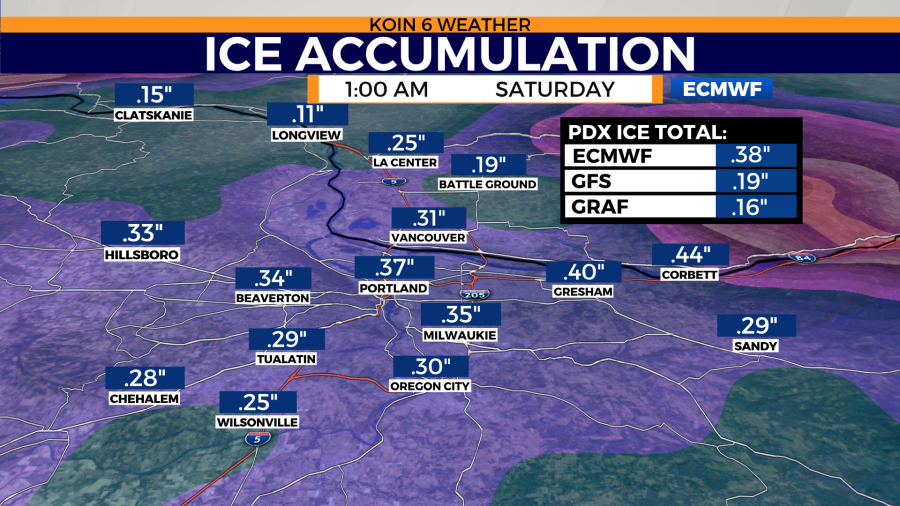
This entire day is dedicated to increased precipitation rates at times with a snow/sleet mix that will turn to freezing rain. Ice accumulation totals will range from 0.2″ to 0.4″ for the greater Portland metro area by the end of Friday. Icing totals around Skamania and Cascade Locks could accumulate an inch or more.
As a warm front advances north, so will warmer temperatures. The south end of the Willamette Valley and coastal areas should reach the low 40s by Friday afternoon. But this won’t be a uniform warmup.
The Winter Storm Warning ends at 10 p.m. Friday for the greater Portland and Vancouver metro areas, but does that mean we’re suddenly back to our typical drizzly 40s? No.
A warm front approaching from the southwest has a big job to do. If strong pressure gradients don’t relax and allow southerly winds to dominate the east flow through the Gorge, it will be hard to rise above freezing by Saturday morning. However, it appears that most of the area will be above freezing with temps reaching the 40s by late morning.
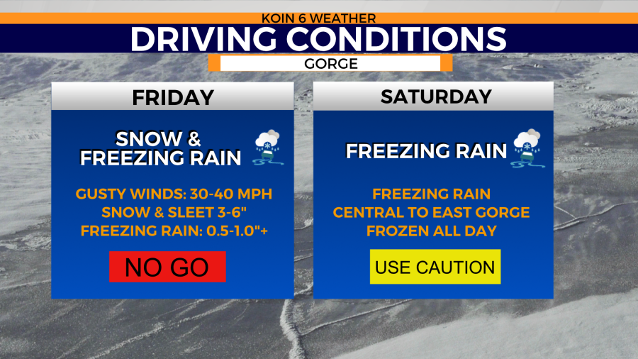
The Gorge
Think you’re getting through the Columbia River Gorge? Fuhgeddaboudit!
Interstate 84 closed from Troutdale to Hood River Thursday night. Icing and heavy snow will intensify in the early morning hours causing whiteout conditions. Expect lengthy delays and interstate closures through the weekend.
Freezing rain favors the west end of the Gorge while Hood River and the Upper Hood River Valley get blanketed in snow. Icing totals on the west end may total more than 1.3″ by Saturday.