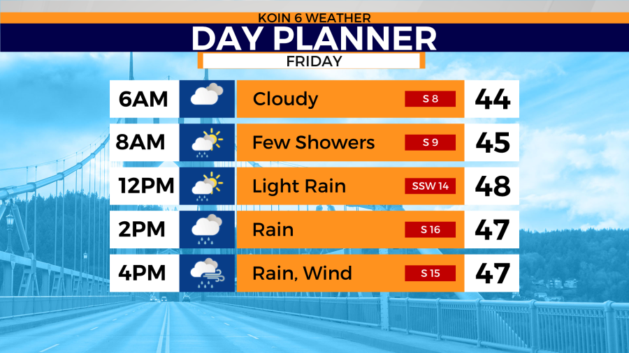
PORTLAND, Ore. (KOIN) — Friday starts cloudy and dry before showers increase by the evening hours which means Friday night commutes won’t be very fun.
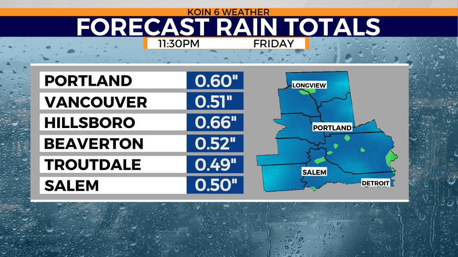
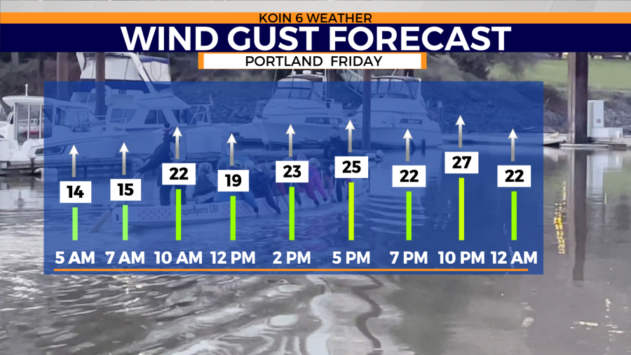
Expect wet and windy conditions Friday night with rain also invading the weekend. Rainfall totals could end up being as much as 1 to 2 inches for three days Friday to Sunday. Daytime highs max out in the upper ’40s to low ’50s. Can you say February weather?
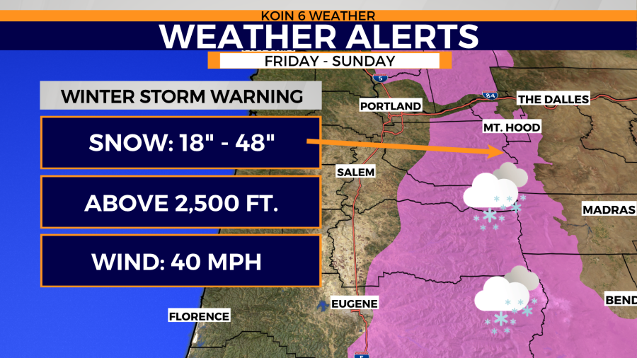
Friday’s storm system creates a snow globe for the Cascades. Snow and gusty winds will create white-out conditions at times and white-knuckle driving. A Winter Storm Warning begins for the Cascades Friday night lasting until Sunday night. Snow levels drop Sunday night. There’s a chance for hilltop snow around 1,000 feet at that time.
Winter storm warning
This weather alert was issued by the National Weather Service, Portland.
* WHAT...Heavy snow expected above 2500 feet. Total snow
  accumulations of 18 to 48 inches. Winds gusting as high as 40
  mph.

* WHERE...In Oregon, Northern Oregon Cascades and Cascades in
  Lane County. In Washington, South Washington Cascades.

* WHEN...From 5 P.M. Friday to 11 P.M. PDT Sunday.

* IMPACTS...Travel could be very difficult.

* ADDITIONAL DETAILS...Conditions can deteriorate rapidly in
  winter weather situations. Slow down and allow extra time when
  travelling. Practice your winter safety rules. Keep an extra
  flashlight, food, and water in your car in case of emergency.
Winter weather advisory
* WHAT...Snow expected above 2000 feet. Total snow accumulations
  of 2 to 4 inches with higher amounts expected above 2500 feet.
  Winds gusting as high as 40 mph.

* WHERE...Coast Range of Northwest Oregon and Central Coast
  Range of Western Oregon.

* WHEN...From 5 P.M. Friday to 5 P.M. PDT Sunday.

* IMPACTS...Travel could be very difficult.

* ADDITIONAL DETAILS...A Winter Weather Advisory for snow means
  that periods of snow will cause primarily travel difficulties.
  Be prepared for snow covered roads and limited visibilities, and
  use caution while driving.