PORTLAND, Ore. (KOIN) — Here we go into the last week of October.
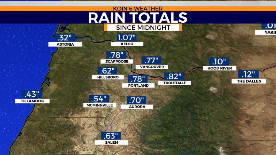
Up until recently, our rain totals were underperforming and disappointing. Thanks to the rush of rain from Thursday night’s bomb cyclone-influenced, atmospheric river-fed storm, we walked away with a daily total of 0.83″. Most of that rain didn’t begin falling until after 5 p.m. That gives us a month-to-date total now of 1.13″.
If we keep up this pace, we’re likely to finish the month with above normal rain.
Here’s a review of the previous monthly totals for Portland this year.
September: 3.76″
August: 0.05″
July: Trace
June: 1.25″
May: 0.58″
April: 0.39″
March: 1.55″
February: 3.73″
January: 7.03″
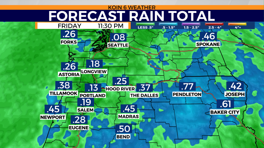
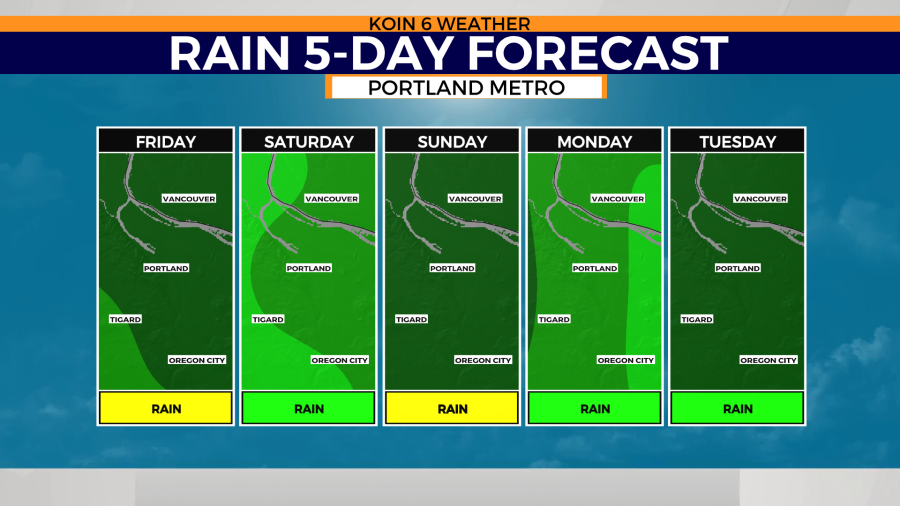
This morning’s temperatures will drop to the low 50’s. Daytime highs will likely only rise just a few degrees as we get on the backside of this cold front. Showers will linger today, perhaps delivering an additional tenth of an inch for Portland and the rest of the valley today.
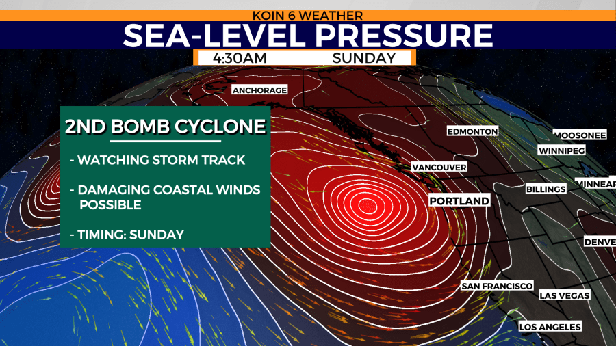
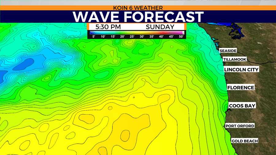
We’ll get to a point this evening where rain will end before the next front arrives. We’ll need that break, especially looking down the forecast tunnel to Sunday. We’re tracking what will likely be bomb cyclone number 2 in the Pacific. The exact path will determine if we stay on the outskirts of the biggest impacts or if we’ll be close enough to encounter damaging winds. Stay with us as we help you prepare for what could be a turbulent weather weekend.
Gale warning
SMALL CRAFT ADVISORY NOW IN EFFECT UNTIL 2 AM PDT SATURDAY. GALE WARNING IN EFFECT FROM 2 AM TO 10 AM PDT SATURDAY
* WHAT…For the Gale Warning, south winds 15 to 25 kt with gusts up to 35 kt and seas 9 to 14 ft at 13 seconds expected. For the Small Craft Advisory, south winds 15 to 25 kt with gusts up to 30 kt and seas 11 to 16 ft at 15 seconds.
* WHERE…Coastal waters from Cape Shoalwater WA to Cascade Head OR out 10 NM and Coastal waters from Cascade Head to Florence OR out 10 NM.
* WHEN…Gale Warning, from 2 AM to 10 AM PDT Saturday. Small Craft Advisory, until 2 AM PDT Saturday.
* IMPACTS…Strong winds will cause hazardous seas which could capsize or damage vessels and reduce visibility.
* ADDITIONAL DETAILS…Coastal jet development is possible late Friday night through around sunrise Saturday.
PRECAUTIONARY/PREPAREDNESS ACTIONS… Mariners should alter plans to avoid these hazardous conditions. Remain in port, seek safe harbor, alter course, and/or secure the vessel for severe conditions.
https://marine.weather.gov/showsigwx.php?warnzone=PZZ250&warncounty=marine&firewxzone=&local_place1=8NM%20WNW%20Seaside%20OR&product1=Gale+Warning&lat=46.0579&lon=-124.0883#.YXKf-9nMJE4
Wind advisory
WIND ADVISORY REMAINS IN EFFECT UNTIL 8 AM PDT FRIDAY
* WHAT…South winds 15 to 25 mph with gusts up to 50 mph.
* WHERE…In California, Modoc County. In Oregon, Northern and Eastern Klamath County and Western Lake County and Central and Eastern Lake County.
* WHEN…Until 8 AM PDT Friday.
* IMPACTS…Gusty winds could blow around unsecured objects. Tree limbs could be blown down and a few power outages may result.
https://forecast.weather.gov/wwamap/wwatxtget.php?cwa=pqr&wwa=wind%20advisory


