PORTLAND, Ore. (KOIN) — Snow is coming to a road near you. It’s Christmas Eve. Are you going somewhere today? Here’s what you need to know before you leave.
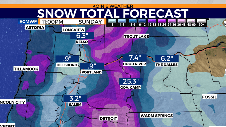
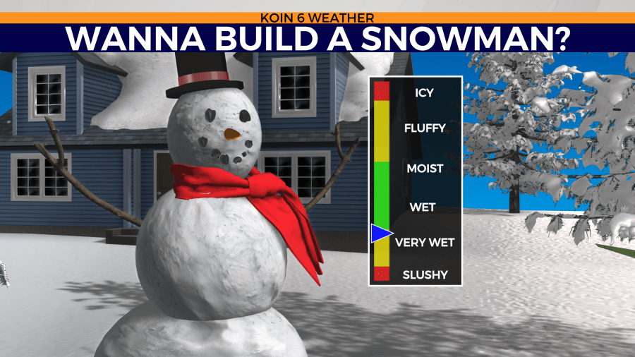
The holiday weekend is going to bring in the cold air. That cold air is going to help transition the rain to snowfall for all. We are going for a trace to 3 inches of snow around the valley floor.
KOIN Weather Alerts
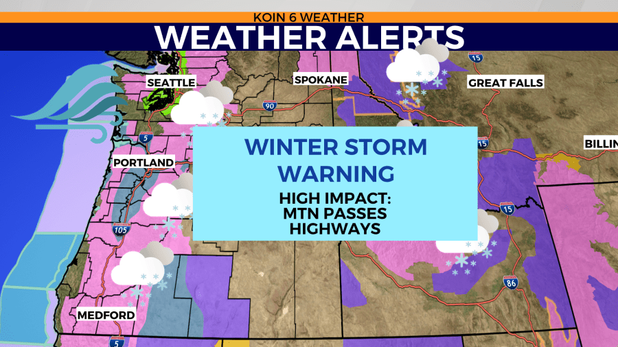
A Winter Storm Warning is in place from 4 p.m. Saturday to 4 a.m. Monday morning for the Greater Portland metro region, with accumulations between 2 and 8 inches of snow. The area affected is the I-5 corridor in southwest Washington and the northern Willamette Valley in Oregon, including the entire greater Portland metro. Highest accumulations of snow are expected about 500 feet, and snowfall amounts could vary greatly because of the showery nature of the snow.
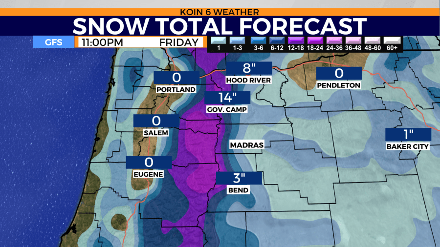
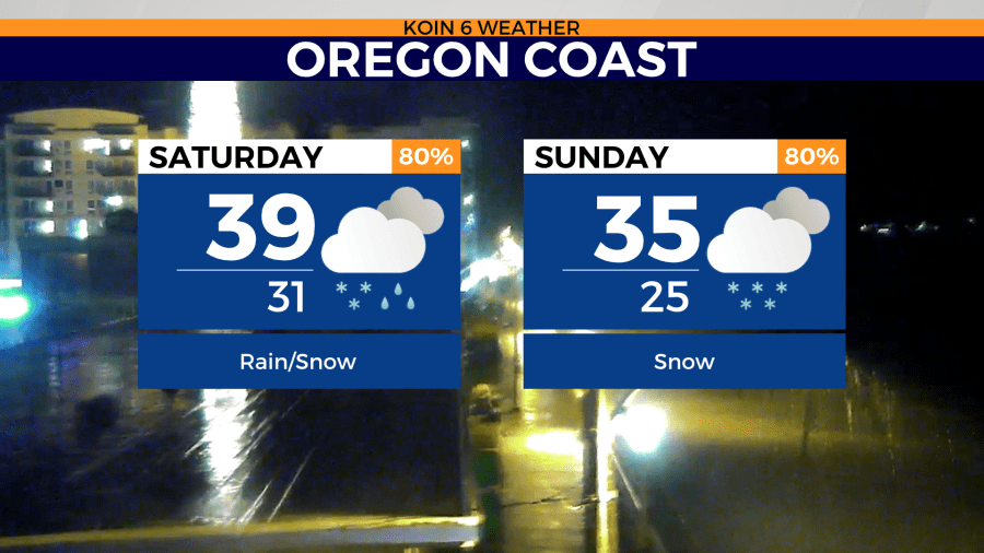
There will also be heavy snow for the mountain passes and out to the coast range, plus snow for the northwest Oregon coast, too.
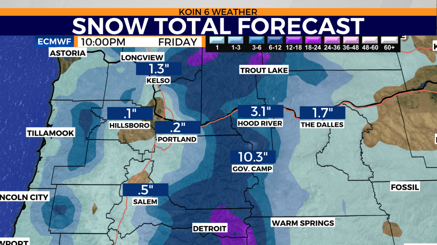
A Winter Storm Warning is in effect for the Cascades and Coast Range from Oregon to Washington Friday 6 a.m. through Saturday 6 a.m. Several inches of snow are possible on the Coast Range above 1,000′. We’re talking up to 2 feet or more in the Cascades. The NWAC Avalanche forecast for the backcountry of Mt. Hood is considered high Friday.
Snow
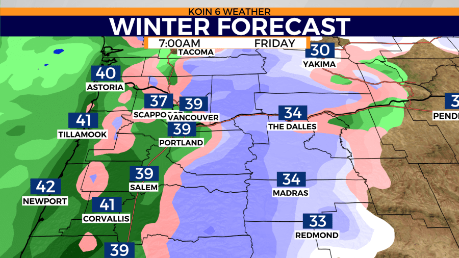
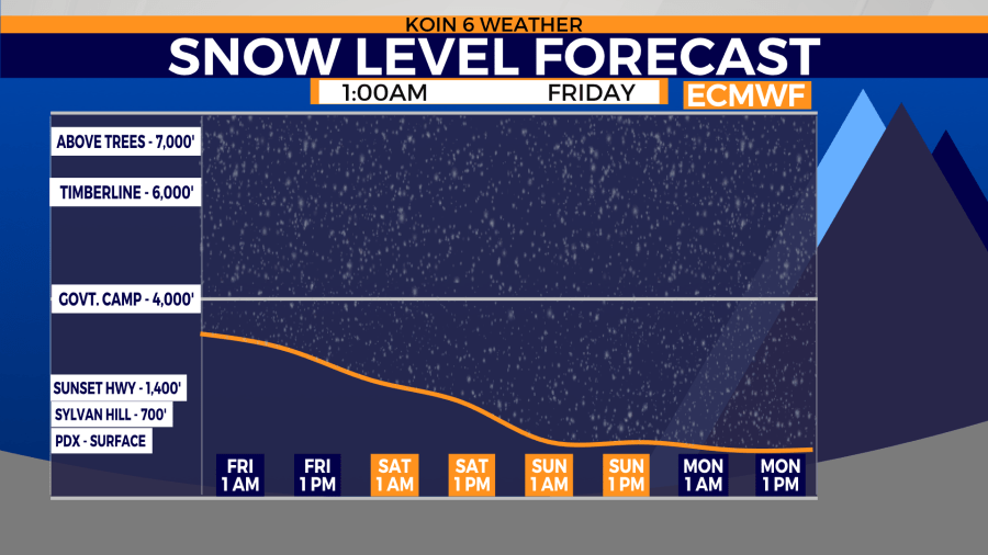
How low today? Accumulating snow down to 1,000′ is possible. Anywhere below that is likely to be temporary and only under the heaviest showers.
How low Saturday? Down to 500′ and then sticking to the valley floor by evening Christmas.
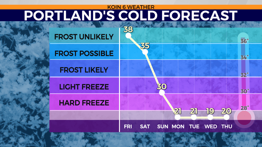
A Winter Storm Warning begins for Portland and the rest of the valley Saturday afternoon and lasts until Monday morning. Hillsides would score higher snow totals and certainly, foothills would have the most next in line to the Cascades. We go below freezing for several days starting Sunday. The wind turns NNE by Monday drawing in the bitter cold, dry air.
Windy
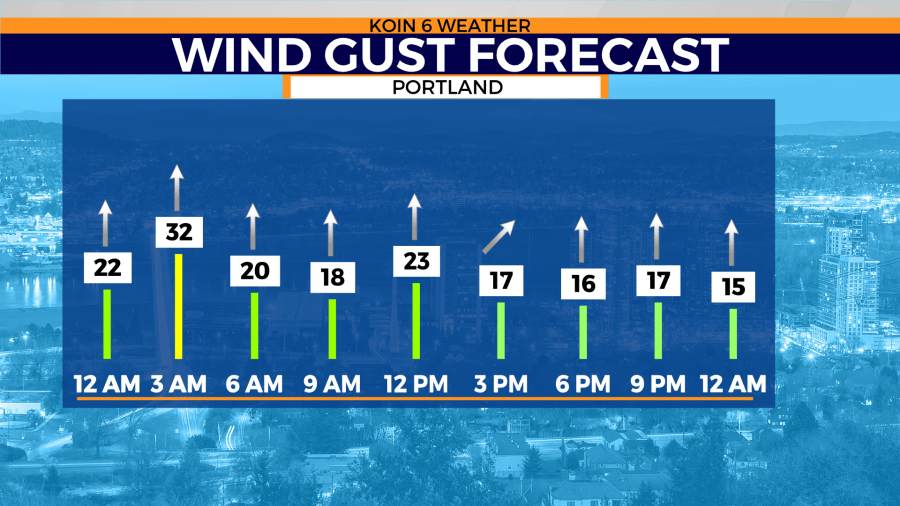
Wind Friday morning gusted up to 25 mph from the south and it remained fairly windy throughout the day.
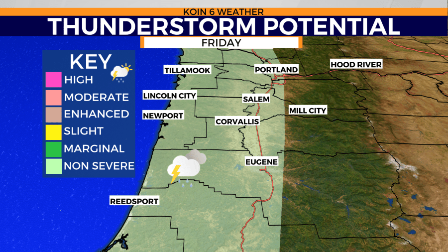
We had a few moments of lightning and heavy rain early Friday morning. A clash of warm and cold air could mean there’s a chance for thunderstorms from the coast to the Willamette Valley later in the afternoon.
Cold air follows, with an arctic blast expected early next week.
