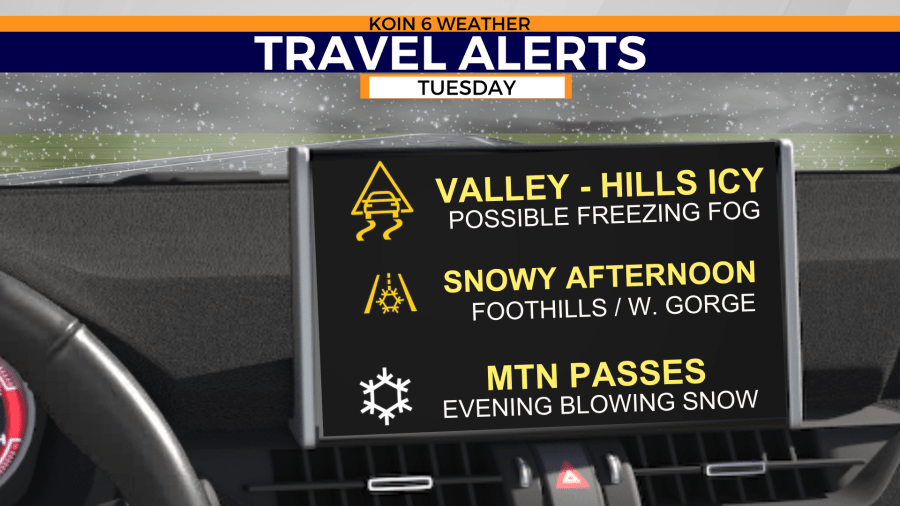
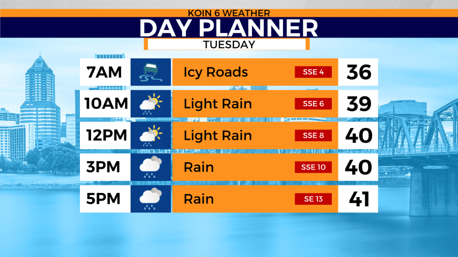
PORTLAND, Ore. (KOIN) — Caution on the roads Tuesday morning: Black ice is possible as temperatures across the Portland and Vancouver metro areas drop to the low 30s.
There’s an opportunity for an isolated snow sprinkle. However, while there’s a chance, it’s not likely to stick on the ground for long.
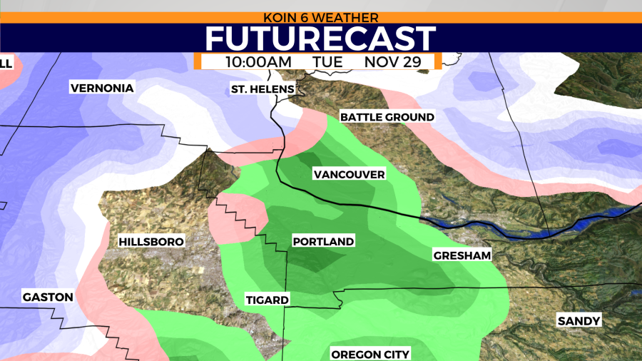
As of 8 a.m. Tuesday morning, people had reported seeing light snow in Southwest Portland, Forest Grove, and the West Hills. The National Forest Service said they’d received reports of snow in Beaverton and Hillsboro and in the Kelso/Longview area.
Highs for Portland on Tuesday are 40 degrees, with a forecasted low of 34. A very different story unfolds for Southwest Washington and the west side of the Columbia River Gorge Tuesday.
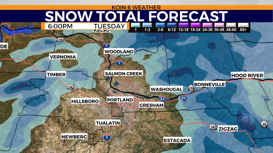
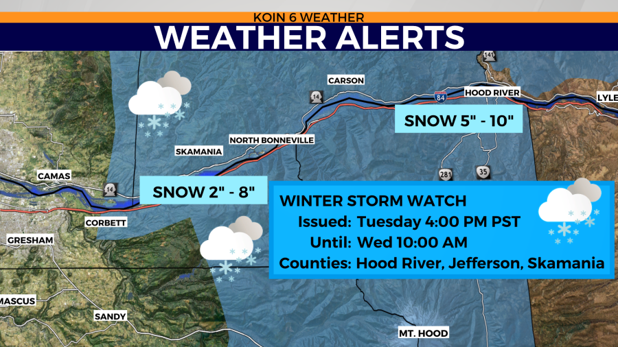
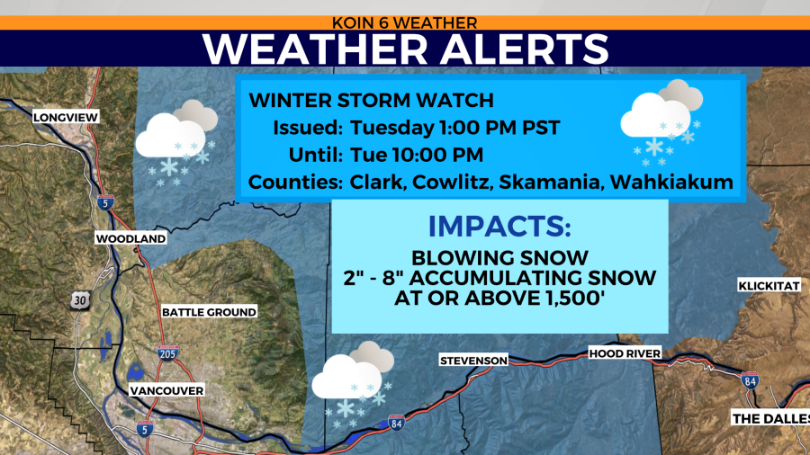
A Winter Storm Watch Tuesday afternoon, ending Tuesday night includes the west side of the Gorge from Corbett all the way to Hood River. This area does NOT include Portland.
A Winter Storm Watch Tuesday afternoon to evening also includes the foothills above 1,500 feet for east Clark and Cowlitz counties, Skamania County.
A Winter Storm Watch for the Cascades begins Tuesday night and lasts through Thursday morning. Between 1-2 feet of snow is expected for the mountains plus gusty winds of 40 mph. If you want to ski, get ‘er done Tuesday before the next front arrives in the afternoon. I predict an epic ski weekend ahead.

Stay with KOIN 6 News for the latest weather information.