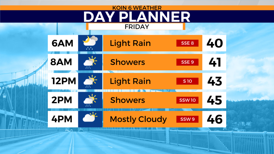
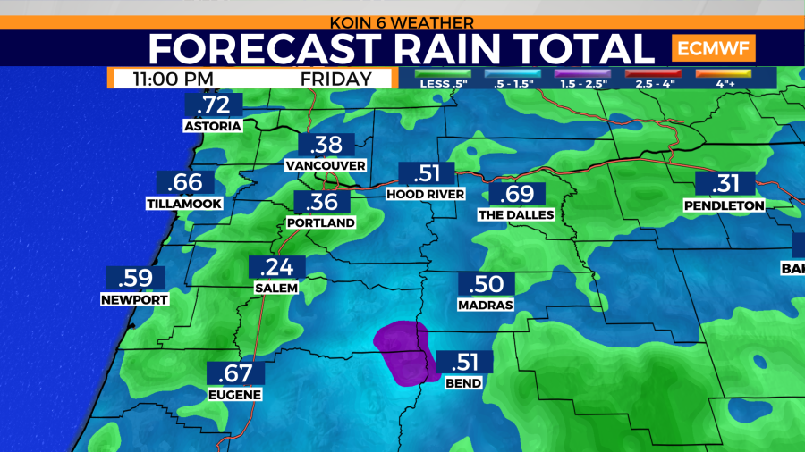
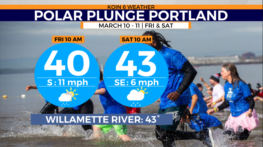
PORTLAND, Ore. (KOIN) — Rain continues to fall most of the morning and afternoon Friday. Rainfall totals for Portland will be around 0.25 inches to 0.35 inches by Friday night. High temperatures only reach the mid-upper 40s. That’s another day well below normal.
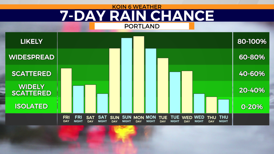
The normal high for Portland for mid-March is 56 degrees. We’ll get a brief break from the rain on Saturday with isolated showers and sun breaks.
Another atmospheric river will target the Pacific Northwest Sunday night into Monday. Forecast models show up to 2 inches of rain could fall over the Willamette Valley during that time.
Weather alerts issued by the National Weather Service
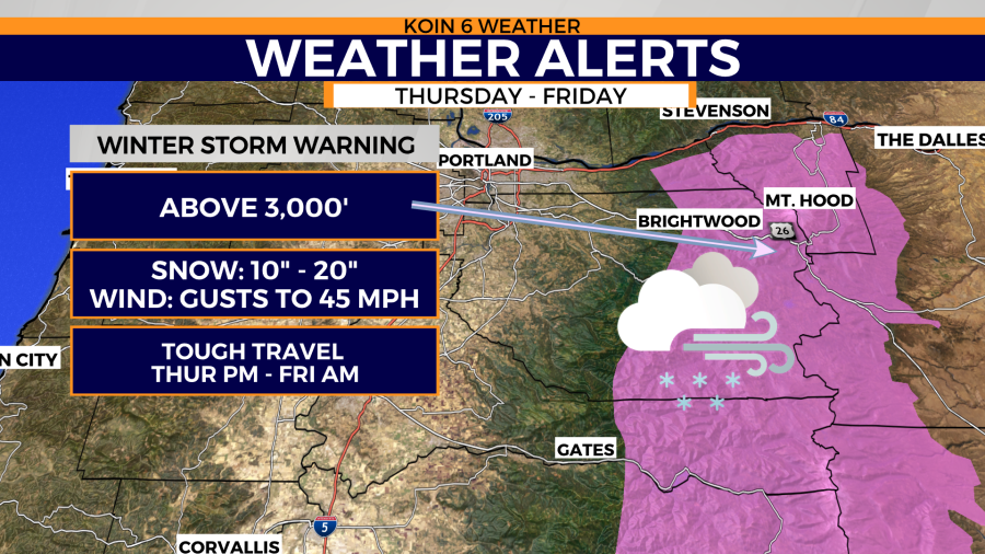
* WHAT…Heavy snow. Additional snow accumulations of 6 to 18 inches, heaviest above 3000 feet and near the crest. Winds gusting as high as 40 mph.
* WHERE…Northern Oregon Cascades.
* WHEN…Until 10 p.m. PST Friday.
* IMPACTS…Travel could be very difficult. The combination of heavy snow and strong winds will severely restrict visibility at times.
* ADDITIONAL DETAILS…Period of heaviest snow is underway this evening, with snowfall rates of 1-2 inches per hour likely until around midnight. There will likely be a lull in the snow after midnight, but heavier snow showers are expected to resume by sunrise Friday.
PRECAUTIONARY/PREPAREDNESS ACTIONS… If you must travel, keep an extra flashlight, food, and water in your vehicle in case of an emergency.
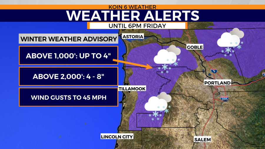
Coast Range of Northwest Oregon- Including the cities of Sunset Summit, Lees Camp, and Trask * WHAT…Wet snow above 1000 feet. Additional snow accumulations of up to 4 inches, except 4 to 8 inches above 2000 feet. Winds gusting as high as 40 mph.
* WHERE…Coast Range of Northwest Oregon.
* WHEN…Until 6 p.m. PST Friday.
* IMPACTS…Expect passes to be snow covered and slick at times.