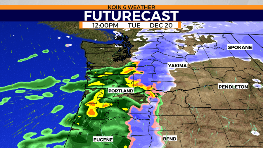
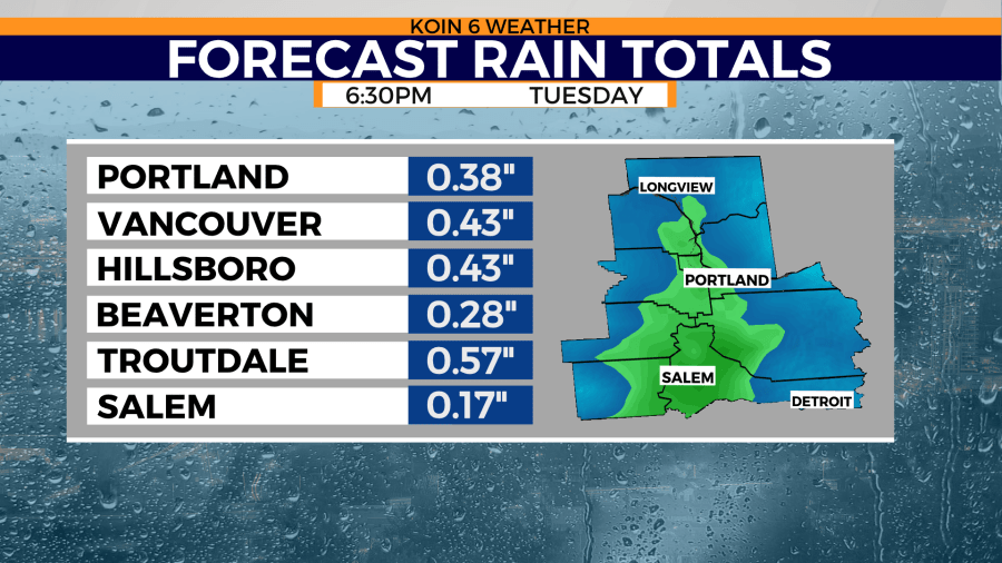
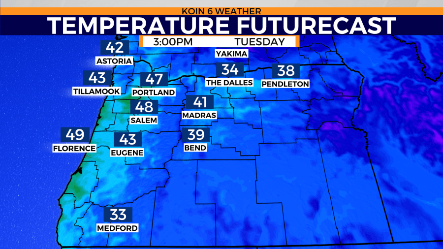
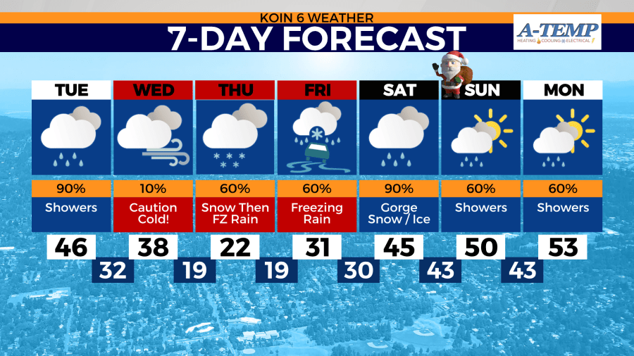
PORTLAND, Ore. (KOIN) — Portland kicks Tuesday off with showers that are expected throughout the day. Temperatures will reach the mid to upper 40s.
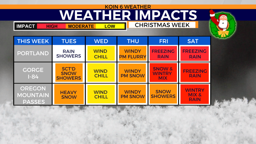
The snow level stays above 1,000 feet, except for the Gorge where snow has already accumulated along Interstate 84. Expect travel impacts in the Gorge and all mountain passes on Tuesday.
Winter Weather Advisory for Oregon Cascades starts at 10 a.m.
Winter Storm Warning for Washington state Cascades starts at 10 a.m.
Swipe through the weather graphics below.
Then on Wednesday, it’s an open door party to an Arctic front! Cover your pipes or they will burst.
While it will be a mostly dry day, you’ll really need to pay attention to the dangerous wind chill. Don’t be distracted by the sunshine. Daytime highs reach the low to mid 30s.
That easterly flow through the Gorge reaches the Portland metro and speed increases during the day. We could start off wind wind gusts 15-30 mph to as strong as 50 mph by evening.
Night time temperatures plummet to the 20s, with wind chill values in the single digits. You have 30 minutes before frostbite sets in, uncovered.
A Wind Chill Advisory will be in effect Wednesday night for the east side of the Gorge and much of Eastern and Central Oregon, which means it could feel like 20 degrees below zero from Wednesday night to Friday morning for those areas. You have 10 minutes before frostbite sets in, uncovered.
Portland climate stats:
- The last 19° temperature in Portland was February 2014.
- The most recent teen temperature at PDX was January 2017 at 11°.
- Teens in December? The last time temperatures dipped to the teens in December was in 2013 and 2009 — both 12°.
- The coldest December temperature ever recorded for PDX was 6° on Dec. 16, 1964
- The coldest temperature ever recorded for PDX was -3° on Feb. 2, 1950
