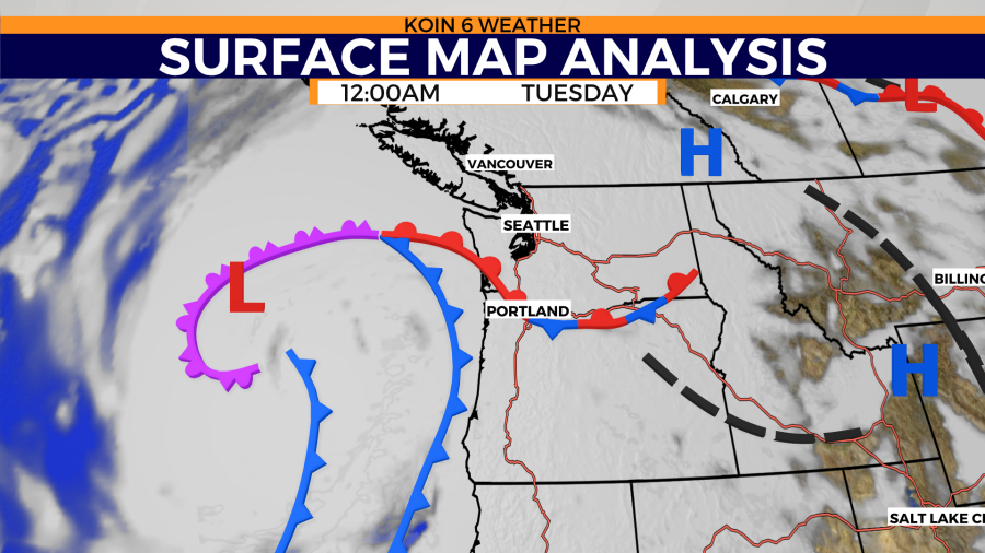
PORTLAND, Ore. (KOIN) — The giant fire hose of the Pacific Ocean, aka the Atmospheric River, aimed at us Tuesday is considered strong which means it is beneficial, yes, but also mostly hazardous. Too much of a good thing.
A strong low pressure system that’s teaming up with this atmospheric river will deliver more than inches of rain. This storm will bring down trees, cause power outages, areas of flooding, huge surf and some storm surge during high tide along the south Washington coast.
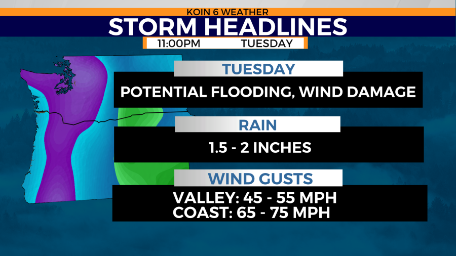
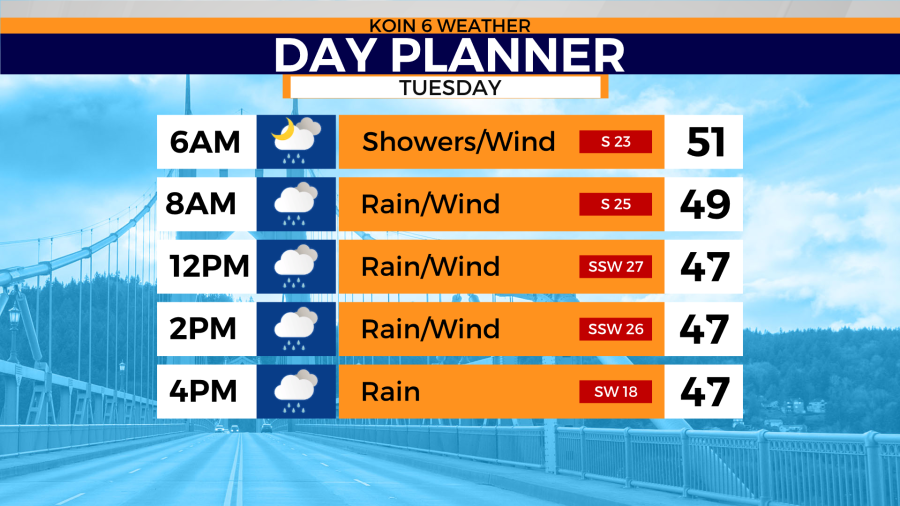
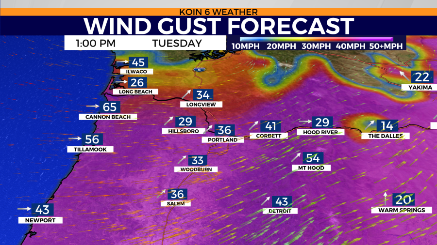
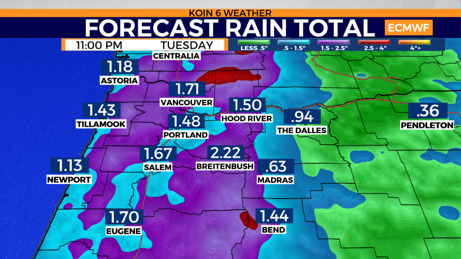
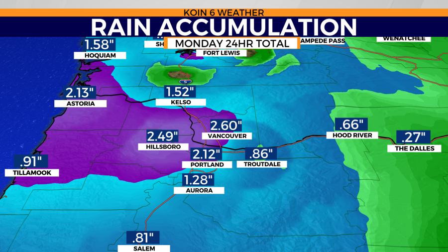
In Portland, 24-hour rain totals of 1.5″ to 2″ inches are expected. There will also be strong wind, with southerly wind gusts reaching up to 45-55 mph for the valley.
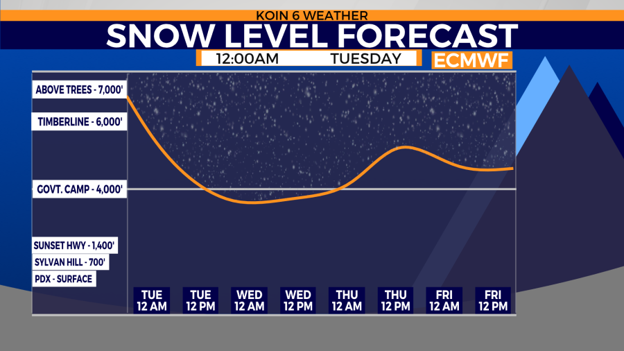
Meanwhile, snow levels rest well above mountain passes Tuesday morning. Colder temperatures arrive late at night which should bring snow to mountain passes late Tuesday night into Wednesday and Thursday.
Stay high and dry
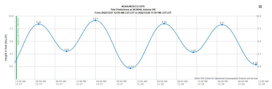
The combination of extremely large waves, very high tides, a 2.5 to 3.0 ft surge/tidal anomaly and high river flows has the prompted the issuance of a Coastal Flood Warning for the south Washington coast. The forecast high tide Tuesday afternoon for Toke Point is 9.6 ft. Up to a 3.0 surge/anomaly is expected, producing a total tide closer to 12 ft.
https://www.weather.gov/wrh/TextProduct?product=afdpqr
Here are the weather hazards issued by the National Weather Service in chronological order.
Greater Portland/Vancouver Metro areas
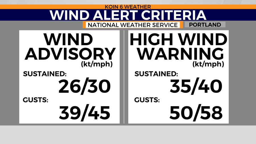
Wind Advisory Tuesday from 2 a.m. to 7 p.m.
Cascades
E. Columbia River Gorge
Wind advisory until 4 a.m. Wednesday
N. to central Oregon coast
High Wind Warning until 7 p.m. Tuesday
Flood Watch until late Tuesday night
High Surf Warning until Tuesday night
South Washington Coast
Offshore waters from Oregon coast
Storm Warning for high seas and strong wind
Climate stats from Monday, Dec. 26:
Maximum wind gust at the coast: SE 75 mph near Garibaldi at Barview Jetty.
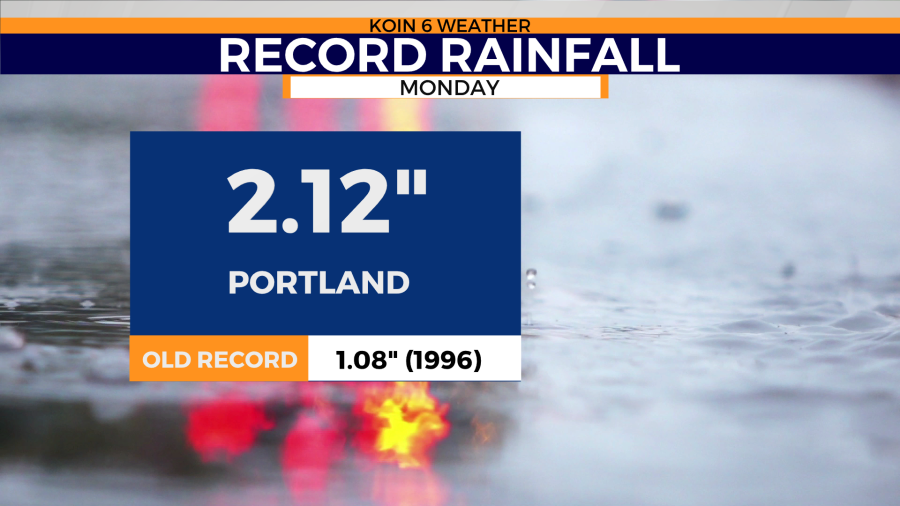
Portland broke its rainfall record Monday with 2.12″ preliminary (old record 1.08″ 1996).
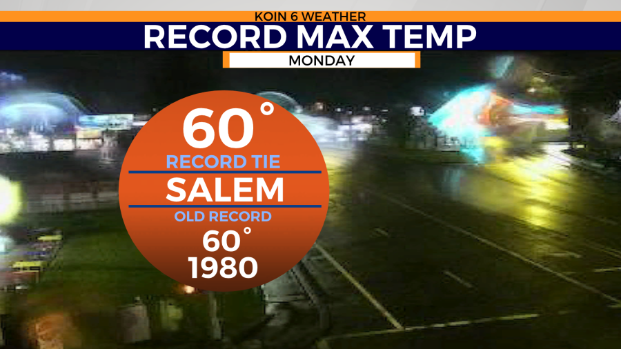
Salem tied its record maximum temperature at 60 degrees (1980). And Hoquiam, Washington vaporized its old record maximum temperature of 58 degrees (1980). The new record is 65 degrees.