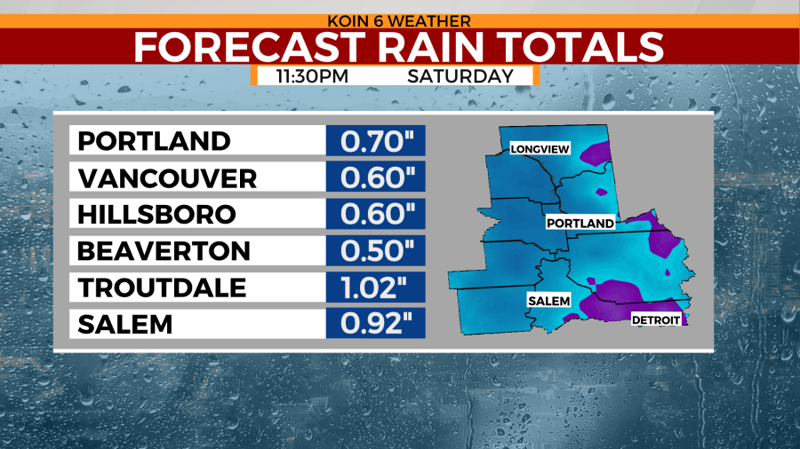
Portland wakes up to rain and goes to bed with… you guessed it… more rain. We could see a few isolated thunderstorms over the weekend, and loads of snow for passes over the Coast Range, Cascades and Upper Hood River Valley. For the Willamette Valley it’s just like a day in early February, daytime highs only reach the upper 40s to low 50s.
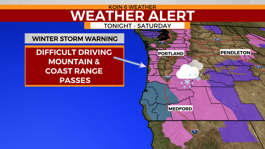
Our latest storm system will bring in abundant snowfall for the Cascades. A Winter Storm Warning is in effect for 2-4 feet of snowfall through Sunday evening. Expect very tough travel and delays this weekend.
The following weather alerts are issued by the National Weather Service Portland.
Winter storm warning for the Cascades
* WHAT...Heavy snow expected above 1500 feet. Total snow
  accumulations of 1 to 2 feet, except 2 to 4 feet above 3000
  feet in elevation. Winds gusting as high as 40 mph.

* WHERE...Northern Oregon Cascades and Cascades in Lane County.

* WHEN...From 8 PM this evening to 11 P.M. PDT Sunday.

* IMPACTS...Travel could be very difficult. Patchy blowing snow
  could significantly reduce visibility. Those with recreation
  plans in the Cascades this weekend should prepare for peak
  winter conditions.

* ADDITIONAL DETAILS...Snow levels will lower from around 3000
  feet to 1000 feet behind a cold front this evening, then snow
  levels will remain unseasonably low through Monday.
  Accumulating snow will be possible for elevations as low as
  500 feet, but the heaviest and most impactful accumulations
  will remain above 1500 feet.
Winter weather advisory for the Upper Hood River Valley
* WHAT...Snow expected above 1500 feet. Total snow accumulations
  of 2 to 8 inches, heaviest above 2000 feet. Winds gusting as
  high as 35 mph.

* WHERE...Upper Hood River Valley.

* WHEN...From 11 P.M. this evening to 11 PM PDT Sunday.

* IMPACTS...Travel could be very difficult.
Winter storm warning for the Coast Range
* WHAT...Heavy snow expected above 1500 feet. Total snow
  accumulations of 4 to 8 inches, except 8 to 16 inches for
  elevations above 2,000 feet. Winds gusting as high as 40 mph on
  exposed peaks and ridges.

* WHERE...Coast Range of Northwest Oregon and Central Coast
  Range of Western Oregon.

* WHEN...From 11 P.M. this evening to 11 P.M. PDT Sunday.

* IMPACTS...Travel could be very difficult. Roads through the
  Coast Range will be impacted, especially the summits. Those
  with recreation plans in the Coast Range should prepare for
  peak winter conditions.

* ADDITIONAL DETAILS...Snow levels will lower from around 3500
  feet to 1500 feet behind a cold front this evening, then snow
  levels will remain unseasonably low through Monday.
  Accumulating snow will be possible for elevations as low as
  500 feet, but the heaviest and most impactful accumulations
  will remain above 1500 feet.
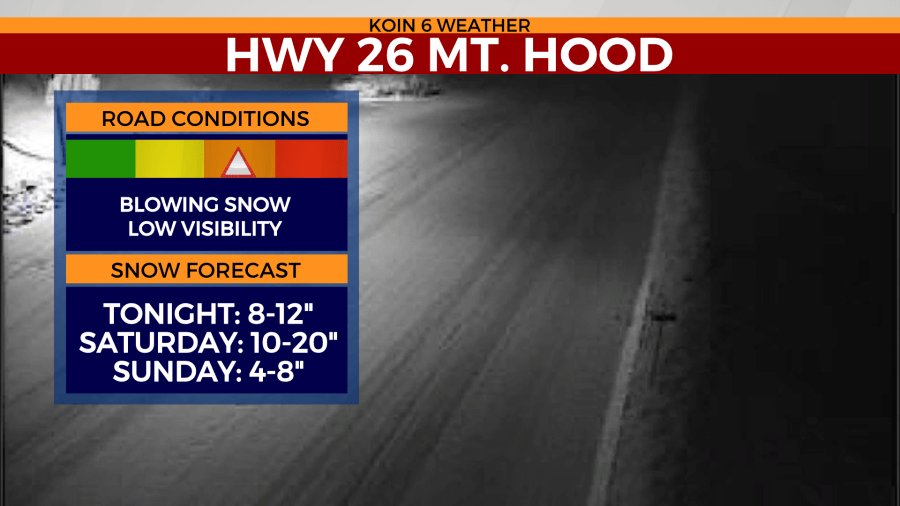
See the snow at Mt. Hood below:


