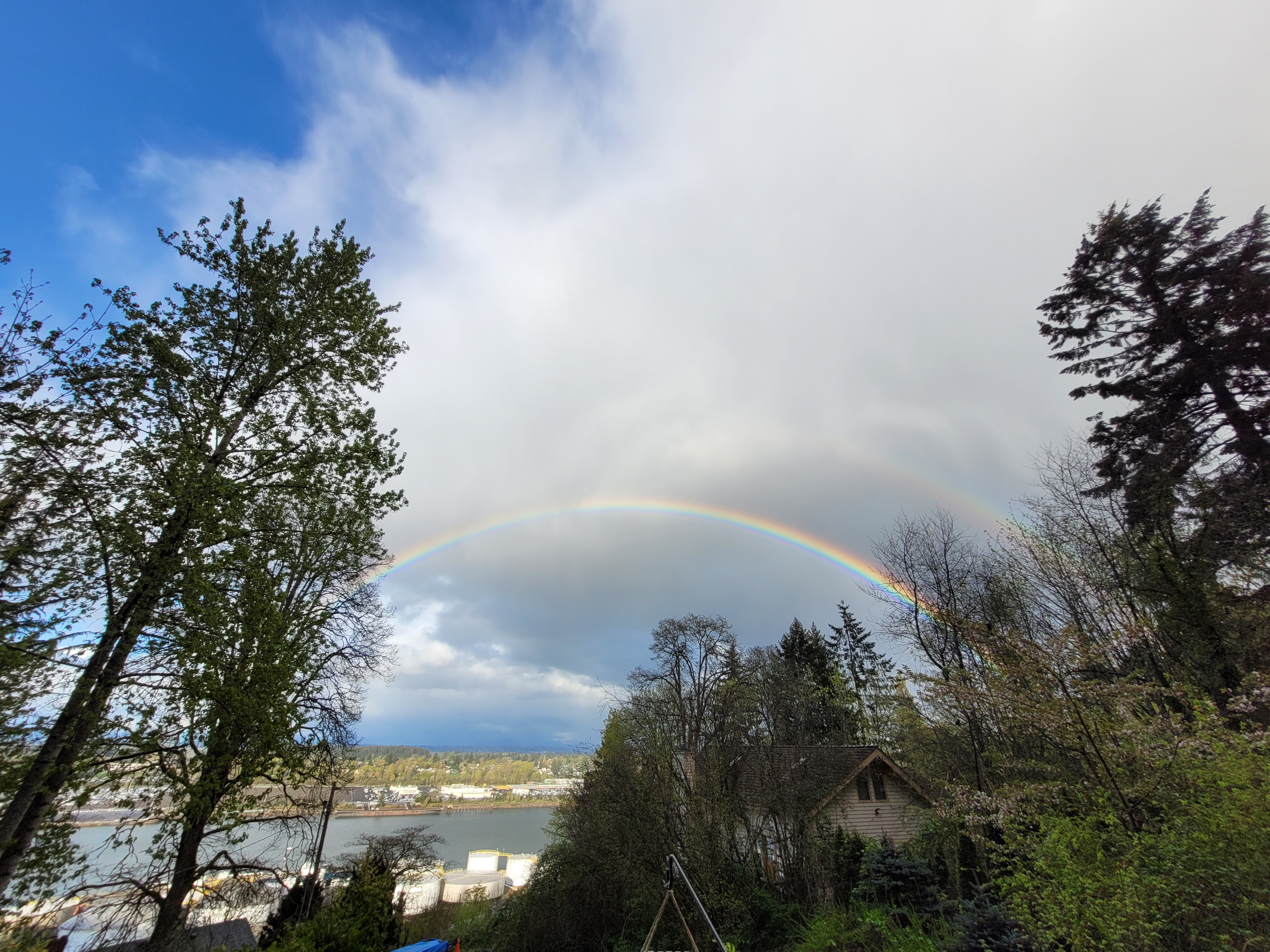
PORTLAND, Ore. (KOIN) — “Wait a minute, Doc. Are you telling me you built a time machine?”.
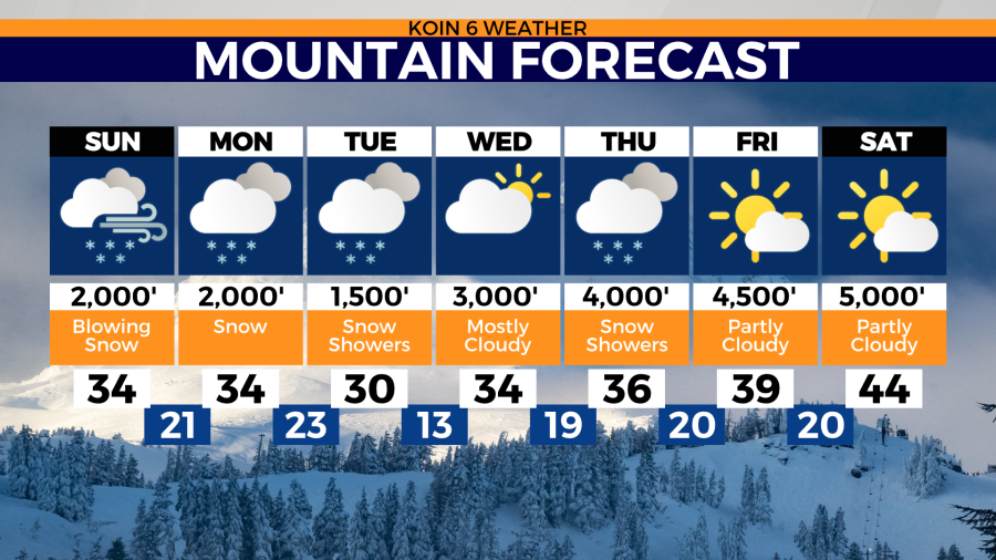
Just like 1985’s Back To The Future starring Michael J. Fox, we too are experiencing a bit of time travel in seasons. Sure, it’s early April but the weather this weekend will more closely mimic February. Daytime highs will range from 49 to 52. Low temps will vary from 36 to 40.
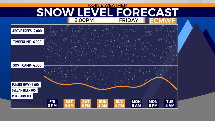
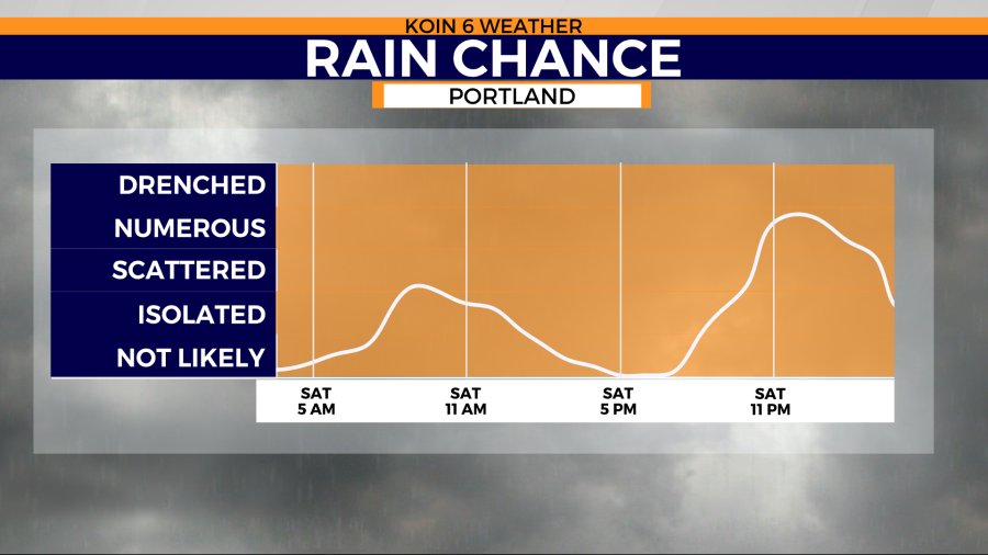
You can expect Saturday to start with the lighter variety showers but thunderstorm chances do exist for the afternoon. Thanks to an upper level trough, we expect showers to increase as the day goes on and lowering snow levels from 4,000′ down to about 1,000′. During those overnight hours snow may mix in with rain to create more of an Icee texture down to 500 ‘.
Lower snow reality check: the snow for the hillsides isn’t going to survive daytime temps in the upper 40’s. Any low snow will only be there for the moment of the heaviest showers and the coldest part of the night/morning.
The last time we had snow in Portland this year was Feb. 24 (0.5″), which is also our total year to date.
Prior to Feb., you have to go back to Dec. 30, 2021 to find snow (0.3″). The month of December felt like our only true wintertime. Total for December (3.9″). The season total to date (4.4″).
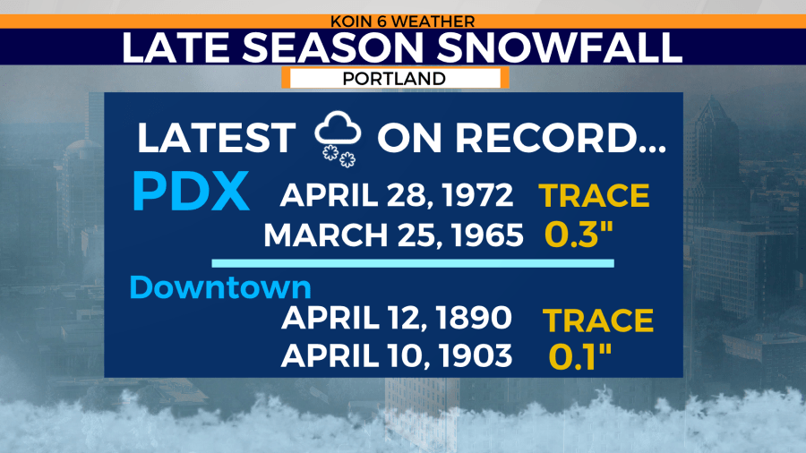
How about the last time we had snow in Portland IN APRIL?
Late measurable snow:Airport: March 25th, 1965 at 0.3″. Downtown: April 10th, 1903 at 0.1″
Late trace of snow: Airport: April 28th, 1972
Downtown: April 12th, 1890
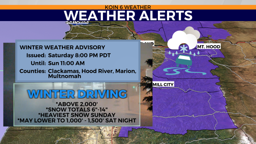


Winter weather advisory
* WHAT…Snow expected above 2000 feet. Total snow accumulations of 6 to 14 inches.
* WHERE…In Oregon, Northern Oregon Cascades. In Washington, South Washington Cascades.
* WHEN…From 8 PM Saturday to 11 AM PDT Sunday.
* IMPACTS…Expect winter travel conditions.
* ADDITIONAL DETAILS…Heaviest snowfall will occur early Sunday morning through late Sunday morning. Snowfall rates up to one and a half inches per hour will be possible during this time period.
https://forecast.weather.gov/wwamap/wwatxtget.php?cwa=PQR&wwa=winter%20weather%20advisory
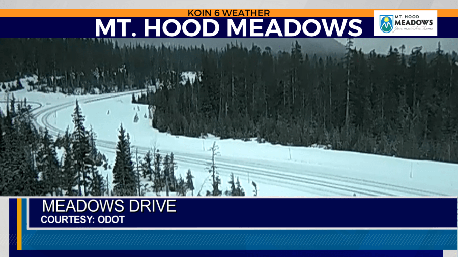
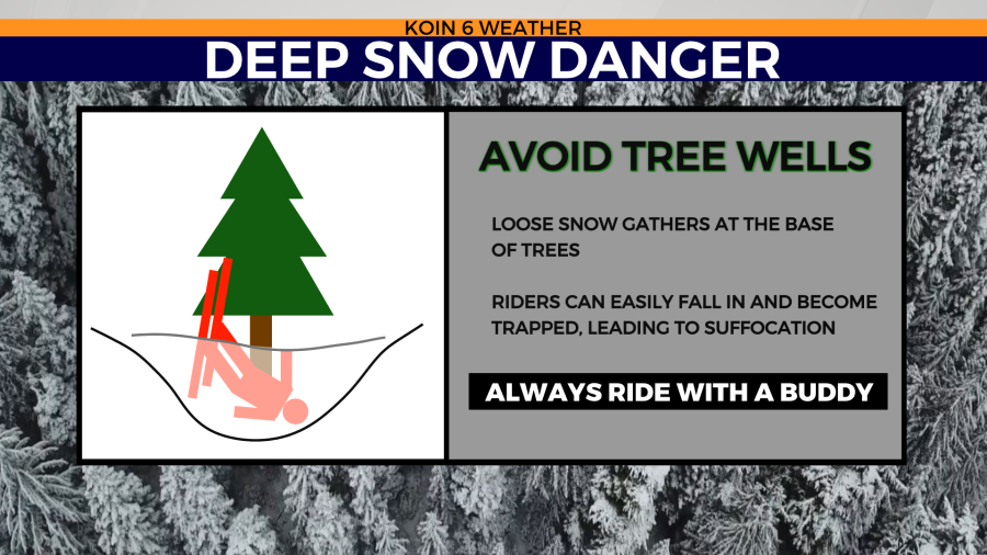
NWAC Avalanche forecast Saturday
Moderate to Low for Mt. Hood
Winter returns over the weekend and you shouldn’t have to look too hard to find wind-affected snow. Strong to extreme winds can form fresh wind slabs further downslope than usual while also stripping windward aspects. Don’t get caught out Saturday night with very cold temperatures, more snow, and persistent winds in the forecast.
https://nwac.us/avalanche-forecast/#/all/