PORTLAND, Ore. (KOIN) — Today will feel like a walk in the park compared to the major storm we’re anticipating Sunday.
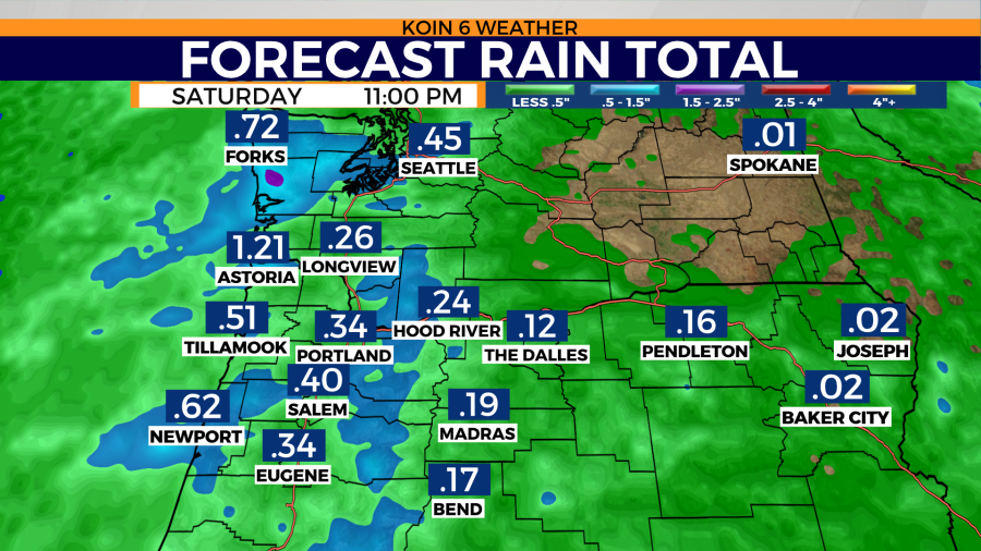
Saturday: A cold front arrives with rain and breezy conditions. Showers stay with us for the morning and afternoon with a few dry breaks. High temperatures reach the upper 50’s. There is a chance for isolated thunderstorms, mostly near the Oregon coast and coast range from Newport south to California.
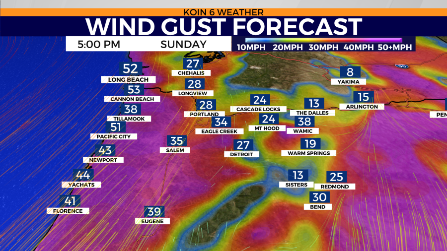
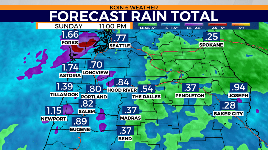
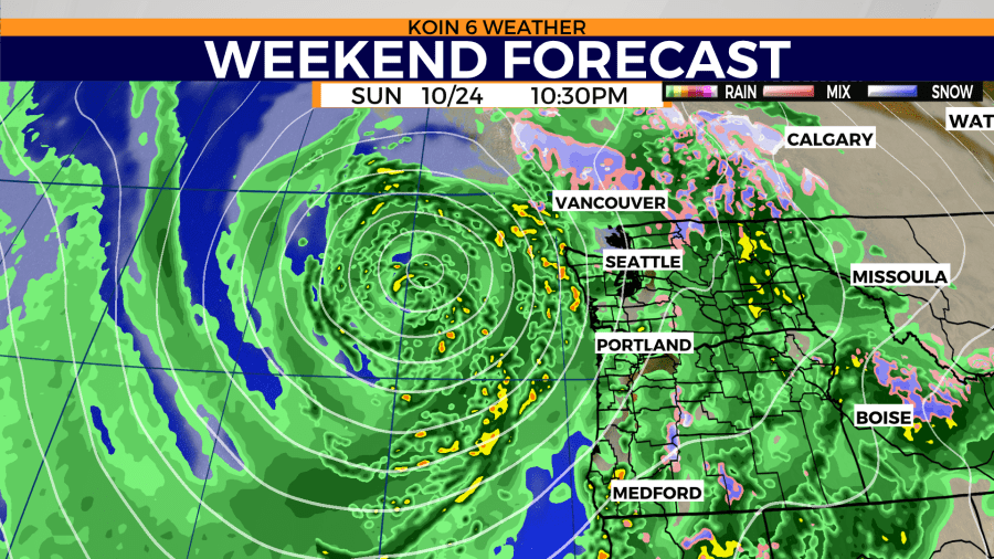
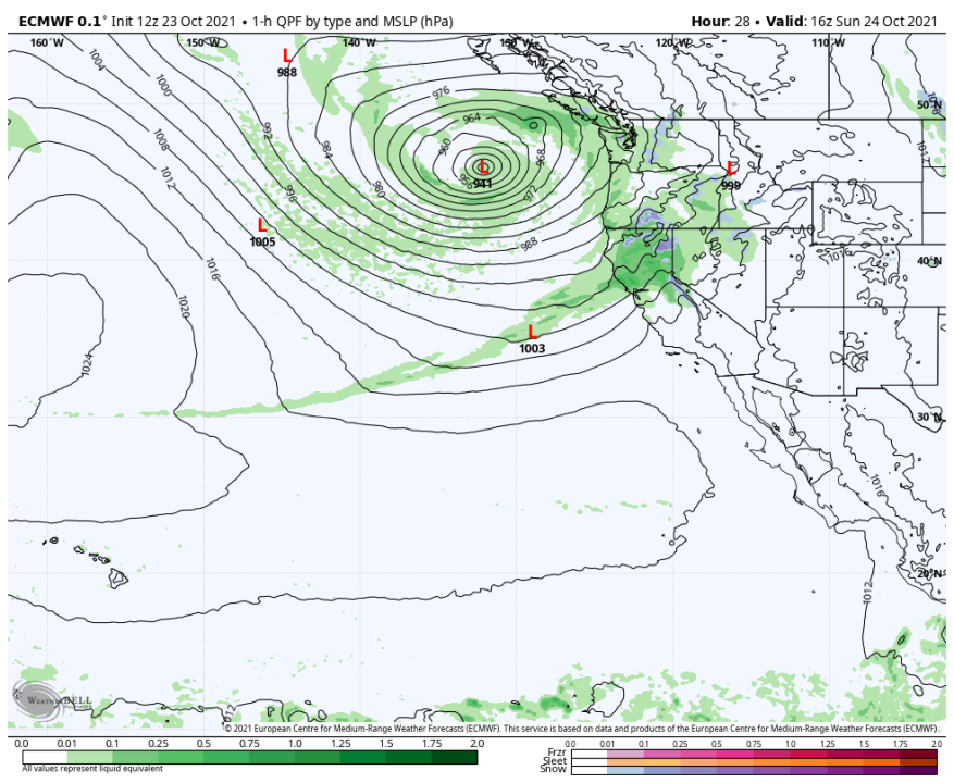
Sunday: This is the day when rapid strengthening of Bomb Cyclone #2 reaches its lowest minimum pressure. While the exact path is uncertain, I can say with reasonable confidence that impacts will be felt from the coast of southern Oregon all the way up to Vancouver Island, British Columbia. This is the 2nd storm of its kind in one week. If you’re thinking this sounds extreme for the Pacific Northwest, you’d be right.
Update: Models are still showing a drop in pressure of more than 24mb (millibars) in less than 24 hours, ultimately achieving a minimum pressure of 941mb (950mb is equivalent to a Cat 2 hurricane based on the DCIC chart). If this outcome verifies, this would be the lowest pressure measured on record for this sector of the Pacific nearshore.
Large, powerful Pacific-born windstorms have a nasty reputation for knocking out power, damaging property, and in some instances taking lives. Such high-impact windstorms are not a regular occurrence here. Look below and you can see the paths taken by significant, historic windstorms. The Columbus Day Storm of 1962 is perhaps the most recognized catastrophic wind event in the Pacific Northwest. It’s important to note angle at which the low approaches the coast, and the strength of the low at a given distance can make or break a major wind event.


Sunday: There’s a chance for thunderstorms all day for the coast and valley Sunday. The marginal risk for severe t-storms along the coast includes damaging hail, damaging wind, and a chance for tornado development. Click here for the SPC statement concerning the severity of these thunderstorms.
The biggest waves will be found south of Florence – that is the stretch of beach under a high surf warning now. However, that doesn’t mean the beach is any safer to the north of Florence. These watches and warnings are subject to change. The north Oregon coast may encounter breakers up to 32 feet. Flooded roads and parking lots are expected during high tide, not because of rain, rather because ocean water will be rushing above the mean tide level.
Watches / Warnings
High Wind Warning
Coastal Flood Warning
Wind Advisory
High Surf Warning


