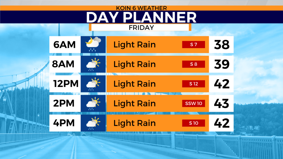
PORTLAND, Ore. (KOIN) — Friday morning we expect scattered showers with temperatures in the mid to upper 30s for Portland. We’ll hit the low 40s by the afternoon. Once again, a day with highs well below normal. The normal for Portland is 54 in early March.
The chance for snow in Portland on Friday morning is slim but not impossible. Based on temperatures and the amount of moisture moving this way means you may only encounter a rain/snow mix.
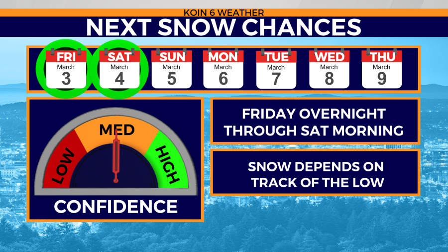
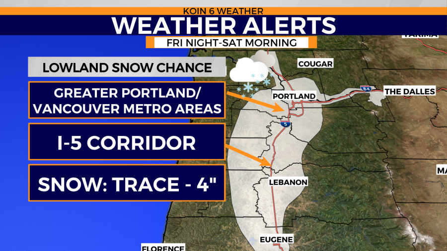
Heavy, wet snow is a possibility from Friday evening to Saturday — but for who? The chance for measurable snow is most likely for elevations above 1,000′. However, some light accumulations are possible down to the valley floor by Saturday morning.
The next Gulf of Alaska area of low-pressure tracks toward the Pacific Northwest late Friday. If it heads another direction, we’re out of the lowland snow game.
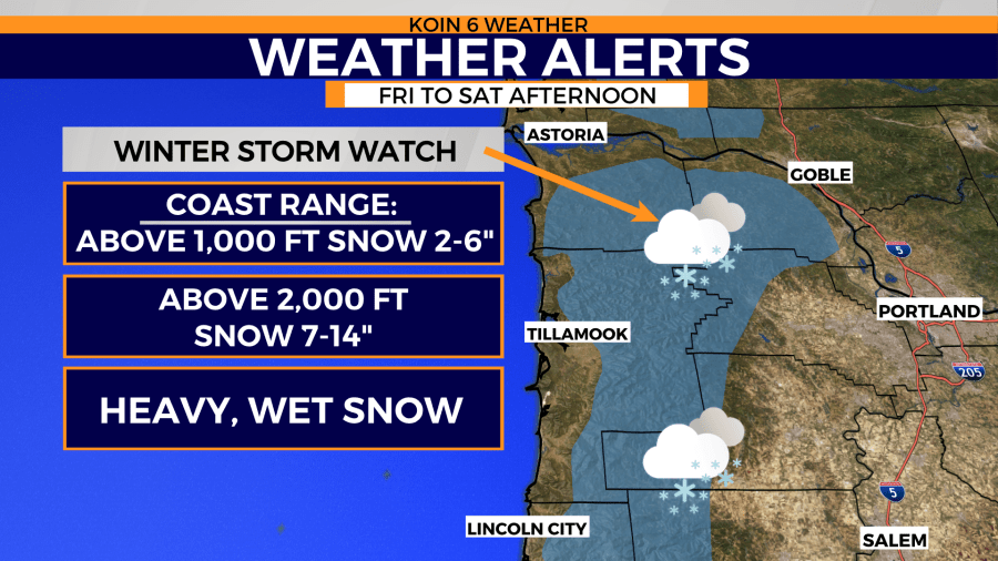
A winter storm watch will be in effect from Friday afternoon to Saturday afternoon for the coast range.
Weather alerts
Issued by the National Weather Service, Portland
WINTER STORM WATCH REMAINS IN EFFECT FROM FRIDAY AFTERNOON
THROUGH SATURDAY AFTERNOON ABOVE 1000 FEET...

* WHAT...Heavy wet snow possible above 1000 feet. Total snow
  accumulations of 7 to 14 inches, except 2 to 6 inches below
  2000 feet possible. Winds could gust as high as 35 mph.

* WHERE...In Oregon, Coast Range of Northwest Oregon and Central
  Coast Range of Western Oregon. In Washington, Willapa Hills.

* WHEN...From Friday afternoon through Saturday afternoon.

* IMPACTS...Travel could be very difficult.