PORTLAND, Ore. (KOIN) – If you’re one who is amazed by the power of Mother Nature, this weather lesson is right up your alley!
This lesson is learning about the weather phenomenon that is called a derecho. What exactly is that? Is that something we will see here in Oregon? Well, there is a lot to learn about this weather topic so let’s just dive right into the details.
NOW IS THE TIME TO STUDY THE IMAGE BELOW AND WATCH THE VIDEO ABOVE!
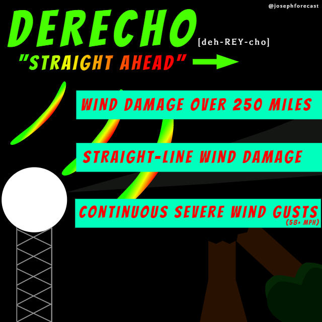
A derecho (deh-REY-cho) is a wind event that spans over hundreds of miles (states) and may produce widespread wind damage. It is a Spanish word for “straight-ahead” or “direct”. These type of events only happen a few times a year, if that.
A derecho is a strong wind storm that’s associated with a band of fast-moving thunderstorms, typically in the formation of a bow. Check out the photos below to see what a “bow echo” looks like on radar. These storms have a strong outflow wind that spreads out in the shape of a bow. Now, a derecho isn’t a tornado, but it may have tornadoes within the line of storms and it may do just as much damage as a tornado.
So what’s the difference between a tornado and derecho? The burst of wind is usually in a straight line. This kind of weather event gets the official title of derecho by meeting specific crititeria.
#1 Stretches the distance of at least 250 miles (it may be as wide as several states)
#2 Produce strong wind gusts of at least 58 mph or greater.
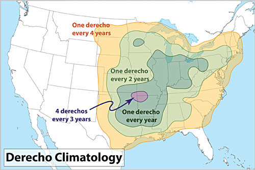
Now this just happened recently across the states of Iowa, Illinois, Indiana and surrounding states. This region of the United States is more likely to see events like this due to the hot and muggy conditions in the summer that offer plenty of energy (convection) for sustained thunderstorm events. It’s tough for a derecho to form in the Pacific Northwest (PNW). Why? We have the cold Pacific ocean, plus hills and mountains act like a bunch of linebackers in football, running interference against events like a derecho. Would I rule this out from happening here in the future? Well, it would be very difficult for this to occur, unless our climate changed dramatically.
This is a video clip of the event that happened on August 10, 2020 across several states in the Midwest.
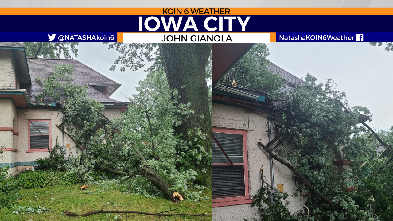
The storm damage photos below are from Jeff Gianola’s brother John Gianola in Iowa City, Iowa on Monday. John said it wasn’t like a tornado but more like a hurricane, where the winds just wouldn’t stop. His roof took a big hit from this tree. Here’s a list of incredibly damaging derechos from the past.
Editor’s note: The KOIN 6 Weather team is presenting weather and science lessons to help serve our teachers and students. Click here for more lessons.
This weather topic requires additional understanding of severe weather & radar knowledge