Editor’s note: The KOIN 6 Weather team is presenting weather and science lessons to help serve our teachers and students. Click here for more lessons.
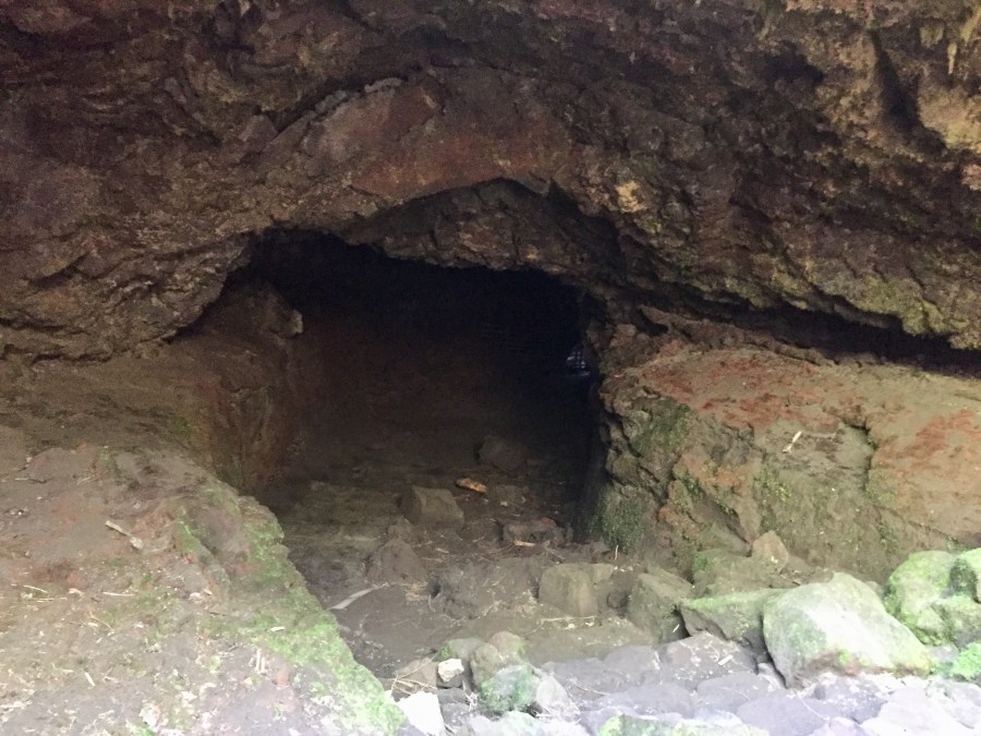
PORTLAND, Ore. (KOIN) – Once upon a time, thousands to hundreds of thousands of years ago lava flowed from Mount Saint Helens. How do we know? There’s evidence all around us. Look closer at the Ape Cave located on the southern side of the volcano.
This enormous cave, about 2.4 miles long, was created by lava nearly 2,000 years ago. Ape Cave is the third-longest lava tube in North America. What’s cool is it’s tall enough to walk through. Speaking of cool, bring a jacket because it’s consistently 42 degrees underground there. Walking through the entire cave would be like walking the length of 36 football fields. I hope you have comfortable shoes.
Learn more about the geology around us from Covington Middle School eighth grade science teacher Paul Asbury who is also a volunteer hiking steward for Mount St. Helens Institute. He and his wife Karen witnessed the eruption of Mount St. Helens when they were just kids.
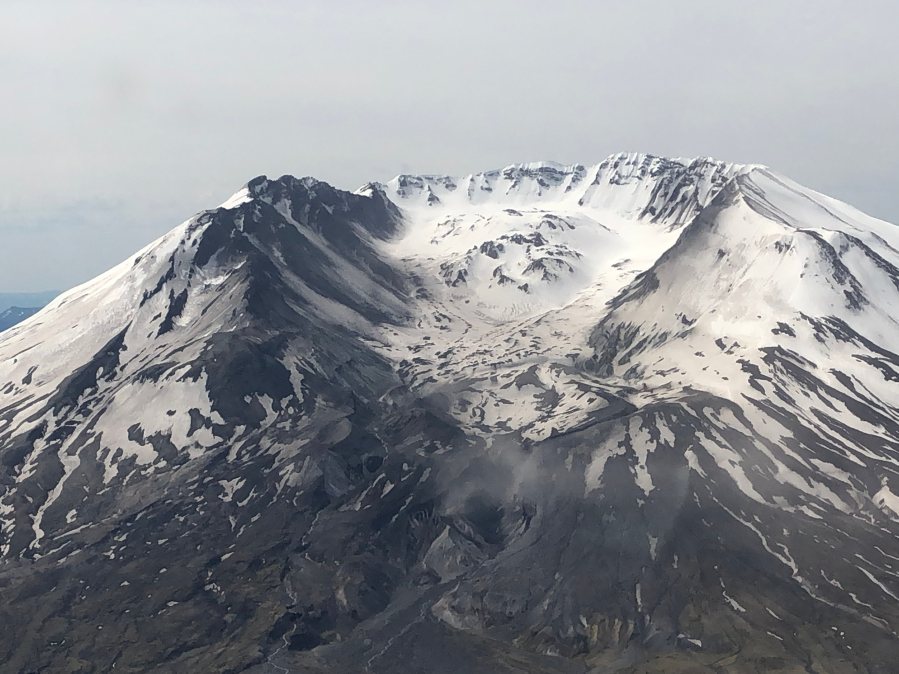
Seems strange that lava came from Mount St. Helens thousands of years ago. Stop and think about the pictures and video you’ve seen from the eruption May 18, 1980. Do you see any lava? No. So what’s up? Mount St. Helens is a composite volcano, also known as a stratovolcano. The name means steep-sided, symmetrical cones made of alternating layers of lava flows, ash, and other volcanic substances.
According to the U.S. Geologic Survey (USGS), composite volcanoes like Mount St. Helens, “tend to erupt explosively and pose considerable danger to nearby life and property.”
Listen to Seth Moran, seismologist and scientist in charge at Cascades Volcano Observatory, explain why Mount St. Helens was so explosive.
Think about opening a can of soda after shaking it. Whew watch out. That soda is going to spray everywhere. Why? Contents are under pressure and when you shake it, the contents get agitated.
Our planet is very much alive inside. Little earthquakes are constantly happening right in our backyard, even as you read this. Can you feel anything? I’m guessing probably not. Small 2.0 earthquakes can be measured by seismographs but aren’t big enough to feel most of the time. Stop here and take a look at all the earthquakes in motion right now.
Here’s what happened the day Mount St. Helens erupted 40 years ago, according to USGS.
“On May 18, 1980, the volcano was transformed. The catastrophic eruption, was preceded by 2 months of intense activity that included more than 10,000 earthquakes, hundreds of small phreatic (steam-blast) explosions, and the outward growth of the volcano’s entire north flank by more than 260 feet. A magnitude 5.1 earthquake struck beneath the volcano at 8:32 a.m. on May 18, setting in motion the devastating eruption. Within seconds of the earthquake, the volcano’s bulging north flank slid away in the largest landslide in recorded history, triggering a destructive, lethal lateral blast of hot gas, steam, and rock debris that swept across the landscape as fast as 680 miles per hour. Temperatures within the blast reached as high as 570 degrees Fahrenheit (300 degrees Celsius). Snow and ice on the volcano melted, forming torrents of water and rock debris that swept down river valleys leading from the volcano. Within minutes, a massive plume of ash thrust 15 miles into the sky, where the prevailing wind carried about 520 million tons of ash across 22,000 square miles of the Western United States.”
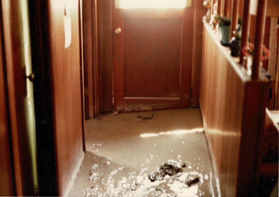
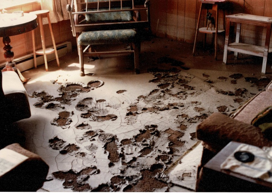
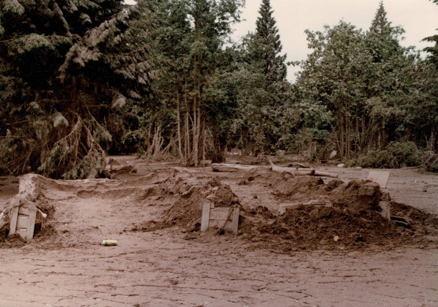
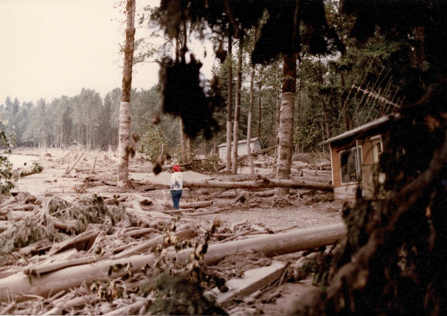
This is what happens in a pyroclastic flow, when water and rock debris join forces and destroy everything. Read Shannon Nelson’s story about his family’s cabin:
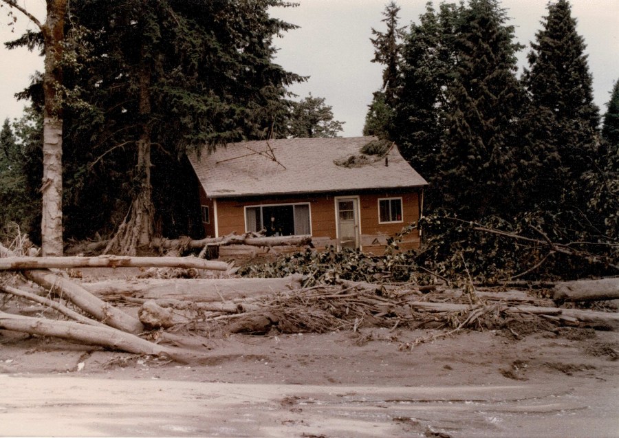

My grandfather’s cabin was a couple of miles up Toutle Park Road from
Interstate 5, a few miles up from where the Toutle River dumps into the
Cowlitz River. That Sunday morning a Sheriff’s Deputy knocked on the
door and told him to get out. He had been going around with a suitcase
in his car, just in case, so he put his coffee cup down and headed out.
We didn’t hear from him until late in the afternoon, when he had made it
to his brother’s house in Longview.Somewhere in some helicopter TV footage that evening we thought we saw
the cabin, but weren’t sure.A few weeks later, after the waters had receded and the mud settled and
hardened, they let us in to survey the damage and recover whatever we
could. We drove in to within about a quarter mile, to where the road had
been covered, then had to walk in the rest of the way. We saw some
other houses filled with mud, totally ruined, and were worried. When we
got to the cabin we found that since it hadn’t been tied down to its
cinderblock foundation, it had floated up on the mud. It had floated
only about 50 feet before it was stopped by the trees, and eventually
settled back down. The top of the mud was about 6 feet above where the
ground originally had been, and we could see on the trees where the mud
had been another 12 feet higher. The house had floated over and settled
over the woodshed, and out from under one corner was the coupler of an
empty logging railcar, stuck in between the cabin and the woodshed. The
cabin structure was a little cock-eyed over that railcar.In front of the cabin was the chest freezer that had floated out of the
workshop, lid open, contents thawed and stinking. Inside the cabin we
could see that the water and mud had seeped in a few inches, but mostly
the interior was untouched. We were able to recover most of the
contents. I still have my grandfather’s dresser, and you can still
faintly see mud stains around the bottom.The garage/shop building had been built with a proper foundation, so it
was filled with mud and the top had been ripped off and floated off
another 100 feet or so. We were able to dig out and clean up most of
the tools, including the electric drills and saws.My grandfather had bought flood insurance about 2 weeks before the
event. The insurance had a 10 day waiting period, so he was a few days
into coverage and got his insurance payout. The federal government
bought out all the properties in the area for a small settlement as
well. It wasn’t a lot, but he was able to buy a nice little single-wide
mobile home.The area is now the Cowlitz Public Shooting Range. The cabin was just
– KOIN 6 News viewer Shannon Nelson
east of where the range is now, on the west bank of the river.
Let’s talk Lava
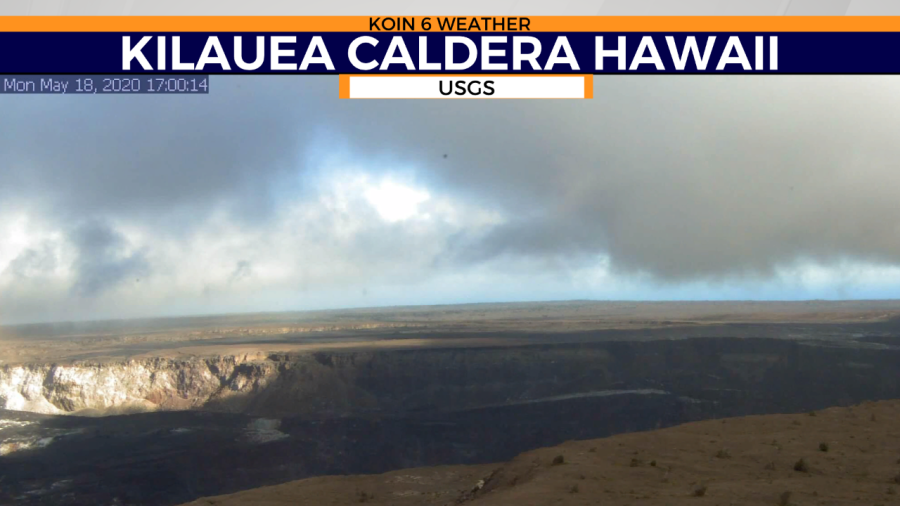
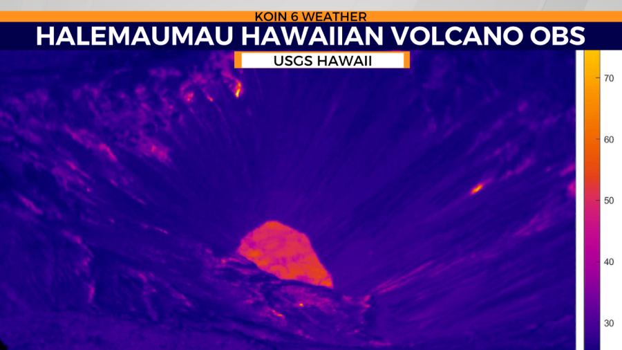
Let’s go across the Pacific to the Hawaiian Islands. Kilauea is the world’s most active volcanic mass, located on the southeastern part of the island of Hawaii. Unlike Mount St. Helens, the gently sloping shield volcanoes of Hawaii typically erupt in a less explosive way. Lava flows more like syrup in some cases and it can go great distances from the active vents. Hawaiian-type eruptions will definitely destroy anything in its path. Stand aside, like down the street, and watch the lava flow from a safe distance. It can be as hot as 2,200°F; that’s beyond the melting point of gold and close to the temperature of a house fire.