Editor’s note: The KOIN 6 Weather team is presenting weather and science lessons to help serve our teachers and students. Click here for more lessons.
PORTLAND, Ore. (KOIN) – It was just the other day we were learning about the jet stream and how it meanders and influences our weather. Today we will take it one step further and discuss something called atmospheric blocking.
Sometimes the word atmospheric can sound a bit intimidating, but once you see the images, it will start to make more sense. From time to time, the jet stream can create interesting patterns and once in a while, part of the jet stream will split or bend in alternative patterns. This lesson will dive into that and it will show examples of weather patterns that are little more unusual unless you’re looking for them.

What is interesting about patterns in the jet stream is the fact that they typically impact everyone in some sort of way. Whether it’s occurring on the west coast, east coast or in between, it will have an impact across the board. Now some of these setups do more “blocking” than others, but the patterns are all interesting to the weather brain! They patterns usually lead to an extended time of consistent weather. Meaning, the pattern will not change as quickly as normal because of the blocking.
Why don’t we start with a few patterns that have the actual word block in the title. We will first begin with what happens fairly often for the Pacific Northwest, which is the OMEGA BLOCK.
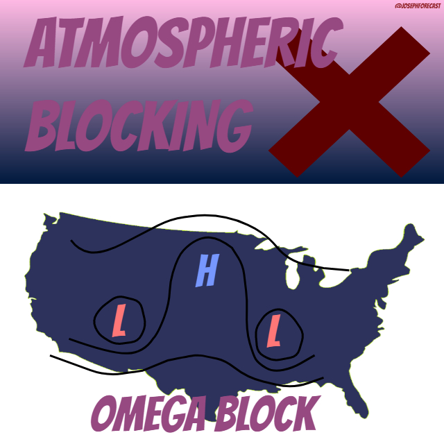
The Omega Block is when a ridge of high pressure splits, what is usually, two cut-off lows. The pattern gets the name omega because it looks like the Greek letter omega (Ω).
What does this mean for our weather? Well if you’re in the area of the high pressure, it will be a period of warm and sunny weather. If you fall in the area of the cut-off low, you will experience cool and wet weather. This can cause a period of time of dry weather for some and wet weather for others. Which may lead to drought conditions or flooding problems.
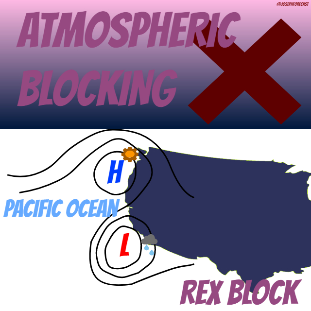

Next up to bat, the REX BLOCK. This is when an area of high pressure stacks above an area of low pressure. This may resemble a figure “8” if you’re looking at it with artistic eyes. Because of the path of the air that is twisting around the high and down around the low, the pattern doesn’t move or break very quickly.
This will lead to persistent warm and dry conditions where the high pressure is perched and cool and wet weather connected to the area of low pressure.
Moving along, we can now discuss a pattern called SPLIT FLOW. What could this possibly mean? Well, you guessed it: it has to do with splitting. In this scenario, the jet stream will rip at the seam and one part will move north and the other south. Generally, the stronger wind will navigate to the north and the weaker to the south.
The area in between will be rather stagnant and calm. This can happen to the PNW from time to time and this pattern will leave us pretty quiet in the winter months. All of the action will move north towards Alaska.
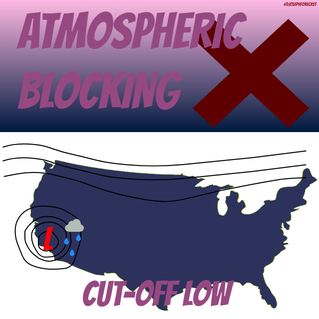
One of my favorites to see show up in a forecast is the dreaded CUT-OFF LOW. This is when an area of low pressure will disconnect from the main flow of the jet stream and literally wobble around in the same area of days. A consistent flow to the north with a sluggish low with nowhere to go! This area of low pressure brings days of gloomy conditions and rain. It takes something to come along and pick it up or push out. This happens to the south of Portland frequently and leads to rainy weather.
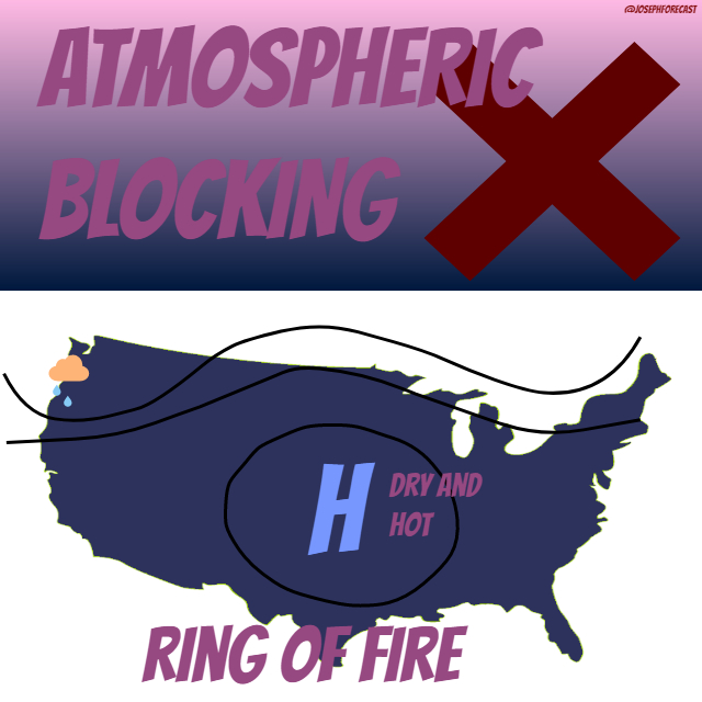
This last one shares the name of a pretty popular song (ask your parents), it’s called the RING OF FIRE. Now, this setup doesn’t typically build in our region, but in the summer, it can really cause major problems for areas of the south. This is when a blocking high builds over an expansive area and doesn’t budge. This leads to heat waves and very little rain at the core of this ring. Generally, the jet stream that is situated to the north is equally weak and doesn’t bring anything in to help break down that area of high pressure. This can be dangerous because this pattern virtually keeps itself going. It can stick around for many days and leads to extreme temperatures.
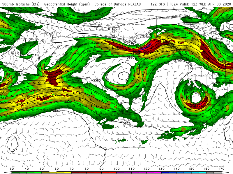
Lastly, I took a snip of a weather model over the Pacific Ocean – go ahead and try to figure out which pattern is forming!
