PORTLAND, Ore. (KOIN) — Wet, windy, and cooler than normal temperatures return to the Portland metro area Tuesday as the latest spring storm moves onshore.
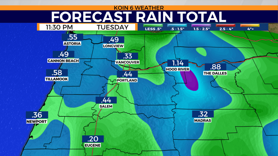
Rain will continue to fall throughout the day Tuesday with a few dry times found during the afternoon hours. Rain accumulation will near a half inch from the coast to the foothills of the Cascades.
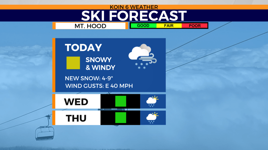
Snow elevations will remain above 3,500 ft. Tuesday. That’s where additional snow of four to nine inches of snow is possible through Wednesday.
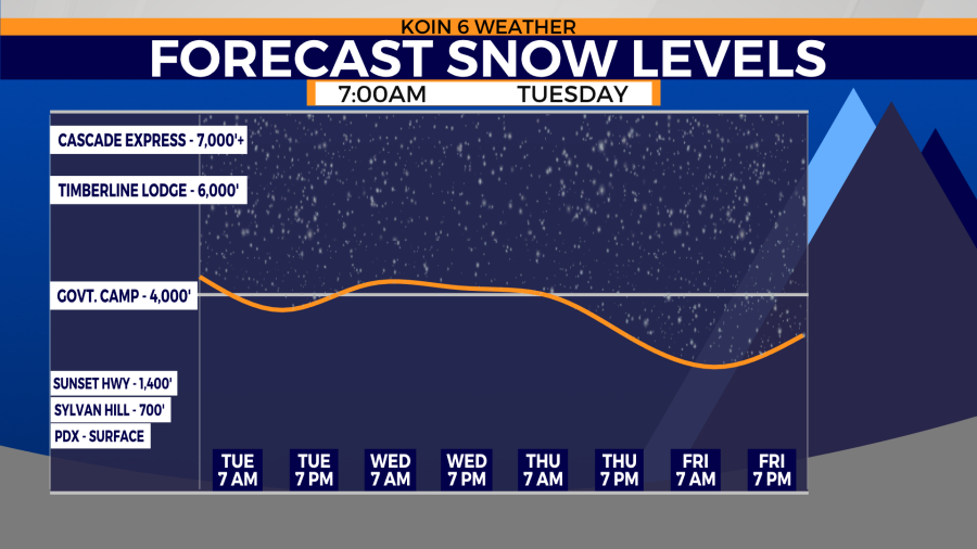
The additional snow is great for skiers and snowboards during spring break, but mountain pass travel could be slick at times. Snow-packed roads are likely through Wednesday above 3,000 ft.
Spring-like temperatures slowly return to the Willamette Valley Wednesday. That’s where afternoon highs will climb into the low 60s. Clouds will clear throughout the day.
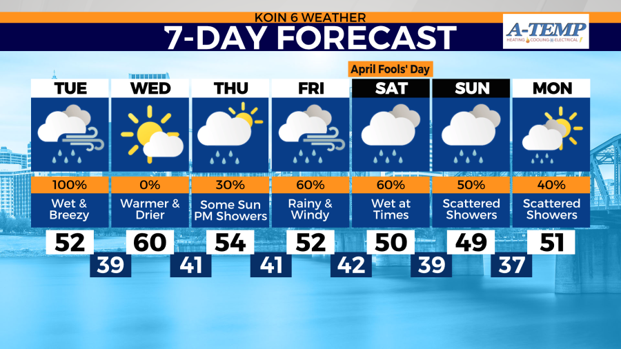
Mostly dry weather continues Thursday before the next round of rain returns late Thursday evening. That’s where temperatures will continue to sit below average by nearly 10-15 degrees through Sunday.