PORTLAND, Ore. (KOIN) – We are working through a fierce temperature inversion right now, which is going to keep conditions cold and foggy near the valley floor most mornings this week.
When we have a full morning of fog, temperatures have a real hard time warming up. During the winter, it may keep our high temperatures from warming up out of the 30s. What exactly is going on though? What is a temperature inversion?
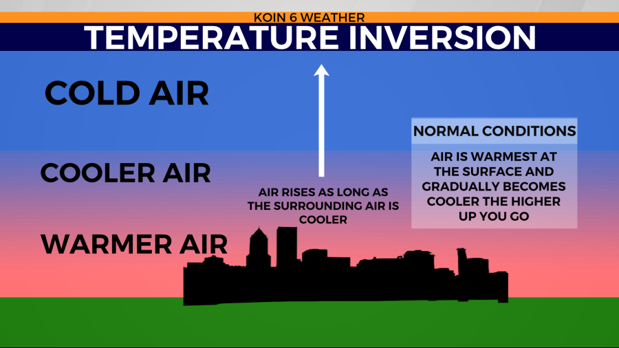
Normally, temperatures are warmer at the surface, cooling as you go higher up in the sky. This allows for most of the rising air and pollutants to continue to disperse out into the atmosphere.
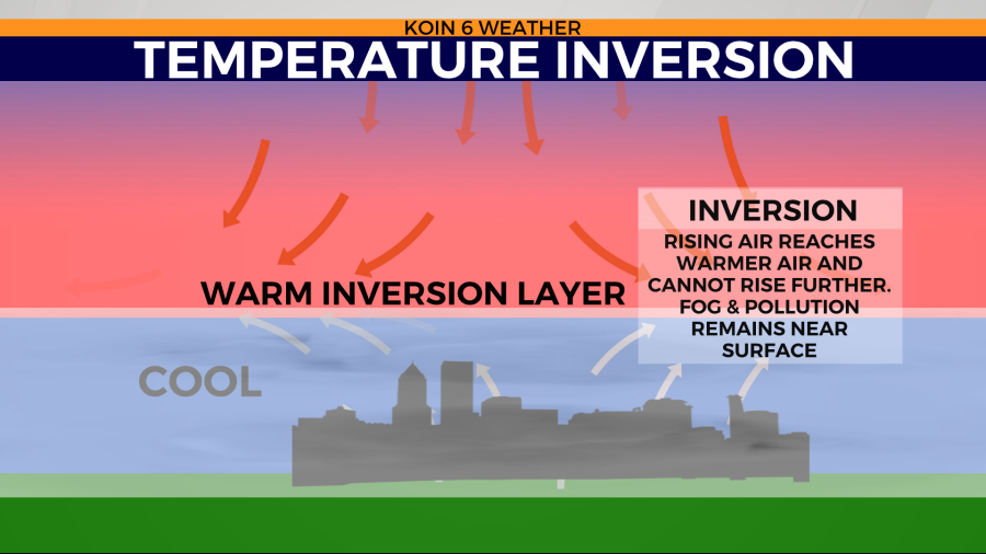
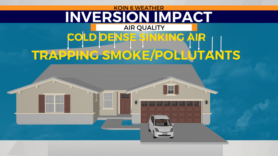
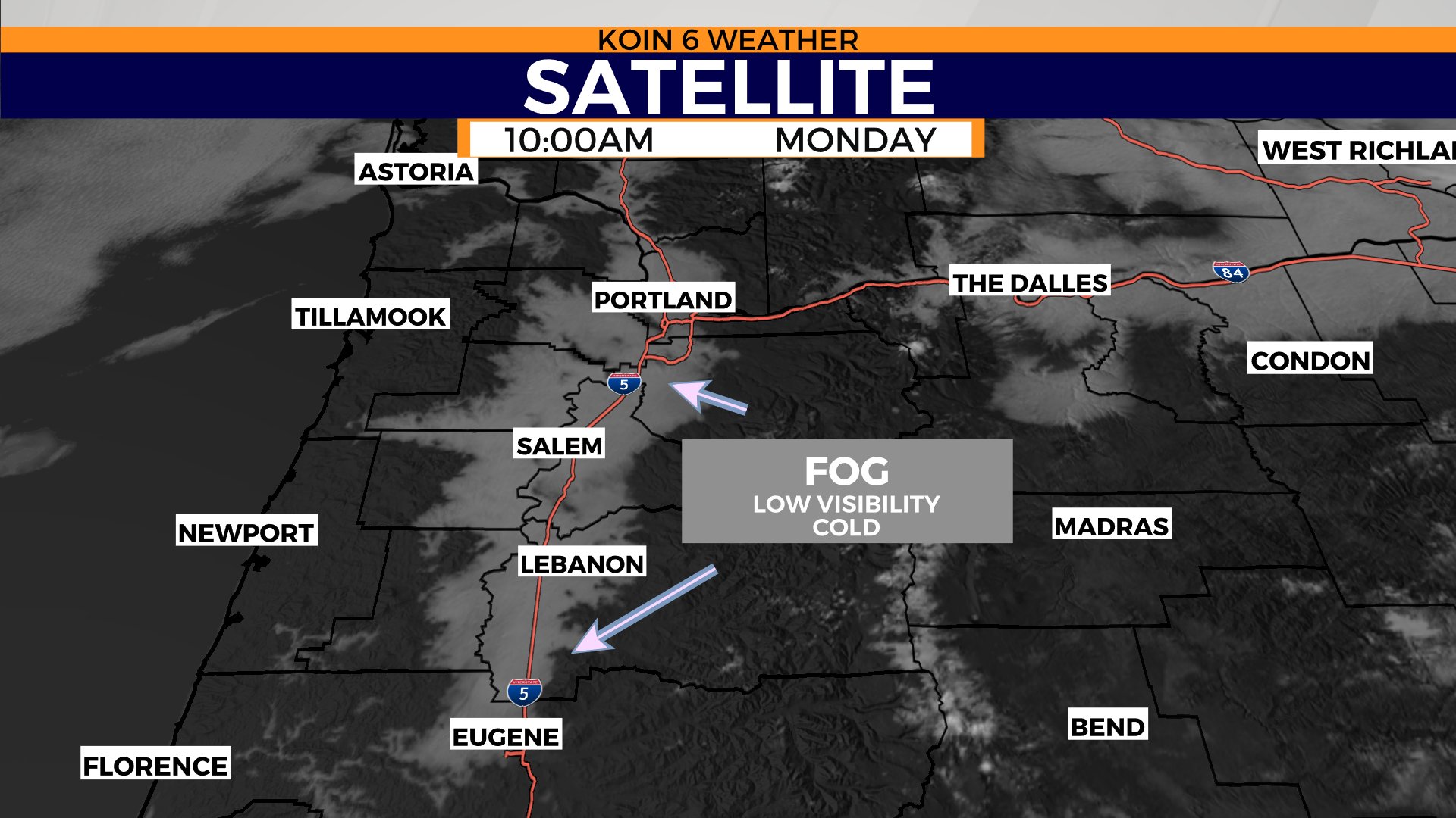
When we have a temperature inversion in place because of persistent high pressure, we end up having the opposite. The surface will be cooler, with a warm layer above. That warm layer prevents pollutants from escaping. This also keeps the temperatures colder at the surface, allowing for fog to form. Cycle through the slideshow below to get a visual of how this works. Cold air sinks to the valley floor during the winter months, as if we are in a cold bath.
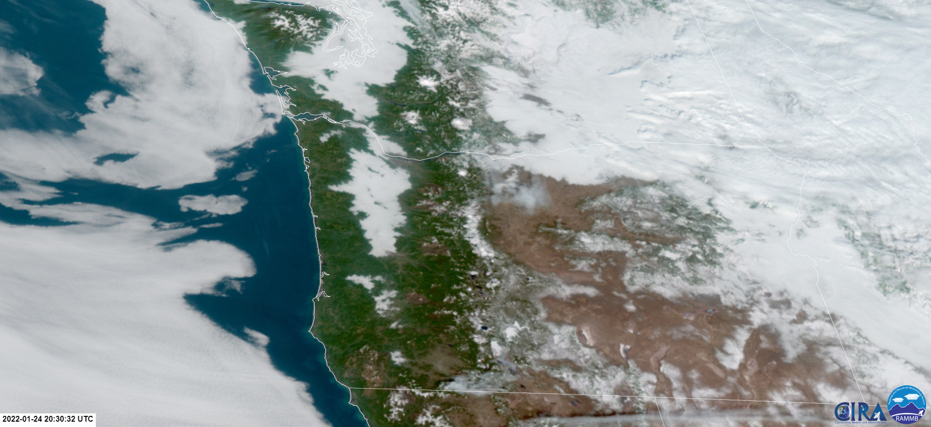
We have the tools to spot this valley fog from space. Visible satellite shows the fog socked into areas of the Willamette Valley late this morning. If you cycle over to the next graphic, you can see how there have been some improvements early this afternoon. Fog branches out to all of the areas that are protected from wind. Once the air becomes saturated, that fog forms. It takes the warm sunshine to help penetrate the fog. Once it can reach the surface, warming the ground, it will help dissipate the stubborn fog. This takes time, it doesn’t happen right when the sun rises. When the fog is dense and we have this type of environment, it usually takes to lunch time or beyond to breakthrough.
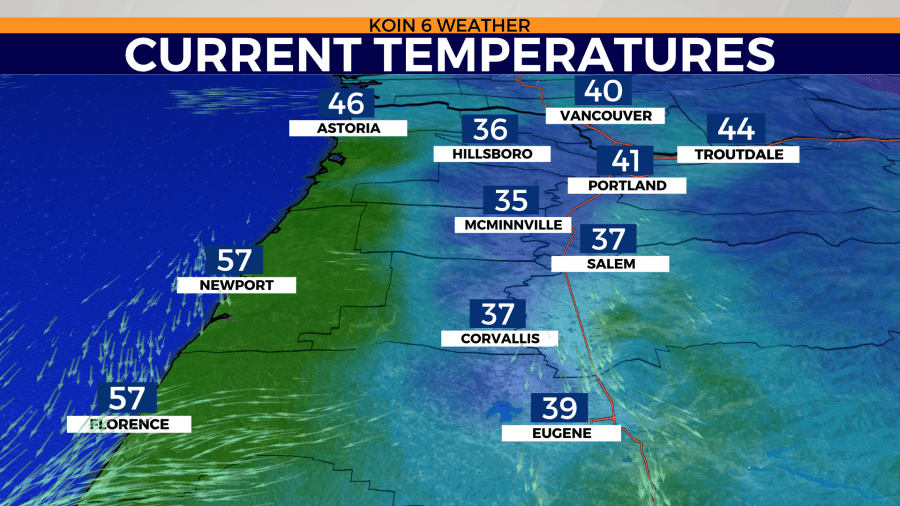
Check out the temperatures as of mid-day. Temperatures nearly in the 60s for the central Oregon coast. We have highs in the lower 40s around Portland, where the sun has finally come out to play. Those west of Interstate 5 out to Hillsboro are still dealing with fog and cold temperatures in the early afternoon. This should improve as the afternoon blends to the evening.
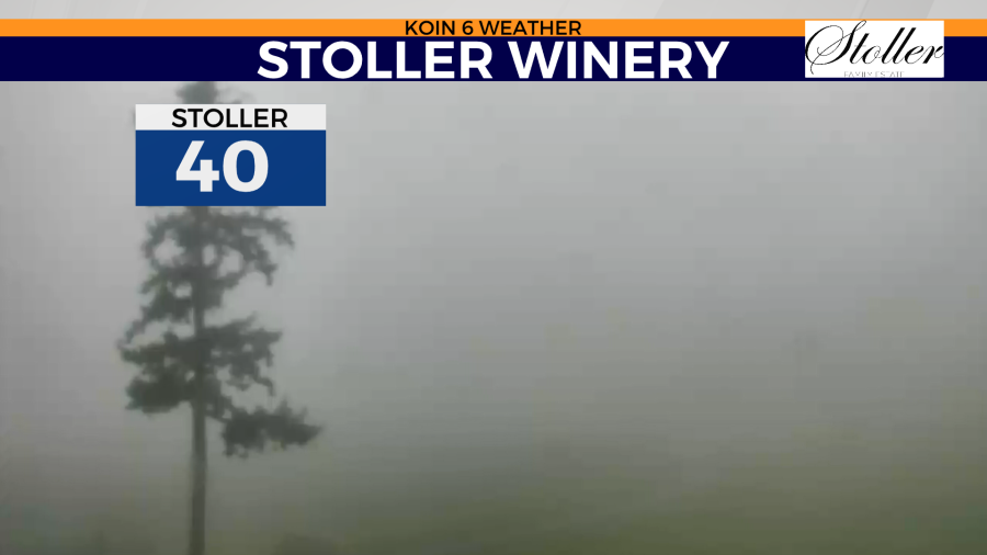
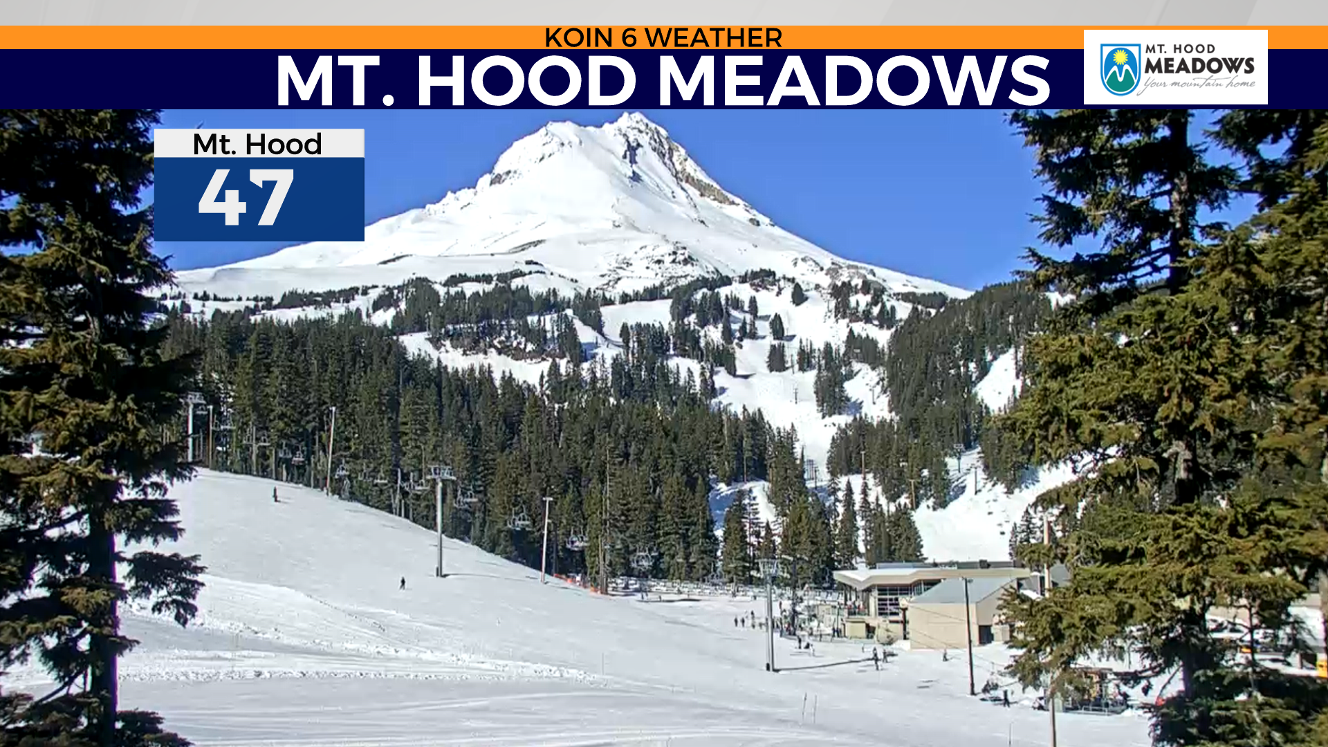
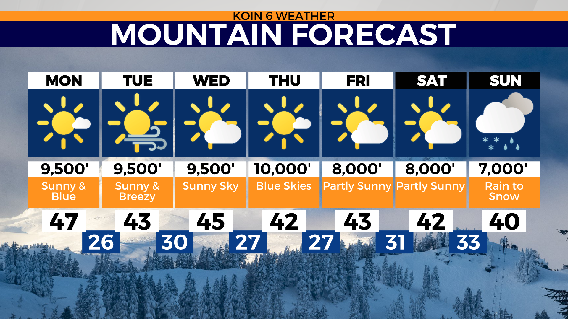
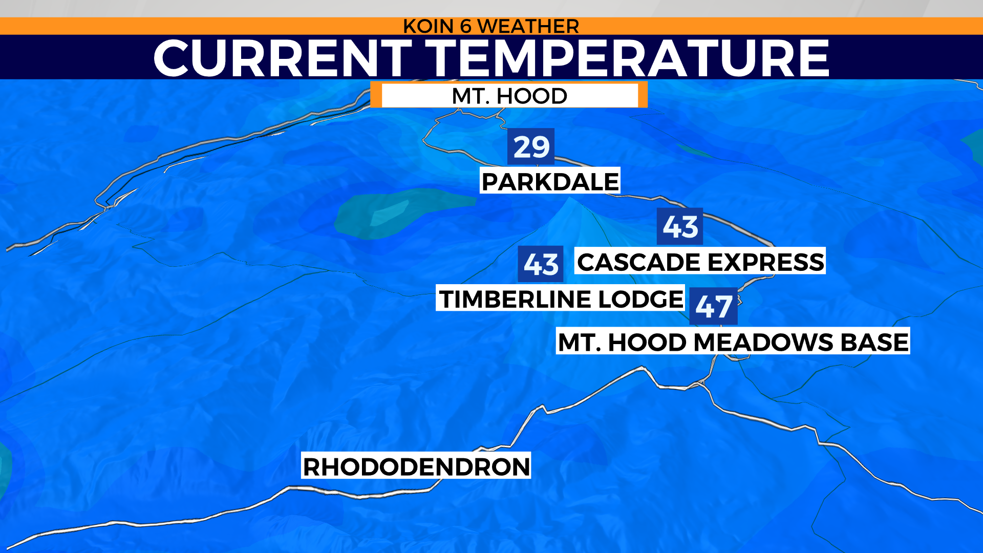
For now, you can start heading up in elevation if you want to warm up. Usually, we look to the mountain to find cooler air and snow. During inversions, we go to the mountain for sunny slopes and a break from the valley fog. The base of Mt. Hood Meadows was reading almost 10 degrees warmer than most communities in the Willamette Valley this afternoon. It will be a warm ski or snowboard for those that want to go during midweek.
Temperatures are going to hover around the mid 40s most of the week and into the early part of the weekend. The forecast is going to stay rather stale until we can shake up the jet stream. We have a blocking pattern in place that is going to leave the forecast unchanged for the week. If you check out the mountain forecast, you can plan out your trip to the mountain. Moisture to arrive on Sunday, tentatively.
If you’re looking for fresh powder, you’re going to have to wait a bit.