PORTLAND, Ore. (KOIN) – What is the deal with all the rain in November?
Why is it so wet in the fall and winter? Have you thought about this before? Today we are going to discuss the importance of our rainy season and why it happens in the first place.
If you’re not from the Pacific Northwest (PNW), you may not know about the rumor that it ALWAYS rains in Portland. Maybe you have heard that before. Well we all know that isn’t the truth. In fact, the summers are pretty dry. However, some winters can be wet and gloomy. In the winter the daylength is shorter and the temperature is generally cooler so we tend to have more clouds.
WHAT ABOUT THE RAIN?
Well let’s first start with some of the numbers for our most rainy months in Portland (climatic normal):
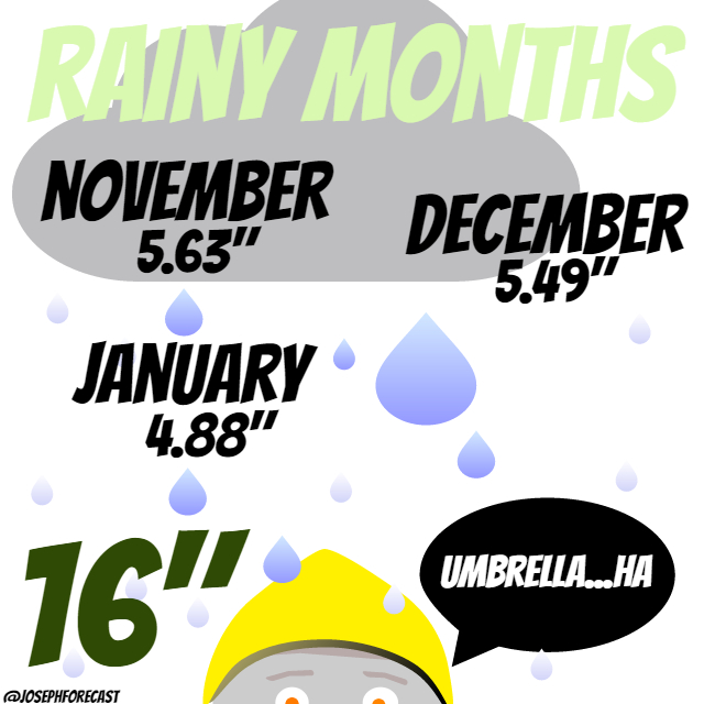
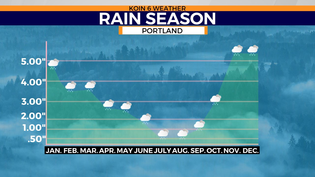
In the period of three months, we bring in over 40 percent of our water. It comes out to 16 inches of rain from the start of November to the end of January. These are the top three wettest months around here. If we happen to have months where we bring in more than the average, we may surpass 50 percent. Think 2015 when we had over 15 inches in December. That was three times the normal amount that we usually accumulate in the month of December! If you make a graph of the average rain from month-to-month starting with January, it looks something like the image below.
LET’S TURN THOSE NUMBERS INTO A CONCEPT!
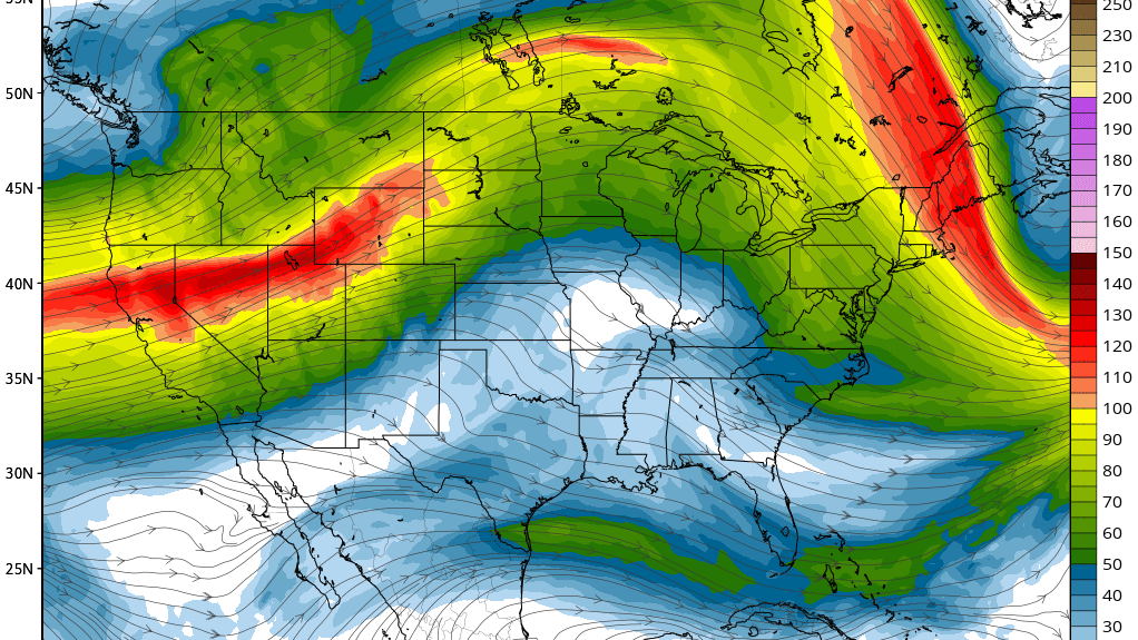
There has to be a reason for the wet weather in the winter vs the summer. We attribute the rain to the helping hand of the jet stream, Pacific Ocean, mountains and just our geographic location. You see, in the winter, there happens to be a larger temperature contrast between points north and south. It leads to a more amplified and active environment compared to the summer. That contrast leads to stronger wind and a result is the polar jet moving farther south. In the summer we tend to have high pressure moving northward and a tame jet stream, leading to mostly dry conditions. This is more evident during a La Niña winter, as a majority of the storms that develop tend to find a path to the Pacific Northwest. The graphic below is an idea of the jet stream and the meandering that takes place in the fall and winter.
We also have this massive body of water right next to us, the Pacific Ocean. It happens to be relatively warm in the winter and it provides plenty of moisture for storms in the winter. You pair that with the direction of the wind and the mountains and you have multiple triggers for heavy rain. You’ve heard of the atmospheric river? That is the water vapor that is transported in our region as the strong wind from the noted jet stream is targeted in our region during the winter. It’s a recipe and we are in the right part of the country for it.
CHECK OUT THE LIST BELOW
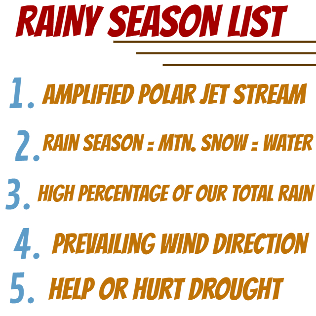
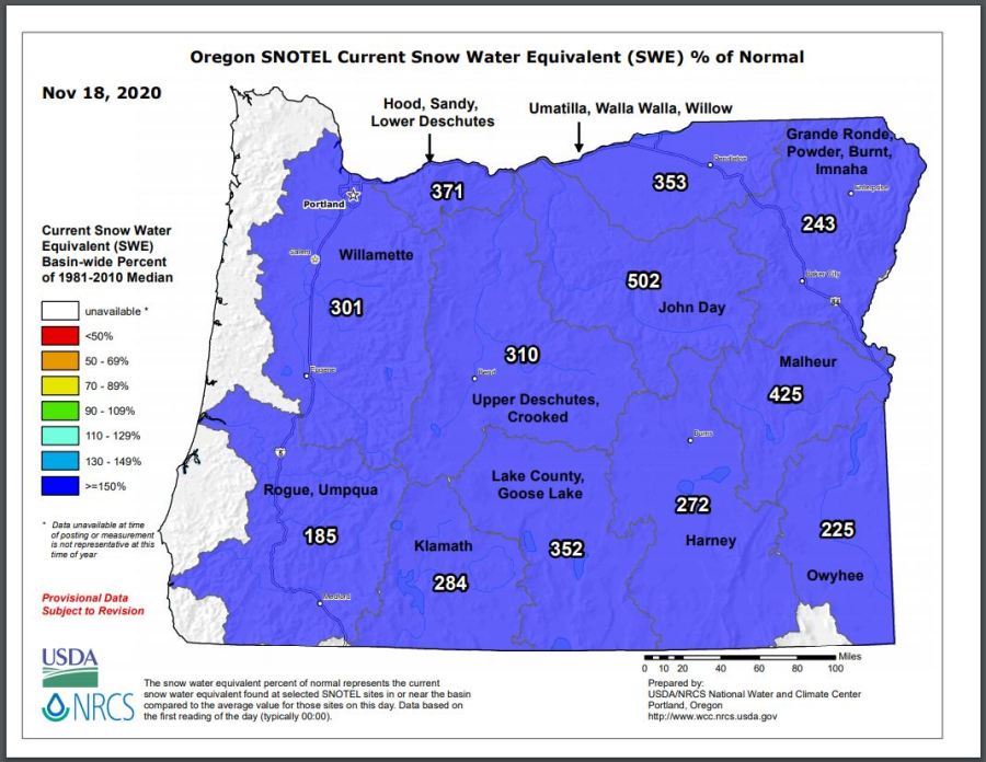
This moisture ends up bringing snowfall for the mountains. A very important process to our overall water supply here in the PNW. We will talk more about snow and the deep elements to our winter weather in a future weather kids segment. The rain season brings mountain snow because of the cold air aloft and that leads to water. Ultimately, the winter season can really help a drought, or it may even hurt it. We keep track of the snow water equivalent here in Oregon to help gauge our season. We are starting 2020 well above normal. Knowing that we typically have our wettest days ahead, what could that mean for our snowpack?
Ponder that one until the next weather kids lesson!