PORTLAND, Ore. (KOIN) – Have you seen a massive cloud develop over the top of a mantle of wildfire smoke? It looks just like a summer thunderstorm erupting over the Great Plains.
If you’re from Oregon or have flown out of state recently, you’ve probably seen the massive Bootleg Fire, which is the largest in the country right now standing at 388,359 acres as of Tuesday. Below you can see a photo of the massive pyrocumulus clouds that are billowing up over the large wildfire on July 14. These types of clouds resemble those that we get from explosive thunderstorms, but they develop from the source of a wildfire.
When you have such massive wildfires creating heat, you can get picturesque clouds and even weather. A popular question that the KOIN 6 Weather team gets during wildfires season is, can wildfires create weather? The answer to that is – yes.
How tall do you think these clouds are below? Can you imagine lightning coming from them? We break it down in the section below, but make sure you take a good look at the photo first.

HOW IT WORKS
Pyrocumulus clouds, like the photo we saw above, is a cloud named after fire. These clouds come from wildfires or other large fire sources. Those pyrocumulus clouds can grow so large that they transition to pyrocumulonimbus clouds. These are storms that are generated from wildfires.
Of course, this all stems from the heat of the wildfire. That is indeed the key ingredient to this process, just like most storm development. You need that energy! Essentially the term pyro means heat or fire. You can find that adding that root to the other basic cloud formation makes this type of cloud specific to the cause – fire.
If you imagine the educational graphic below as a scenario that is close to home here in Oregon, you can start to understand the process of these pyrocumulus clouds a little more. You have large wildfires generating a lot of heat, which leads to rising thermals. There happens to be water vapor in the air from the vegetation and also water vapor is the outgrowth of a fire. This leads to moist air that is available for cloud development. The strong updraft from the warm rising air is going to bubble up and create larger cumulus clouds, which will condense as they continue to grow. This is all because of the heat from the wildfire that is active at the surface (and some oxygen).

When these clouds reach massive growth, upwards to 30,000 feet or more, they may start developing thunderstorms. These storms can be extremely dangerous for wildfire conditions and wildland firefighters. They may ignite more fires due to lightning strikes that reach the ground. They may also create strong, erratic winds, that may push flames quickly. This may carry embers well out into the distance which may also create more fires. This process happens frequently in mega-fires, which adds to the already troublesome situation.
You can learn about everyday thunderstorms and the elements that come with storm development here.
VISUAL EXAMPLE
Do you want to see what this looks like? The best way to show this is from a visible satellite, way up in space (22,000 miles). The GIF below is of the expanding Bootleg Fire, which has been developing pyrocumulus clouds just about each afternoon as the fire picks up steam. Notice the blowing smoke and particles early in the loop, then it looks like an eruption as the wildfire creates these massive pyrocumulus clouds. Those large plumes will carry ash and soot and it will decrease the air quality down the road. You don’t necessarily see a lot of rain because the air is still very dry near the surface, so you’re mainly just left with ash and wildfire debris. You can see that the start of the development is coming directly from the area above the wildfire and not necessary downstream. We know that these massive clouds can produce it’s own weather based off the information above.

Sometimes they even produce fire tornadoes or fire whirls.
This has happened a few times now this summer! A fire whirl occurs when that intense heat rises, which we discussed above, during turbulent wind that is changing direction as it builds in height. This is extremely dangerous, just like any other tornado.
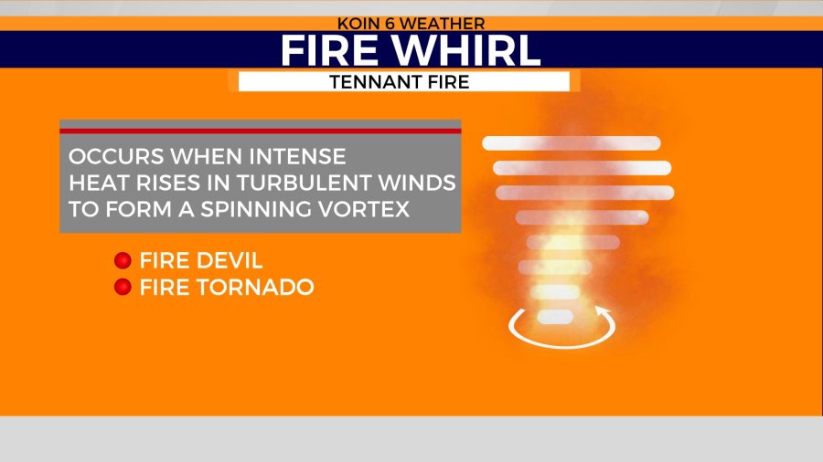
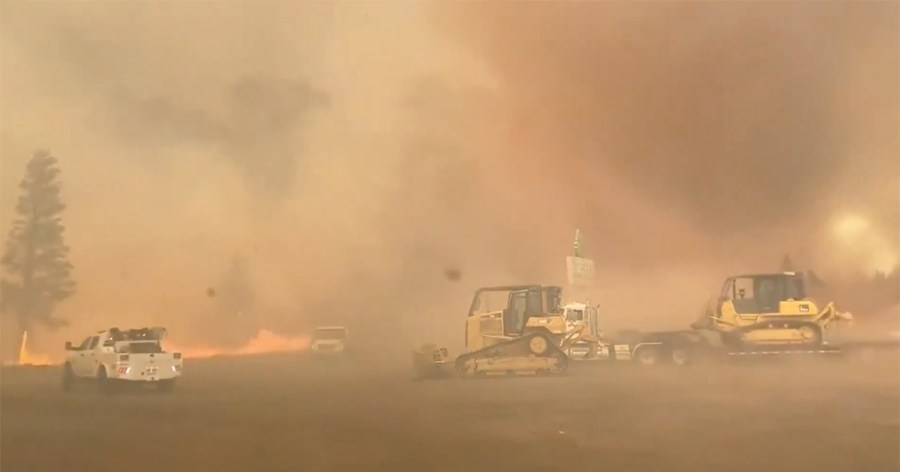
Embedded into this image below, there was a fire whirl that the U.S. Forest Service captured on video down in California at the Tennant Fire. Notice how hard it is to even see what is going on through the smoke, but then you also have the additional danger of these turbulent situations.
Wildfire season continues until we bring back the heavy doses of rain. That usually arrives in the fall. You can follow our updates here.