PORTLAND, Ore. (KOIN) – Wildfire smoke moved in as we finished up the work week, and now it will move out as we wrap up the weekend.
It’s been hanging around for a few days now, limiting our high temperature around Portland while also causing air quality levels to drop. I expect improvements by Monday, but we may notice them as early as Sunday evening.
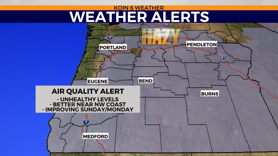
An air quality alert is in place for Portland until Monday. Most of the state is under an air quality alert, outside of a few counties out near the northwest Oregon coast. It’s been a combination of wildfire smoke from Washington, Oregon, and California that has put us in this situation. With wildfires still burning through the region, we are likely not off the hook just yet (west of the Cascades).
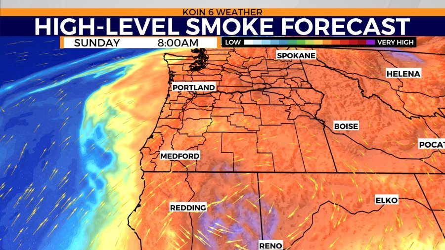
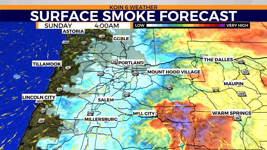
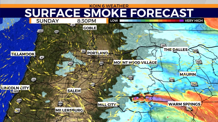
Not only am I expecting the high-level smoke to improve on Sunday, but I am also expecting the low-level smoke to improve. You will have to use the slideshow below to cycle through the smoke graphics. Notice the morning hours are going to be smoky still. That smoke will start to clear from the west to the east throughout the day.
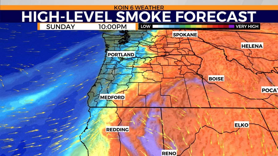
You may capture an orange sunrise as the wildfire smoke lingers around to start our day. Hopefully by the afternoon, we clear out enough haze to bring us closer to normal. The high-level smoke forecast model for Monday night has a massive improvement from the mountains west. It still looks to hang around most of central and eastern Oregon. I believe your improvements will arrive later Wednesday into Tuesday as a trough slides through.
Cycle through our surface smoke forecast model and you can also see the improvements by Sunday evening.
It sure is possible that we are free of most wildfire smoke around the valley by the evening hours. That will not be the case for those of you in central and eastern Oregon, just like the high-level wildfire smoke, it will hang around through most of the day.
The Bull Complex is still giving up a decent amount of smoke as it was flaring up at times Saturday. Weather models are projecting a stream of surface smoke moving into the Warm Springs area in the afternoon and evening. I would expect a smoky scene for you folks there on Sunday.
What does this mean for temperatures?
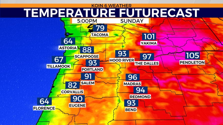
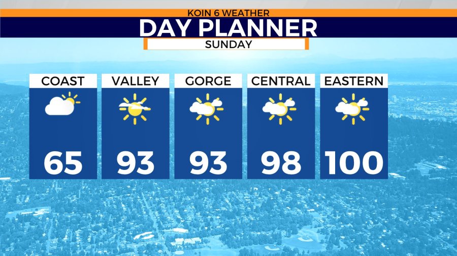
It likely won’t change much to the forecast compared to what we had going on Saturday. I expect temperatures to warm into the 90s Sunday, with some in the mid-90s. I actually think it is possible that we are warmer in Portland Sunday than on Saturday because of less haze. It is going to be close, because there is cooler air moving in aloft, eventually arriving on Tuesday in full force. However, the 850mb temperatures are projected to be slightly cooler Sunday than the last few days.
Temperatures should hold to the 60s along the Oregon coast, which means that is the place to go for cool air. Temperatures in the upper 90s to near triple-digits for The Dalles and Madras. We are looking at triple-digits for Pendleton and communities in the Lower Columbia River Basin on Sunday.
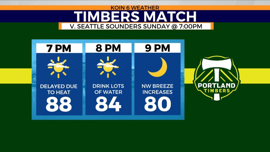
Just a reminder the Timbers match has been pushed back to 7 p.m. Sunday because of the heat this weekend. Temperatures are still going to be very warm at the start of the match, with evening temperatures in the upper 80s. It will probably feel pretty nice as the match wraps up, but be prepared for the heat while you’re there.