PORTLAND, Ore. (KOIN) – As the wildfire season settles in, our attention to conditions that may impact wildfires will increase.
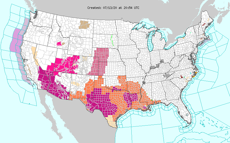
Rapid fire spread can be a major issue in the summer and we want to make sure that we supply updates and a forecast as the wildfire season carries over through the summer. Right now there are no active alerts for Washington and Oregon, but there are Red Flag Warnings scattered all across areas of Arizona, California, Colorado, Idaho, Nevada, and portions of Utah. Although it has been dry in Oregon, we haven’t quite had the bite of those states down in the southwest. The weather continues to be an issue and wildfires have been more alarming.
Red Flag Warning: These are issued from the National Weather Service when warm temperatures, very low humidities, and strong winds are expected to combine to produce an increased risk of fire danger.
Although wildfires come and go each year, the wildfire season can always be different. The wildfire season for 2020 has been rather slow even though our drought status has been troublesome.
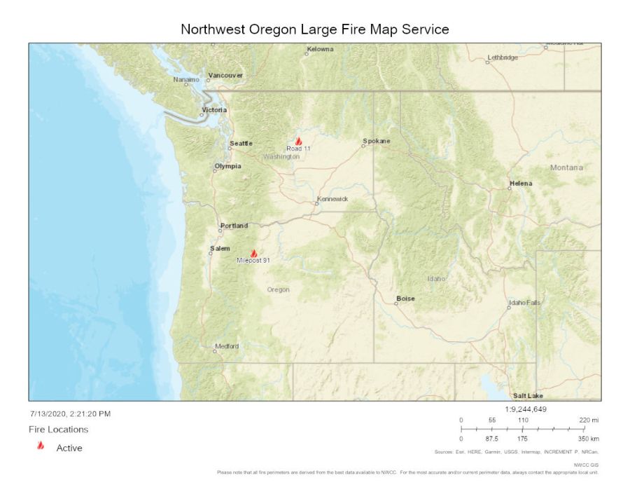
We have been fortunate enough to avoid major lightning storms, especially through areas of the Cascades and points west. According to the National Interagency Coordination Center (NWCC), as of July 13, there are currently no new large wildfires. There are two large fires that were present prior to this week, which are the Milepost 91 and Road 11 wildfires. Information that you can find here. Below is a map of those two wildfires. The Milepost 91 wildfire that is near Warm Springs, is 99% contained.
New fires as of July 13 are all very small and under control at this time. There were 11 new fires in Oregon and 12 for Washington, coming in at a total of 23 new fires and 74 acres. A large fire consists of a wildfire that includes timber of 100 acres or greater, 300 acres or greater in grasslands, or has an Incident Management Team assigned to it. Each new fire is well below that criteria at this time.
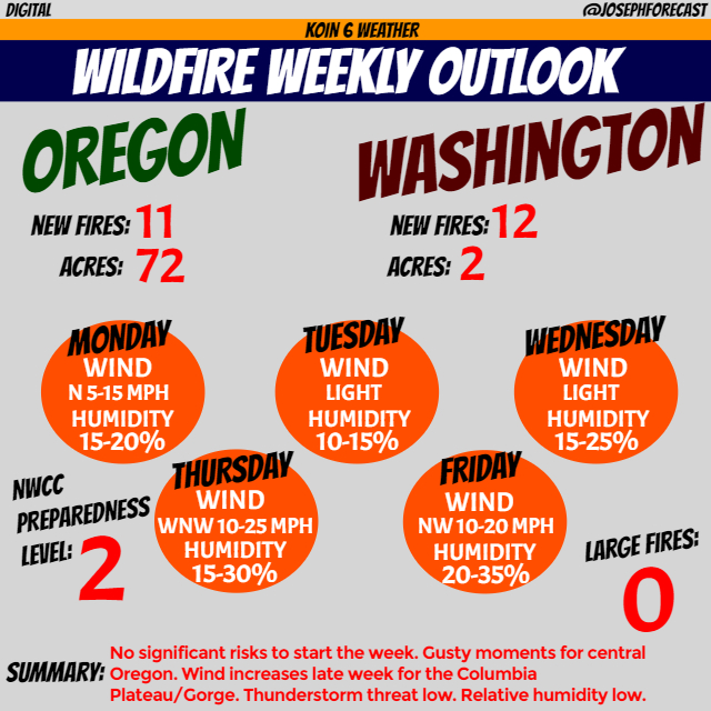
Why don’t we discuss the forecast for the next five days. The confidence of this forecast is high, with subtle alterations to no changes as the week unfolds. This forecast mainly focuses on areas of central and eastern Oregon.
Right now, conditions from the coast to the foothills of the Cascades are better than those to the east. Breaking down the forecast into two parts, early week will be a mix of dry but tame conditions. The minimum humidity for those in Wasco county down to Deschutes and east will be lower to start the week, with an increase in the minimum humidity levels by the time we get to Thursday or Friday. Meanwhile, the late week will bring in breezy conditions and a very small threat for a few isolated thunderstorms for southeastern Oregon. However, the humidity level will increase because of moisture moving in.
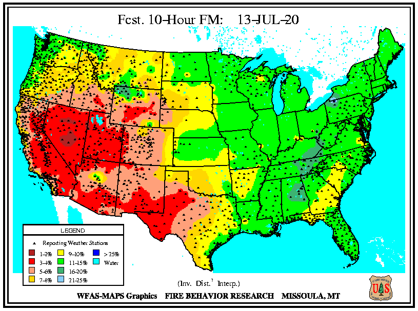
I do not anticipate any Red Flag Warnings to start the week, but it may be possible that we see some locations come Wednesday or Thursday. The 10-hour fuels as of Monday are relatively low for those in central and eastern Oregon. Bottoming out at 5-6% for the southeastern section of the state.