PORTLAND, Ore. (KOIN) – It only takes one timely wind event to exacerbate an already brittle wildfire environment.
Most locations across the PNW have had very little rain for the last few months. The northern Willamette Valley has either had no rain or just a trace going back to early July. Portland is closing in on 63 days of no measurable rain.
SO WHAT IS DIFFERENT?
We have had significant stretches of high heat and record-breaking temperatures this summer (June 23 – July 1). We already know that there is a struggling drought. Those drought conditions are spread across many communities south and east of the northern Willamette Valley. You may also be thinking, this isn’t our first fire weather alert for the valley either. This is all true! So what exactly is different this time around?
- WIND STRENGTH
- WILDFIRE STATUS
- TIMING
This upcoming forecast is tentatively going to be the strongest wind that we have had this summer. That east wind will be strong enough to encourage rapid fire spread. The wildfires are much larger now than earlier in the season too. This has prompted concern locally, leading to many fire weather alerts being issued this week.
FIRE WEATHER WATCH
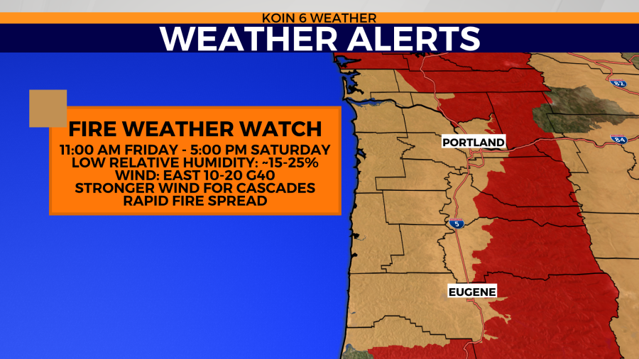
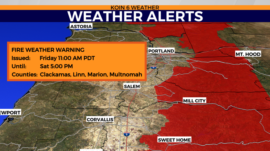
The National Weather Service in Portland has plans for a fire weather watch to be in place Friday and Saturday. This may be upgraded to a red flag warning by the time Friday arrives. Expecting this to go into effect Friday at 11:00 a.m., continuing through Saturday night, 5:00 p.m.
The forecast is calling for a sustained east wind running around 10 to 20 mph, with potential for 40 mph wind gusts. The wind gusts may even push 50+ mph for the Cascades. These type of winds, combined with the dry fuels, may lead to rapid fire spread.
This fire weather watch includes the Gorge, Willamette Valley, and points extended west to the Oregon coast.
RED FLAG WARNING
The locations of the Cascade foothills that are encroaching upon the Willamette Valley are the spots that are of most concern. This includes portions of Clackamas, Linn, Marion, and Multnomah counties in Oregon, with sections of Clark and Cowlitz up in Washington. This is because of the expected wind and low humidity.
WIND TIMING
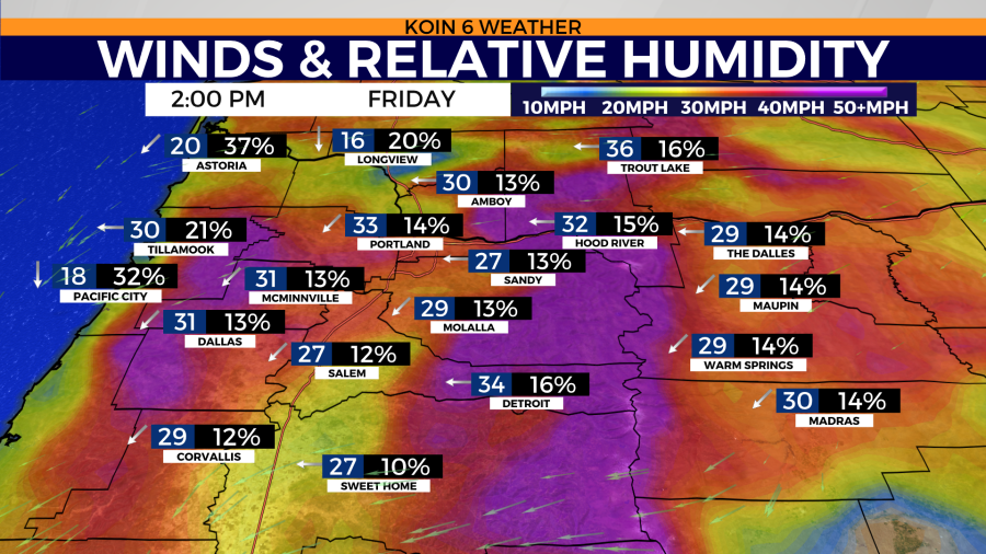
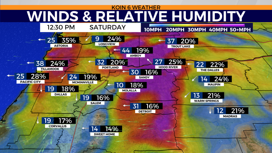
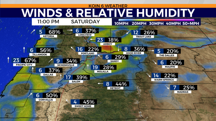
As suggested by the timing of the fire weather watch, the wind is expected to increase Friday after 12 p.m. You can swipe through the wind slideshow below to get an idea of the strength and relative humidity (RH). The lower the RH, the less moisture there is to transport to fuels. RH levels drop as the temperature increases.
Weather data has wind gusting to around 35 mph early to late afternoon on Friday. We are expecting a downslope wind that will encourage warmer and drier conditions. It will then pick right back up around mid-day on Saturday before turning direction and becoming more gentle by Saturday night.
The RH is expected to plummet to around 15 percent Friday and Saturday afternoon. As temperatures cool Saturday night, the relative humidity should rebound to nearly 40 percent.
WILDFIRE SMOKE
I’m expecting the most wildfire smoke that we have had to deal with this summer moving in Friday and Saturday. This is the most active our wildfires have been, we are also getting the direct influence of the east wind for multiple layers of the atmosphere. Most of the smoke around the region will start to transport from west to east during this event. We can expect more of a high-level smoke haze come Friday at mid-day. It’s hard to say how much smoke will impact the region, but it is expected to be stronger than some of the other moments this summer.
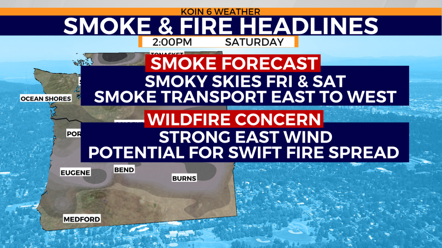
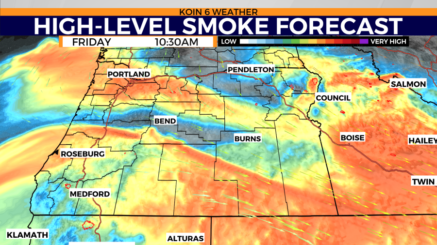
Here is a smoke forecast that is more focused on high-level smoke. We may avoid anything too serious around the surface, but it’s possible that we have some low-level smoke rolling in from the cedar creek fire.
You will be able to find air quality updates and updated smoke forecast during our broadcasts over the weekend.

