PORTLAND, Ore. (KOIN) — On the heels of a nasty ice storm that left a mark on the Pacific Northwest, another round of wicked winter weather is headed into the region.
Starting Monday evening, several weather watches and warnings have been issued for a storm system that is expected to bring a lot of rain and some pretty significant wind to Northwest Oregon and Southwest Washington through Tuesday.
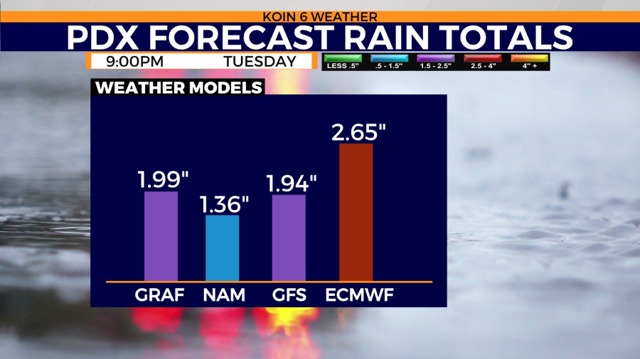
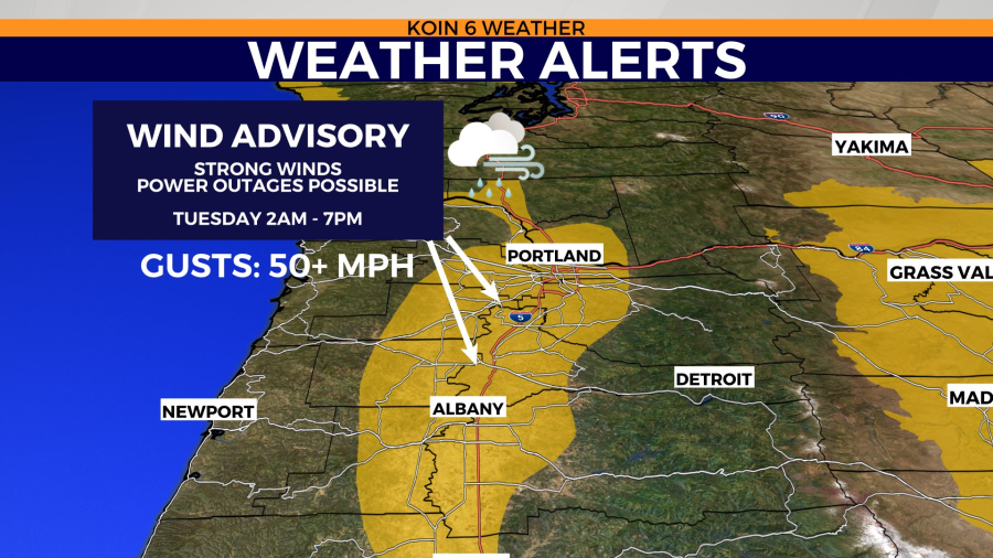

According to KOIN 6 Meteorologist Kelley Bayern, the steady rain in the area Monday will increase and the metro area could see an additional 3/4 of an inch to an inch of rain Tuesday. The other, major concern is the arrival of strong winds early Tuesday morning. There could be gusts of 40 or even 50 miles per hour to the region Tuesday and that could mean more downed trees and power outages similar to what happened late last week, according to Bayern.
A Wind Advisory has been issued for a majority of the Willamette Valley from 2 a.m. to 7 p.m. Tuesday.
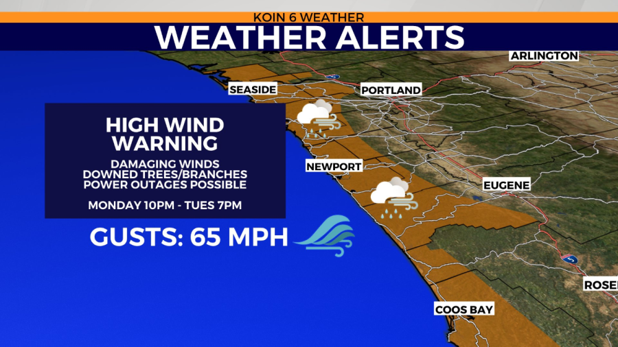
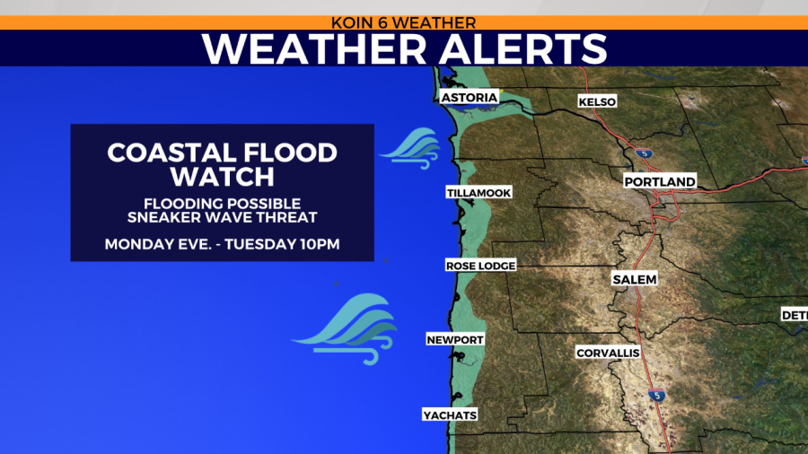
The Oregon Coast is expected to get slammed by the same storms too, with the heavy rain and wind starting there earlier Monday and lasting into Tuesday. A High Wind Warning and Coastal Flood Watch have both been issued for most areas along the coast through Tuesday evening.
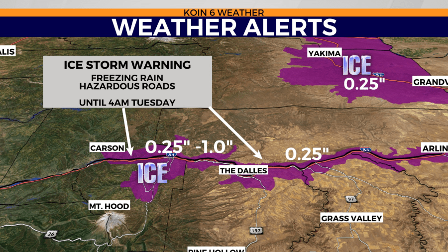
The storm system will likely spell more trouble for the Columbia River Gorge too, according to Bayern, where temperatures are still hovering below freezing in a lot of places. There is potential for another significant round of freezing rain. An Ice Storm Warning is in place for damaging ice and tough travel on Interstate 84 and Highway 35 through Tuesday.