
PORTLAND, Ore. (KOIN) — An active day of weather is on the way Sunday. A winter storm warning is up for the Cascades, along with far northeast Oregon along the I-84 corridor from just outside of Pendleton to Baker City.
The next system arrived overnight and will pile up the snow in mountains — 15-20 inches over the passes before the day ends. This will create travel issues in these areas. Be careful on your drive back home from holiday festivities.
KOIN Weather Alerts
Sunday will also be wet, windy and cold in the valley and along the coast.
There is also talk of lowering snow levels for the coming week. This is definitely going to be true. But it is still too early to tell if it will make it all the way into the metro area on the valley floor.
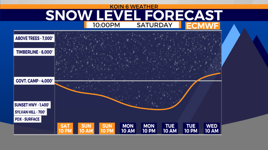
More systems are lined up behind Sunday’s storm. Each successive storm will bring cooler air. Stay with the KOIN 6 Weather Team for the latest forecast updates this week.