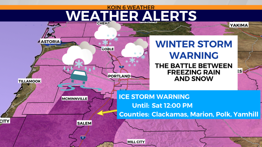
PORTLAND, Ore. (KOIN) — This weekend is going to be messy as we transition out of these snowy and icy conditions.
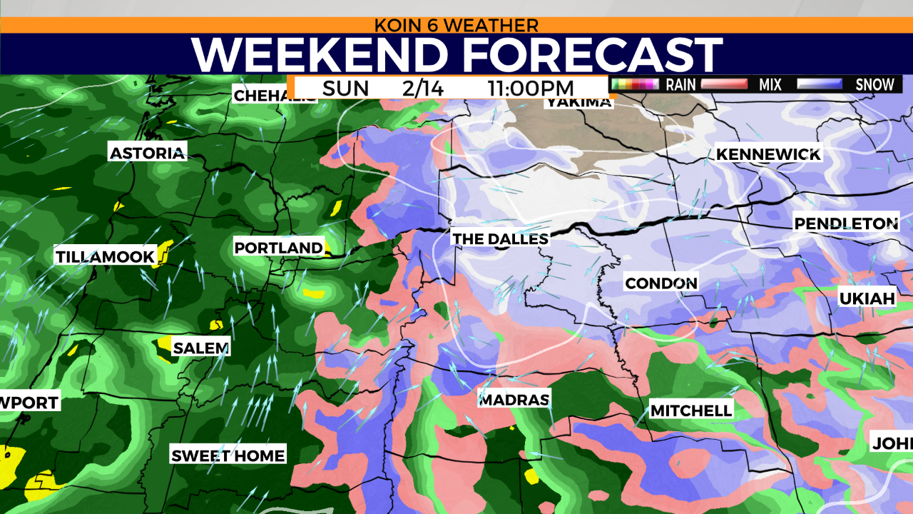
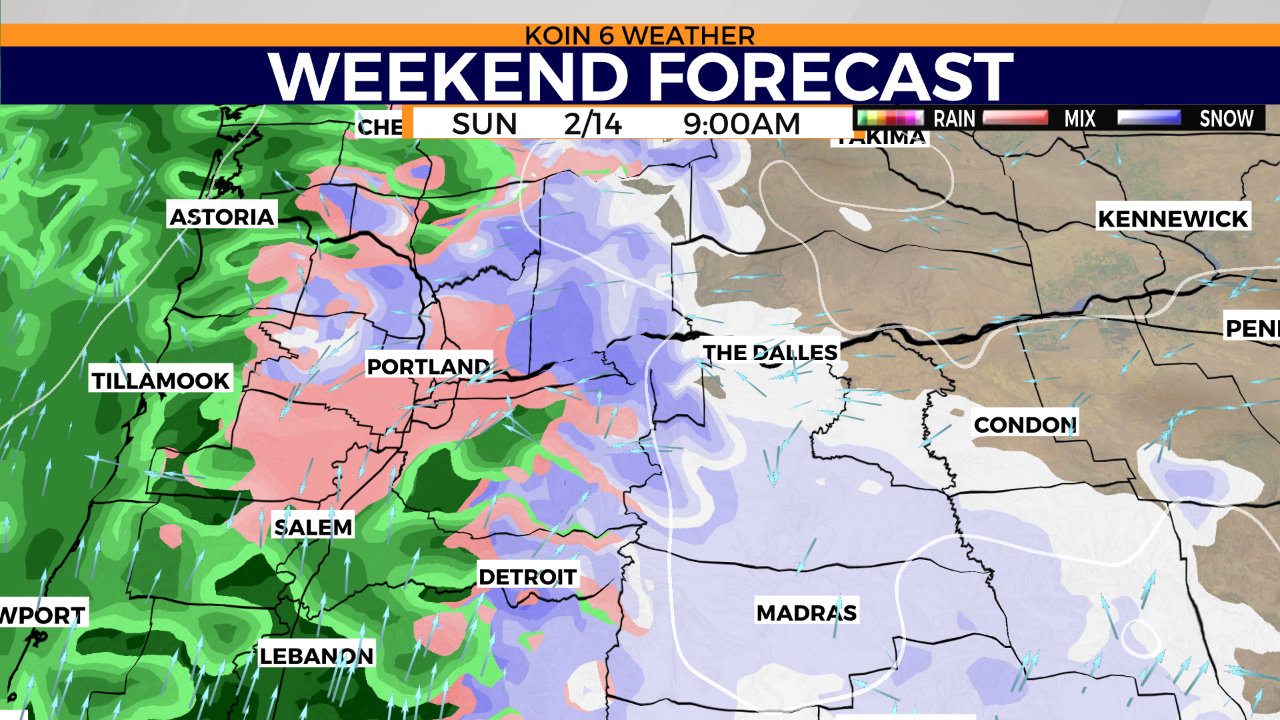
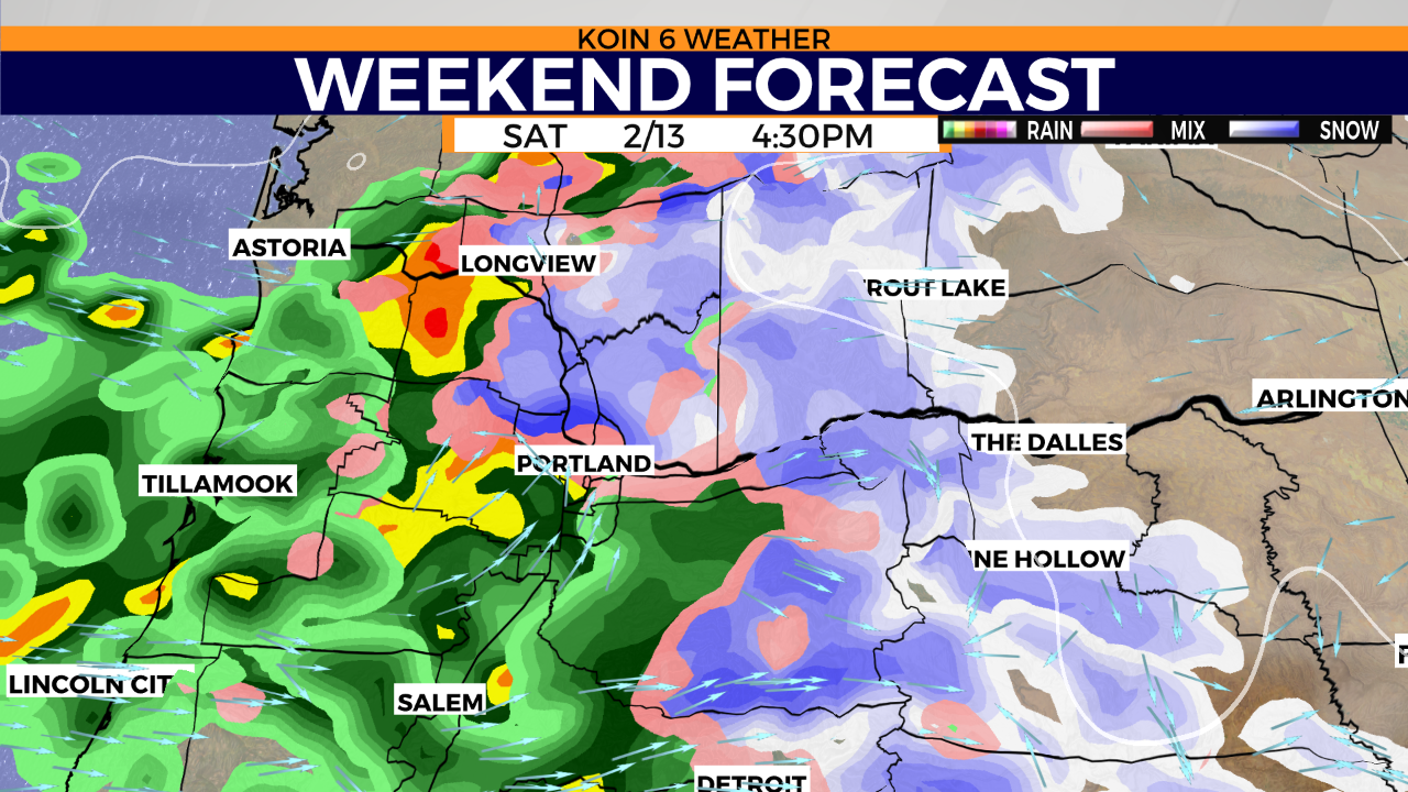
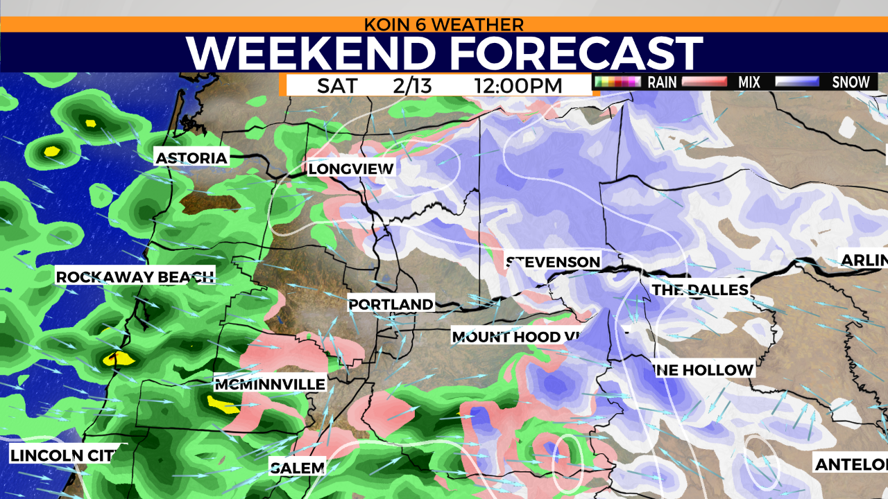
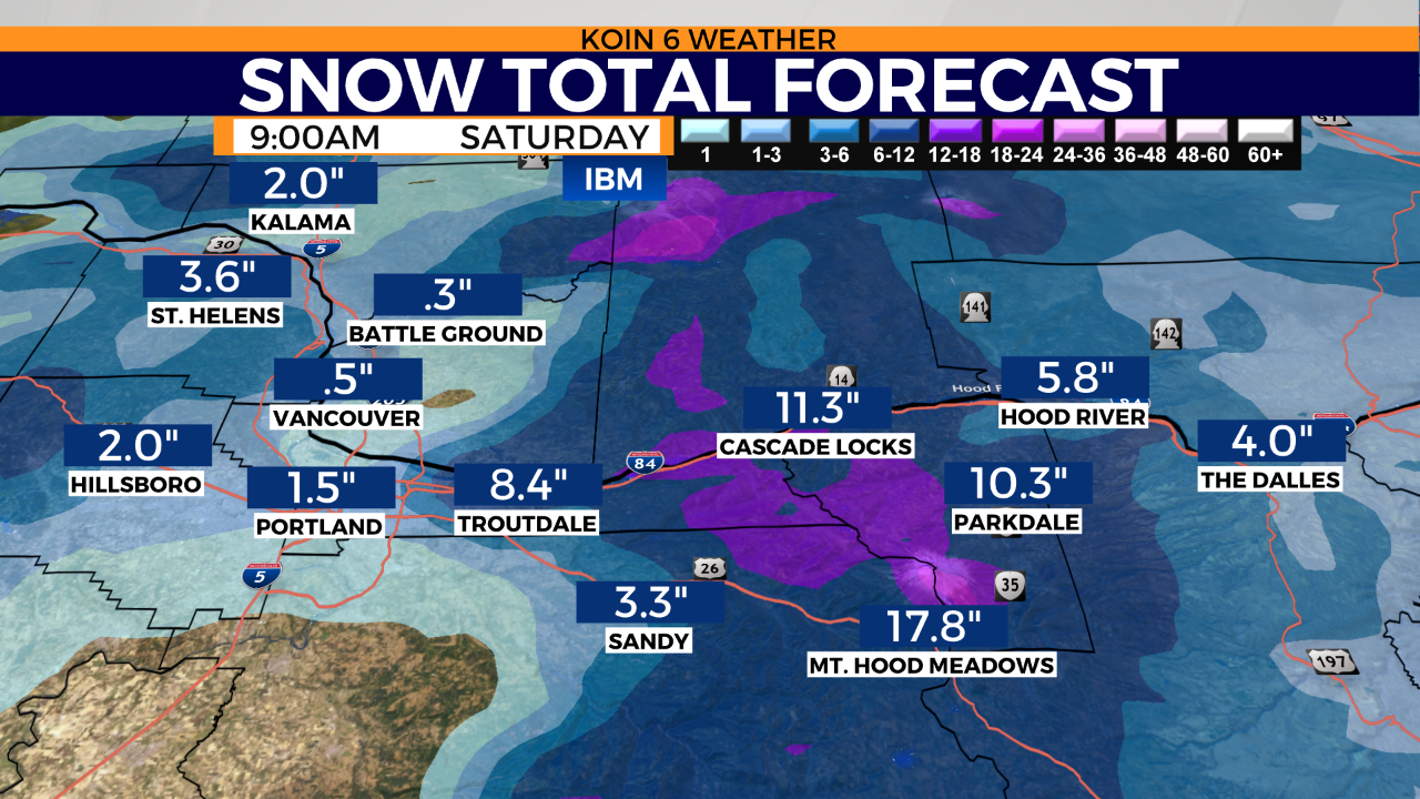
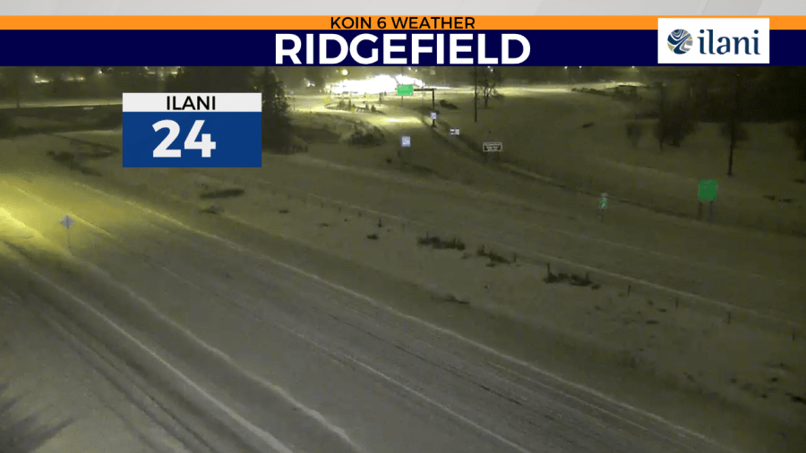
There’s a chance to see another shot of freezing rain/snow Saturday morning and again in the afternoon. Only slightly warmer temperatures arrive Sunday with a chance to see more freezing rain/snow/rain. Some of the snow you see today across SW Washington and the Columbia River Gorge will likely stick around for days.
The Forecast
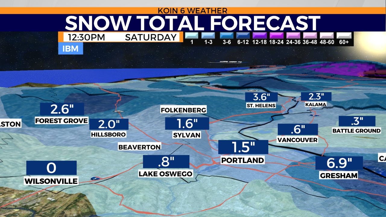
MORE SNOW?
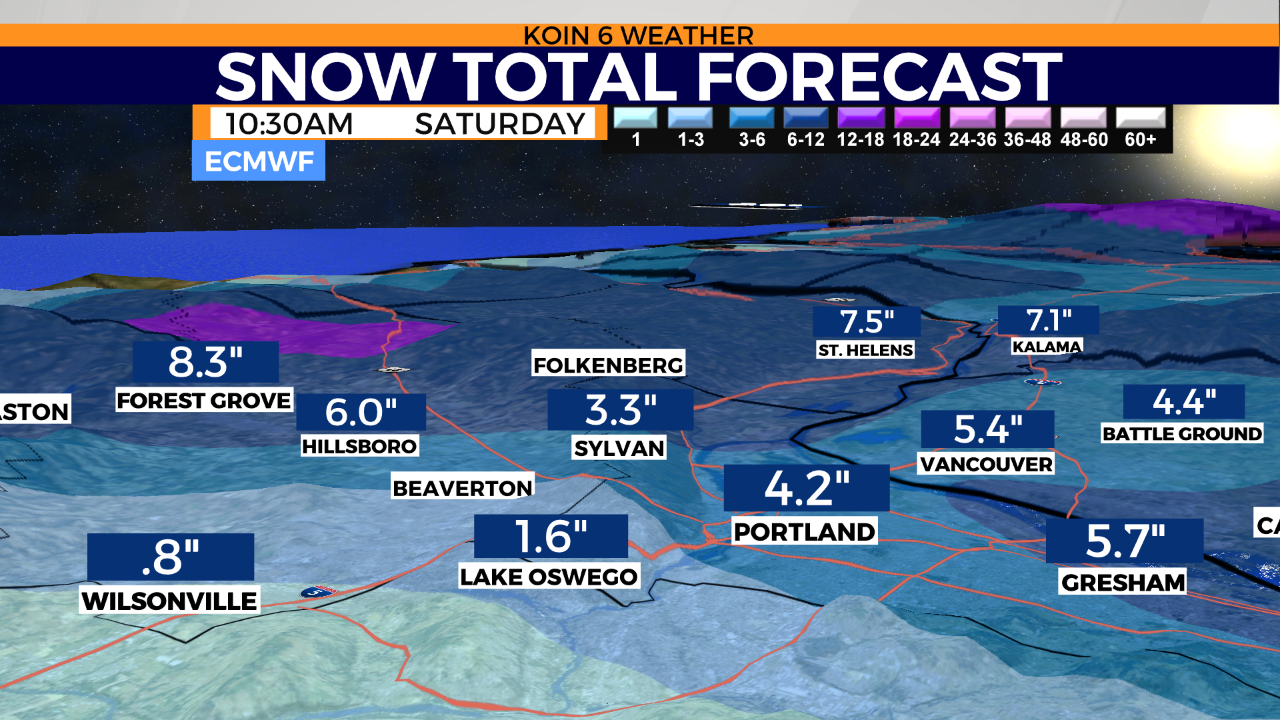
So where’s the snow for the rest of the Portland metro area? Downtown? West Hills? Was it swallowed by the thick monster warm layer that slid up and over our modified Arctic pool of air? Yes and no. We may be able to cool the entire column of air over southwest Washington, possibly Portland Saturday morning but it will take a lot of the right things to make it happen.
A few of our high-resolution models point to a transition from freezing rain to snow sometime early this morning. At that point, Portland downtown may be able to pull 1- 1.5 inches of snow from the sky. Global models still insist on dropping 4-6 inches of snow over Portland through this morning. If this were to occur, then Vancouver/SW WA would be in store for another 7 inches from now to midday.
At this point, that scenario seems doubtful. Still, a lot of variability in model outputs. Probably one of the most complex and cantankerous forecasts I’ve ever corraled.
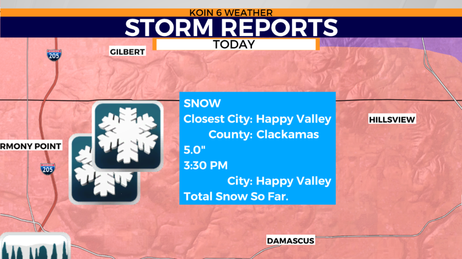
Storm Photos & Summary
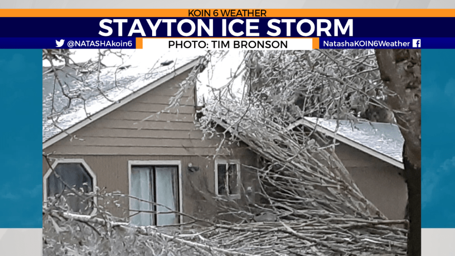
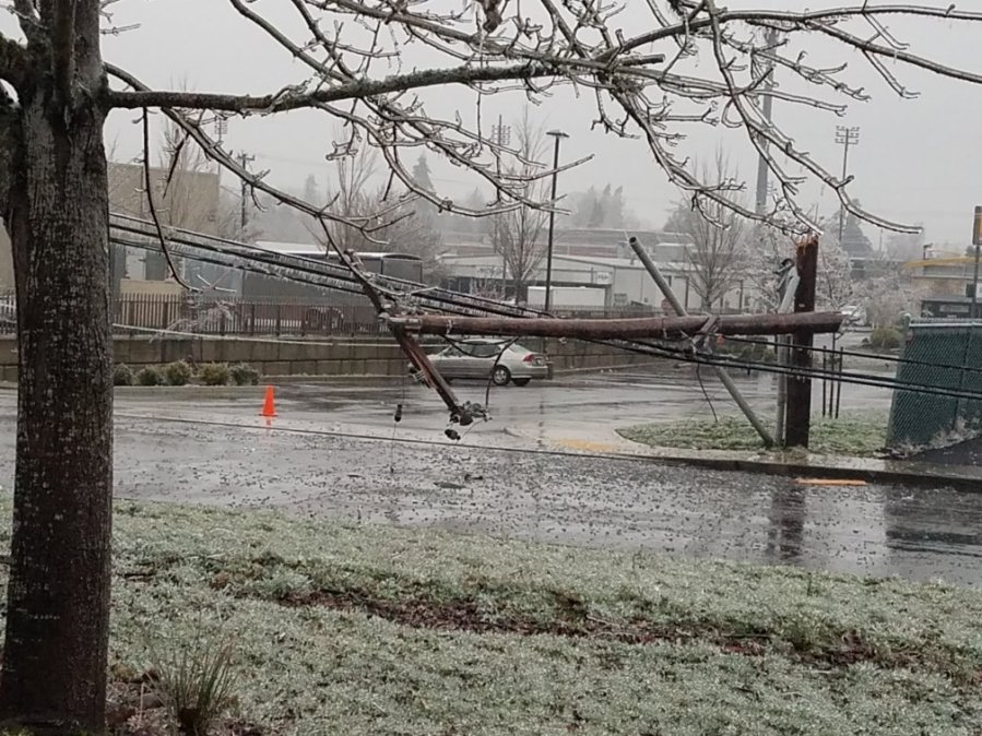
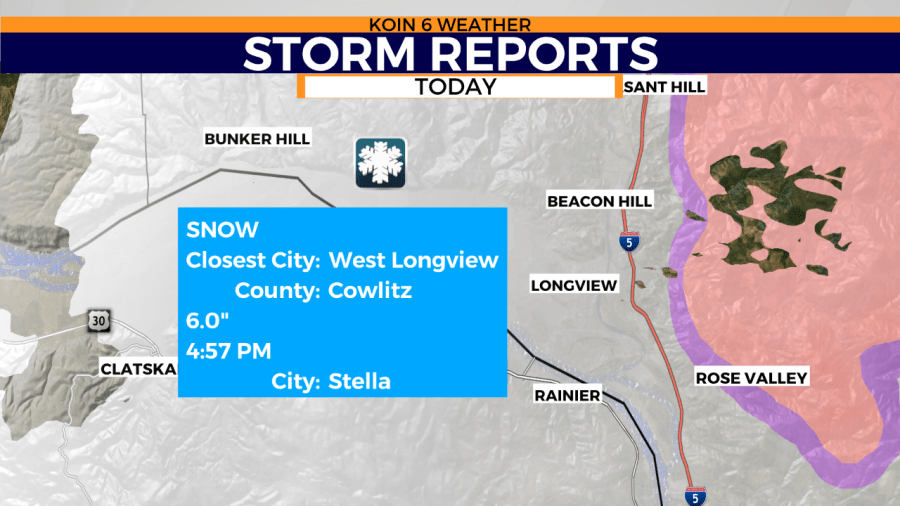
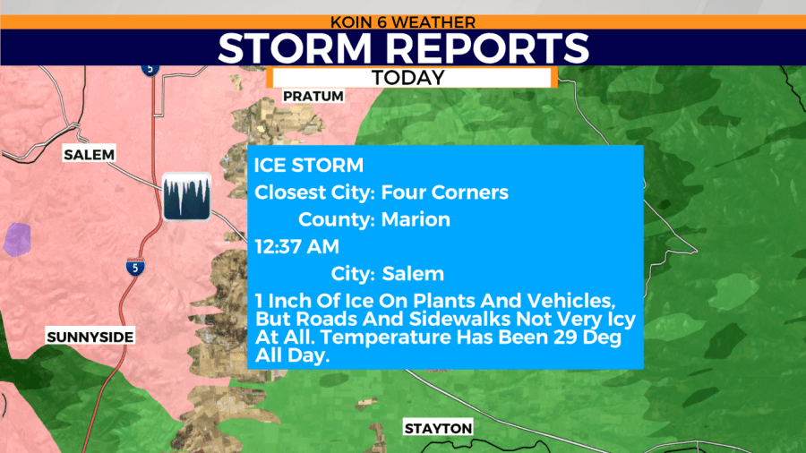

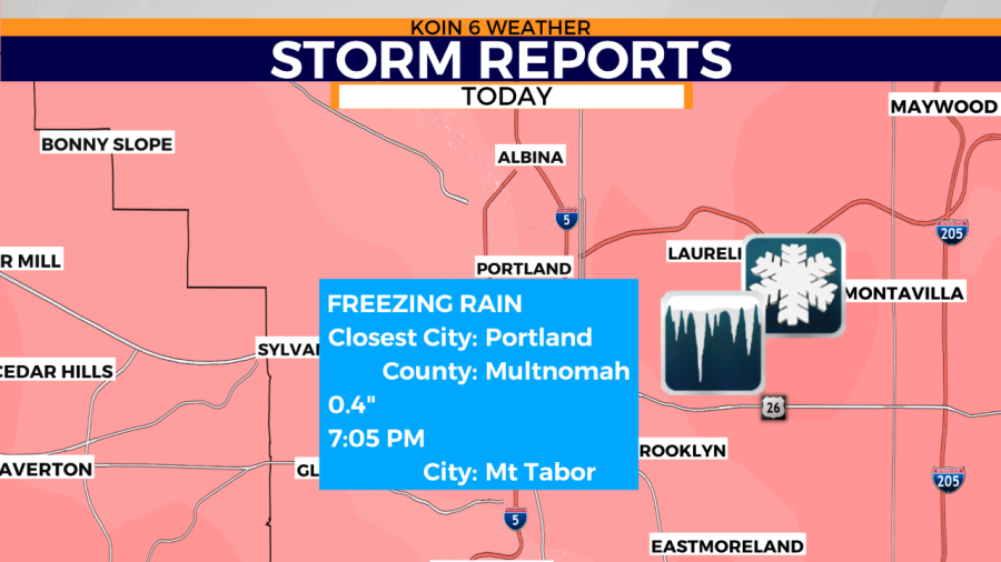
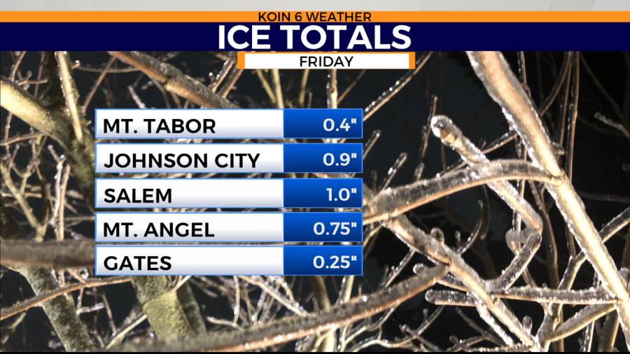
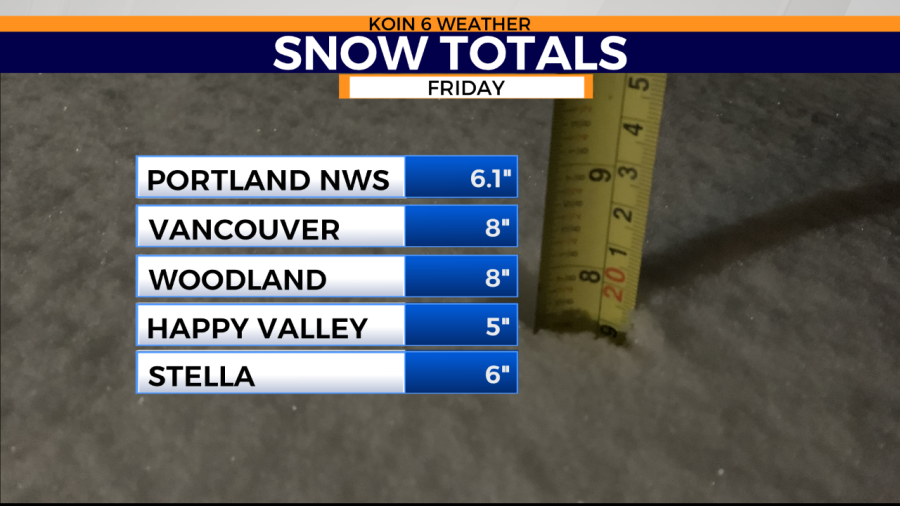
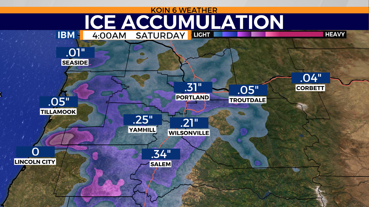
Around the greater Portland metro areas, ice accumulations from freezing rain ranged from 1/10 of an inch to 1/4 of an inch. At the Portland NWS office, they measured 6.1 inches of snow for Friday.
According to Portland National Weather Service, “The 6.1 inches of snowfall at the Portland NWS office Feb 12 ties the airport Feb daily record of 6.1 inches set Feb 19, 1993”.
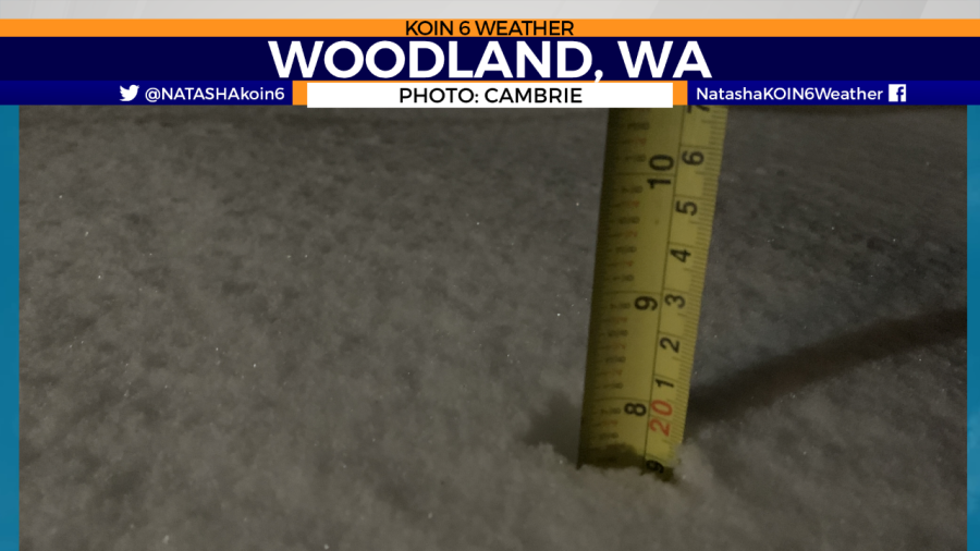
Downtown Portland, on the other hand, ended up with a frozen layer on top of the small dose of snow from earlier in the day. Vancouver and most of SW WA got hammered with snow. Totals ranged from 6 to 9 inches and it was still falling there at the time of this post.
Did you know, Troutdale Airport tied a record low temperature on Friday? It was 25F.