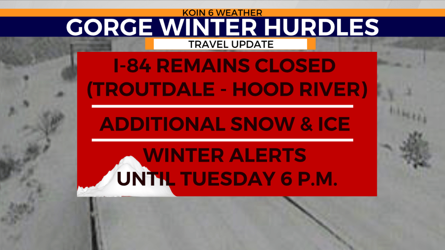
PORTLAND, Ore. (KOIN) – Winter has a grasp on the Columbia River Gorge and the mighty Cascades for our first Monday of the new year.
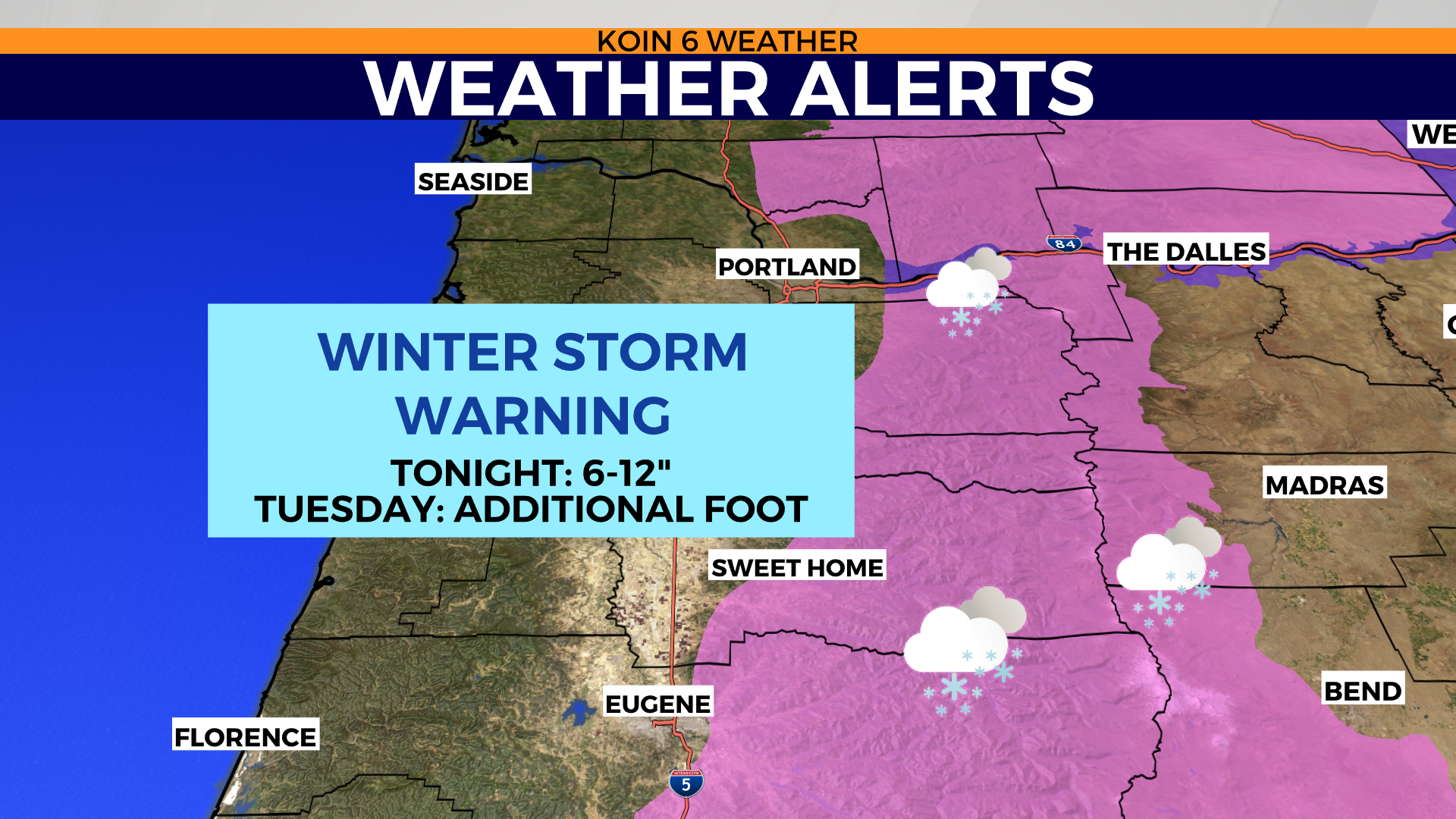
There are major travel slowdowns and time-consuming closures across the state due to the heavy snow and the icy conditions over the last 18 hours. A winter storm warning and winter weather advisory are in place until Tuesday at 6 p.m.
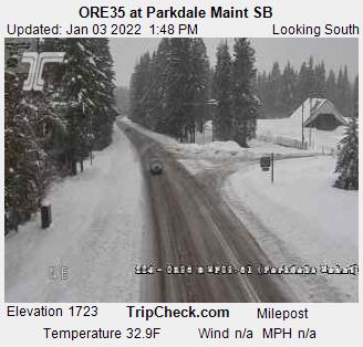
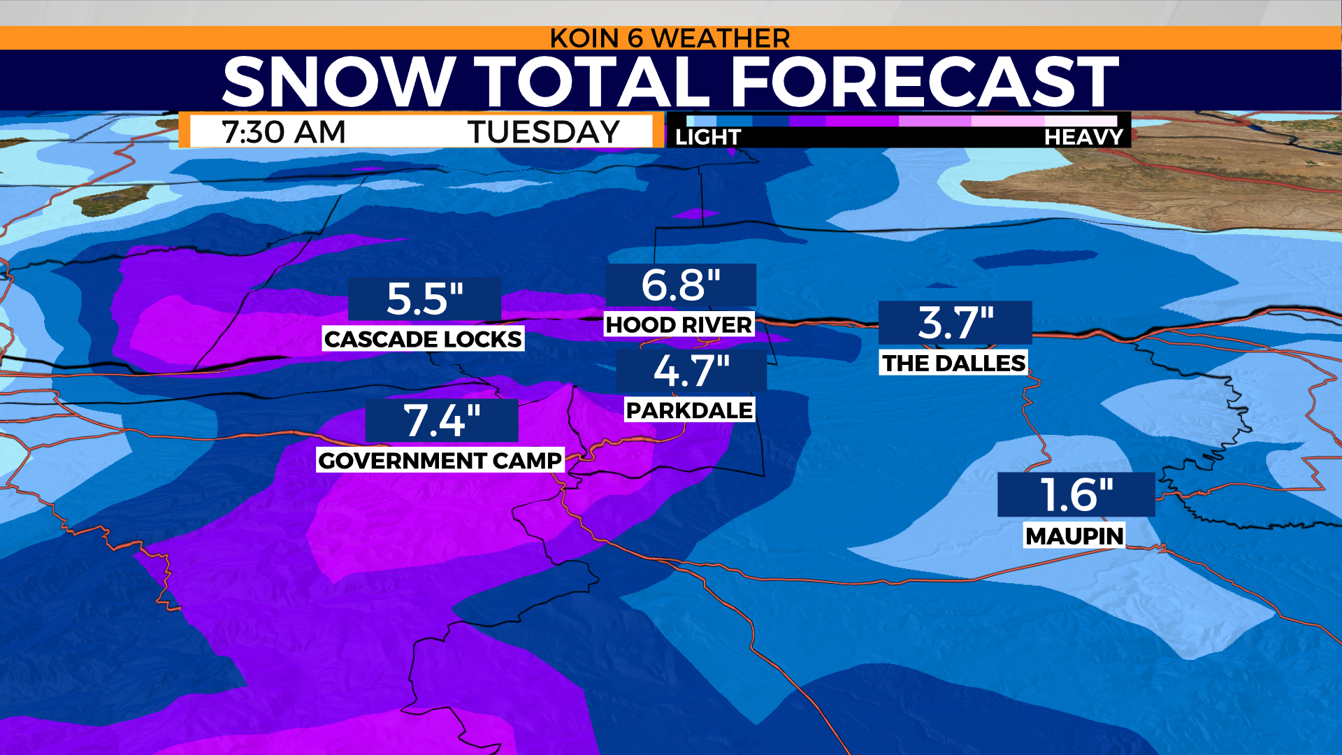
There will be multiple inches of snow for areas like Hood River and Cascade Locks through the remainder of the day and early Tuesday morning. This should hamper the travel in the Gorge through the rest of the day. Expecting more snow than ice at this point, but conditions may still call for a wintry mix at times.
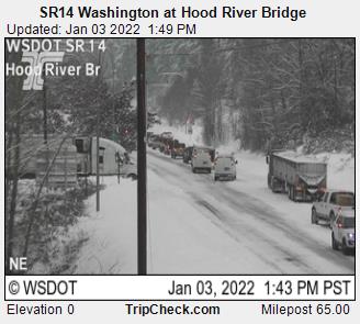
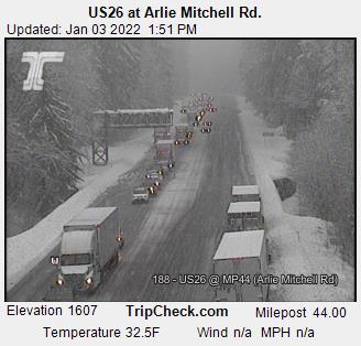
Here are some of the views across the region entering the afternoon hours today. Cars are lined up at SR14 and at US 26 due to closures from the weather. You will want to avoid travel outside of areas of the Willamette Valley and out to the coast today.
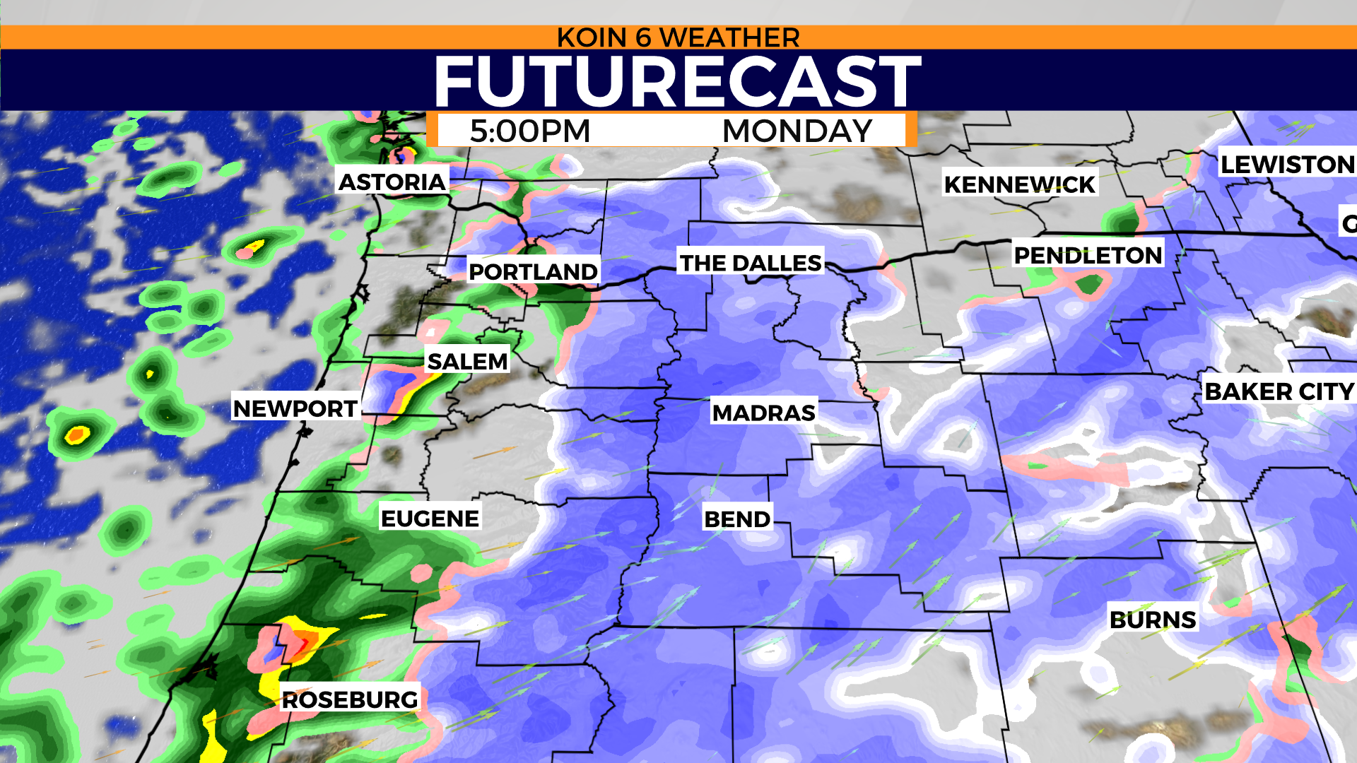
Futurecast keeps scattered showers in the forecast through the evening. Swipe through the slideshow below to get a visual representation of what we will experience later in the day. Notice that there is some snow trying to fight down into the hills of Cowlitz and Clark counties. We may even have a few showers produce snow around the hills of Portland or areas of the coast Range. The larger concern will still be the Gorge and through the mountain passes tonight. It is likely that another foot of snow falls up on the mountain from this afternoon through Tuesday afternoon. A southerly wind should keep conditions warm enough down at the floor of the valley, but the foothills of the Cascades are still vulnerable down to 1,000 to 2,000 feet today. Snow continues to fall for central and eastern Oregon this evening.
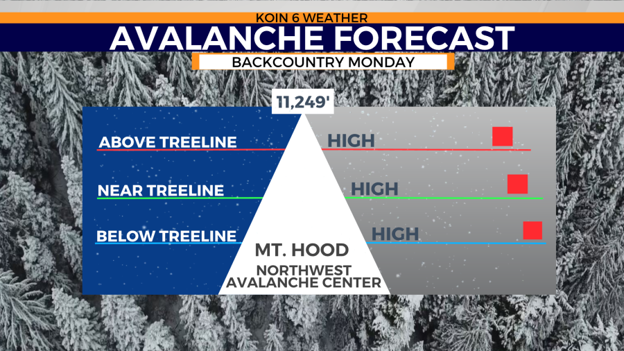
The heavy snow is leading to a high risk of avalanche for the northern Cascades today too. You can read more about that here.
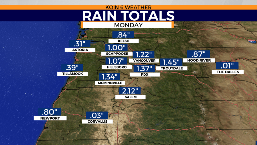
As of Monday afternoon, Portland has received 1.37 inches of rain. The forecast was calling for 1.25 to 1.75 inches of rain through Monday night. We are right in that window, which is also enough to break a record here in Portland. The previous record was 1.32 inches set back in 1966! Today we have topped that and that rain total should climb by tonight. A notable location is Salem, which has now picked up over two inches of rain since midnight. Heavy rain like this can cause some issues to the vulnerable spots across the valley and out to the coast range. This is the type of rain that weakens the bed of the ground and we may have some issues with the ground giving away or trees losing the stability that they need. We are expecting an additional quarter-inch of rain through the rest of the day. More rain is expected to the south, with less to the north.
You may have some issues driving north and south on I-5 today due to excess water on the roads. Localized flooding is also a concern because of the large rain totals that we’ve had going back to midnight. However, there should be some time for improvement in some areas because of the lull in the action later tonight.

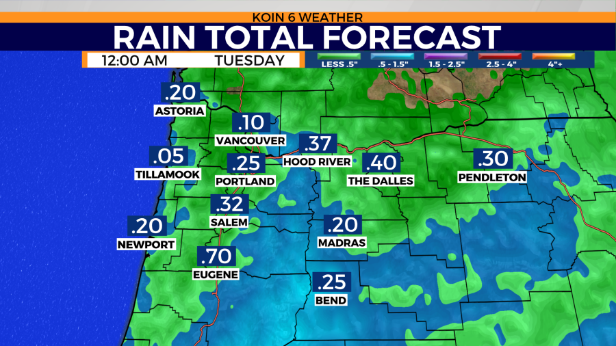
We gear up for our second surge of moisture that moves in from the southwest Tuesday.