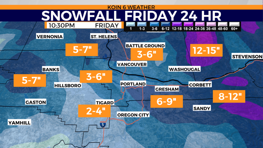
Editor’s note: Please click here for our latest weather forecast on the upcoming significant winter weather event, which is slated to bring snow and freezing rain to the region.
PORTLAND, Ore. (KOIN) – There may be a morning where you’re waking up to a white scene, but our Wednesday will be dry and the winter weather isn’t quite here yet.
However, we do want you prepared for it when it does start to move on in. That timeframe for winter weather is set for Thursday, but it may be Friday morning when you find the snow on the ground in your neighborhood. For Wednesday, we are shooting for the mid-40s under a mostly sunny sky. Clouds increasing later in the day and then you may get some light precipitation from Wednesday night to Thursday.
Now let’s talk about the winter weather!
What hasn’t changed:
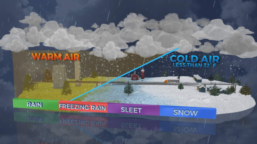
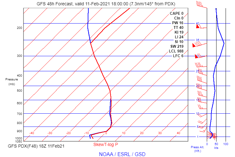
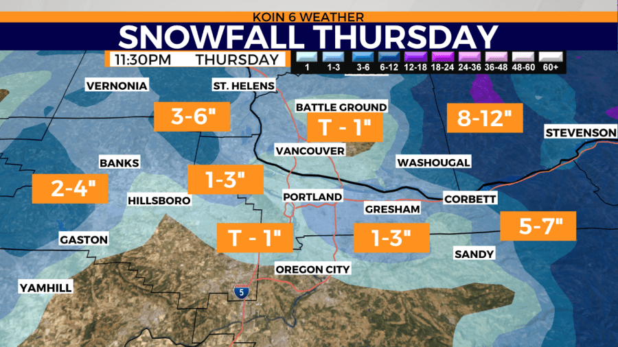
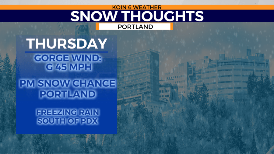
Cold air comes rushing in during the day Thursday. The east wind should be fastened early and it becomes stronger through the day. This is mainly for the surface, with the wind shifting to the southwest around 3,000 to 5,000 ft. That means we may have some issues with a wintry mix of precipitation across the valley. A layer of warm air aloft may lead to freezing rain leading to icy conditions. It is likely that Portland has a similar transition from rain to freezing rain to snow, although a greater threat to the south. Snow likely later in the day Thursday, leading to accumulating snow into Friday. Those thoughts have not changed much. Heaviest of the snow will be east and closer to the mouth of the Gorge.
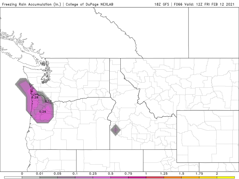
Here is an idea of one of the freezing rain accumulation by Friday morning. This can lead to a very icy start to your day on Friday. Now we will have to see if that wintry mix makes it to the Oregon coast, but I would be prepared for that in the valley. You can see some accumulations pushing .25 inches and we may have more than that by later in the day Friday.
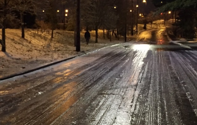
We know that freezing rain can be just as treacherous, if not more, than snow. Your Thursday evening commute may be impacted and that goes for Friday morning. This is going to be a timeframe that you really need to prepare for winter conditions.
We have plenty of hills around here and you know what the terrain is like around your commute and path.
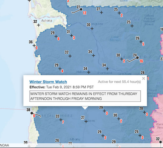
Right now the National Weather Service in Portland has issued a Winter Storm Watch for the Willamette Valley and surrounding communities. Here is the statement regarding the Willamette Valley:
Heavy snow possible. Total snow accumulations of 1 to 6 inches possible. Occasional light freezing rain or sleet is possible, mainly to the west and south of Portland Thursday afternoon into early evening. Winds could gust as high as 45 mph, with strongest winds east of Interstate 205 towards the Columbia Gorge.
NATIONAL WEATHER SERVICE – PORTLAND, OREGON
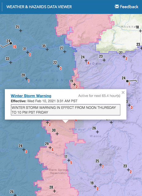
FOR THE COLUMBIA RIVER GORGE
Heavy snow possible. Total snow accumulations of 5 to 10 inches possible. Winds could gust as high as 45 mph with gusts of 45 to 60 mph west of Cascade Locks.
NATIONAL WEATHER SERVICE – PORTLAND, OREGON
What may change:
It is still possible that the snow totals change by the time we get to the event on Thursday. Why? Well everything mentioned above. We may have a moment that is a wintry mix and not snow. We may also have a new tracking to the area of low pressure that could alter snow totals.
We may also have more going on this weekend which will be a follow up to what happens Thursday and Friday.
Snow thoughts:
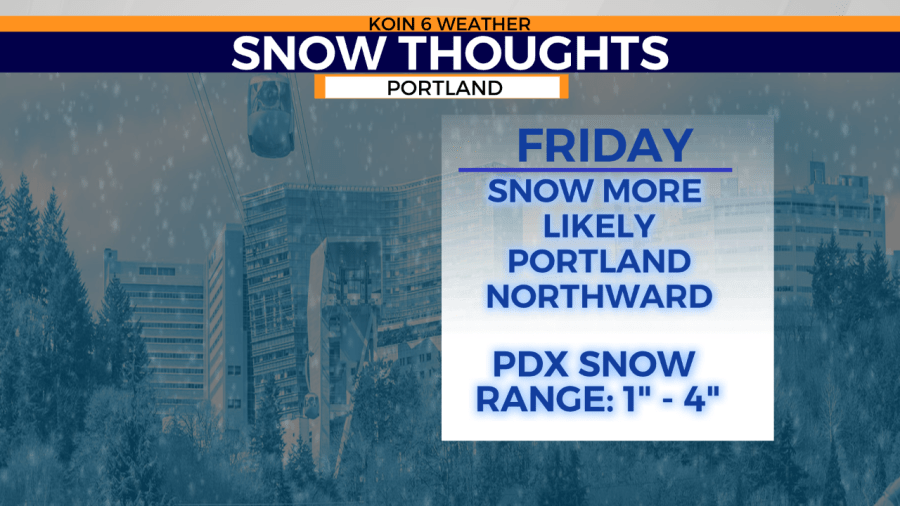
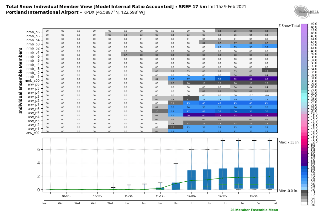
If we look at an ensemble of weather models for the upcoming winter storm, we find a range of a zero to 3 or 4 inches of snow for Portland. Those are good numbers to anticipate for our upcoming event Thursday through Friday morning. Snow totals again higher near the Gorge and to the north, with lower totals to the south and west. Snow adding up overnight into Friday morning.
Don’t forget to follow us on social media and to keep up with the forecast the next 24 hours!
