PORTLAND, Ore. (KOIN) – Just like that, Portland is coming in at No. 10 for the wettest May on record. That is going back to the early 40s!
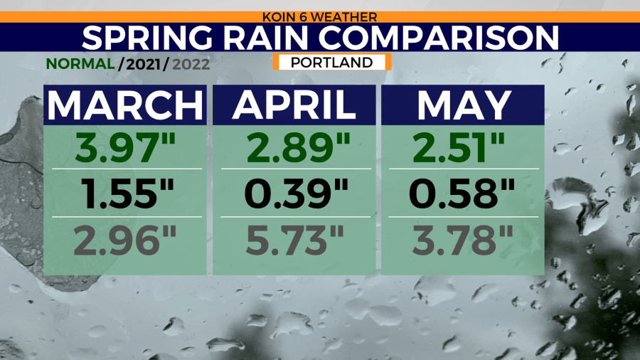
Portland is set to finish the month with 3.78 inches of measurable rain. To put this into recent perspective, we brought in 6.5 times more rain this May than we did in 2021. The average rainfall for the month of May is around 2.5 inches.
There is more to the story.
Spring 2021 was the driest spring on record, with only 2.52 inches of total rain over the course of three months. This year, we have finished the meteorological spring with 12.47 inches of rain! That is nearly 10 more inches than what we had accumulated last year. Talk about a significant difference between two years.
This is a good example that not all La Niña years are the same. The combination of March, April and May can really set up the summer for success — or in some years, it may be the start of a struggling and parched environment.
Unfortunately, this rain didn’t reach all of the state this spring. It was enough to help drought conditions locally, but not spread across the state.

We can now start thinking about the start of June! Are we just going to turn off the rain? That’s not exactly how it works out, but that is how it feels some years.
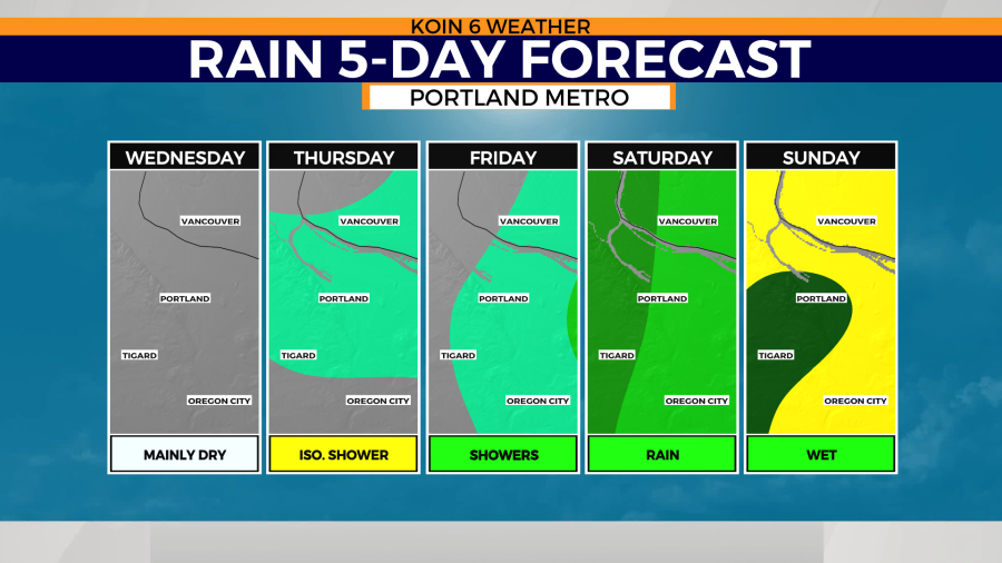
This year, we are confident that we will at least start with some rain this weekend. The 5-day forecast for rain, shows a chance for showers the next three days, with light to moderate rain by the weekend.
We are not on our way to a completely dry June — which is excellent news because we want to keep the rain coming. The cooler temperatures aloft will also help with preventing a quick melt of the snow. Summer is truly around the corner, so our fortune for rain isn’t promised to continue.
The wettest day coming up appears to be Sunday. We will keep our focus on the weekend, as it will be the first of the month and it is trending to be wet. There will be a transition from warmer and drier air midweek to that cooler and wet weather this weekend.

This all means we are wrapping up meteorological spring and now pushing into meteorological summer!
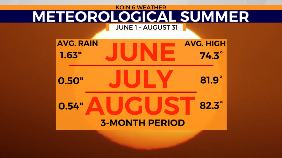
Check out the link below for a more information about meteorological seasons. Meteorological summer is the three month period of June, July, and August. This is when we really notice the warmer and drier conditions for the Pacific Northwest (PNW). This is essentially when we turn the faucet from flowing to dripping.
JUNE: AVERAGE RAIN – 1.63″, AVERAGE HIGH – 74.3°
JULY: AVERAGE RAIN – 0.50″, AVERAGE HIGH – 81.9°
AUGUST: AVERAGE RAIN – 0.54″, AVERAGE HIGH – 82.3°
Last year we had 1.25 inches of rain in Portland for the month of June. We also had an average high of 82.6 degrees! It was the warmest June on record if you average the high and low temperatures together. That came in at 70.7 degrees. This is when we had the heat dome in the PNW. We will discuss this in further detail as we get close to the anniversary of that event (25-29).
