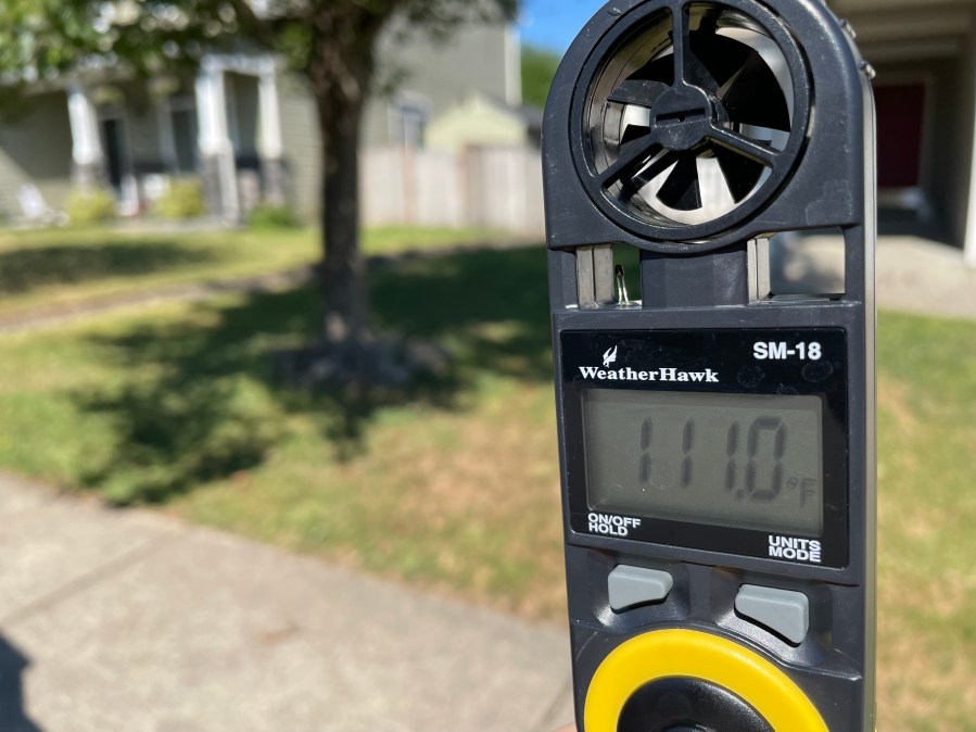
PORTLAND, Ore. (KOIN) — There were just three miserable hours left before reaching the hottest part of the day and the temperature was already 100° in Portland. My family was overheating under a canopy on the grass, partially distracted by the commotion at a local splash pad. This kind of heat would barely pass as acceptable in August but here it was June 26!
My husband who’s largely unshaken by anything, statistically 40% macho and 60% dismissive, turns to me beet red and says, “our kids are going to have tough times ahead.”
Was he right? Would this high-pressure hell coined a heat dome haunt us every summer, or worse – multiple times a year? Or was it just some nightmarish anomaly? Were we on a one-way road to famine, mega-fires, water wars? These were not wild ideas. This was already happening.
My generation never had to worry about these kind of weather catastrophes, at least, that was my sheltered view. I grew up thriving in 1980’s excess. Why conserve when you can splurge? Drought be damned! A 30-minute shower was a God-given right. Go on, spray your hair high to the heavens with ozone-depleting CFCs. Crank that air conditioning to 65º. Single-use plastic lifestyles are a thing of the past. The only thing I can promise my kids now is mild relief at a splash pad and a future of consternation.

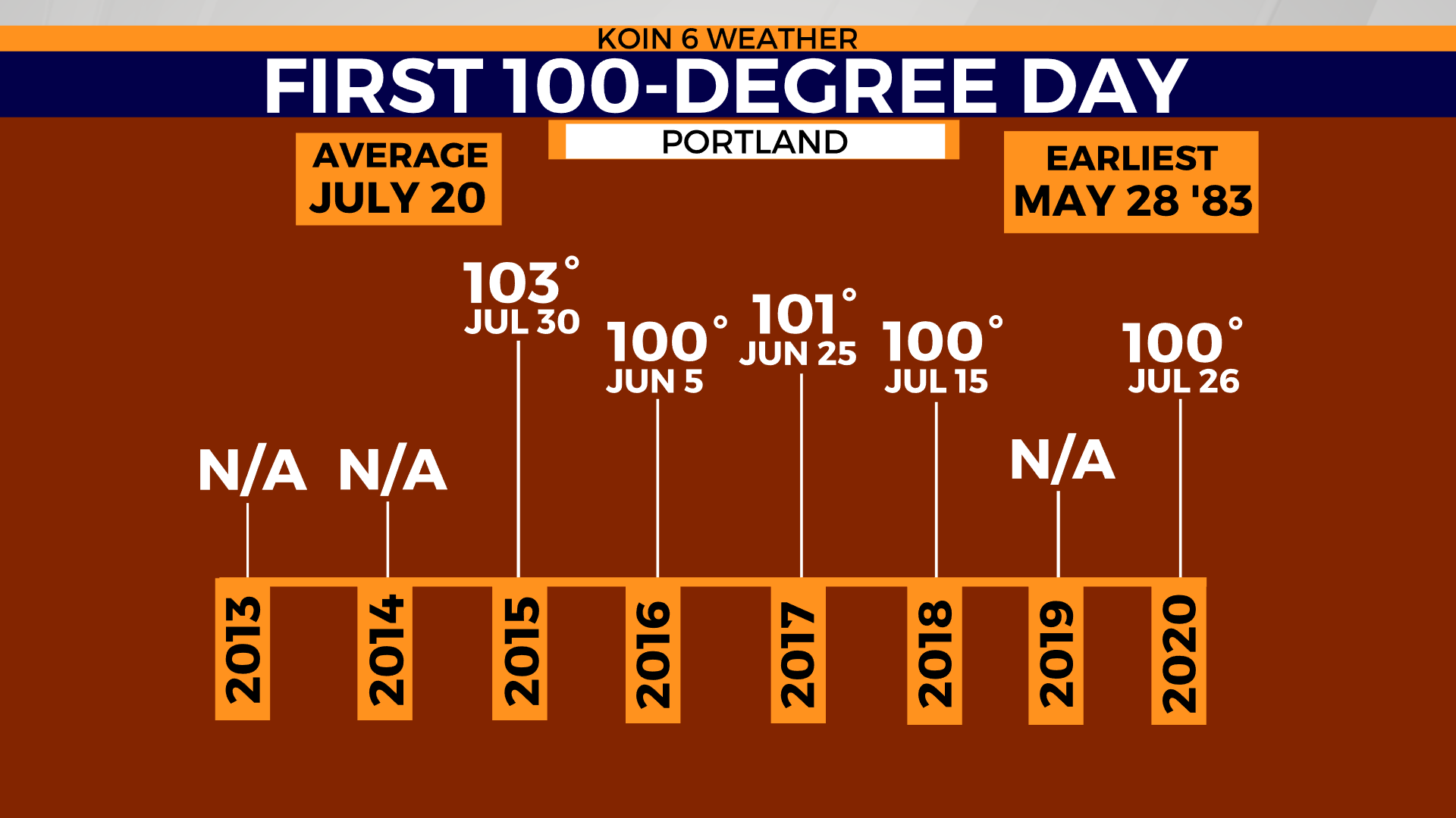
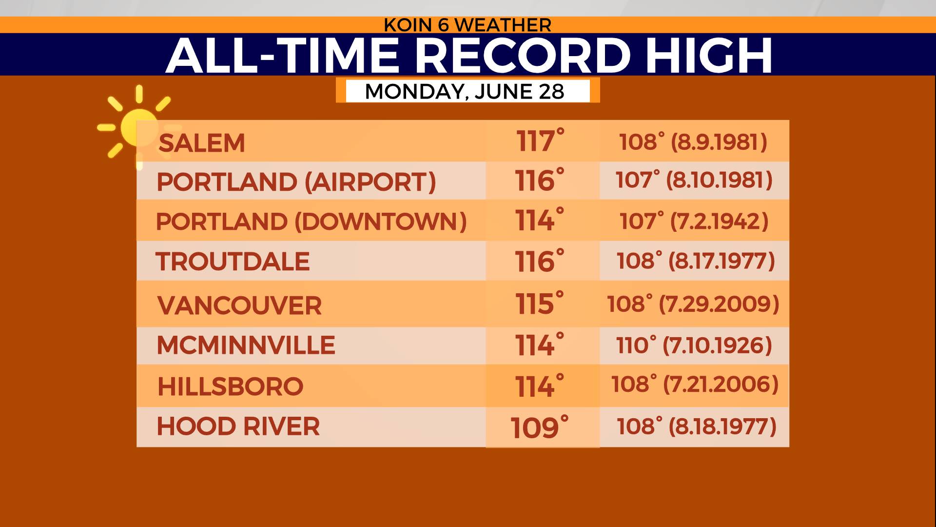
Portland’s normal high for June 26th was 78º, based on the 30-year climatological normal. The first 100º day doesn’t occur until July 20, on average. Portland’s weather records go back as far as 1858 with local climate data for downtown Portland starting in 1871. Portland Airport records, however, started much later in 1940. By all record-keeping accounts, June 2021 was the hottest we’ve ever been, not to mention the earliest for the season. You couldn’t find relief anywhere. We even broke our maximum low temperature record (74). On Monday June 28, Portland’s ‘coolest’ temp was 75. That’s insulting when your daytime high is 116.
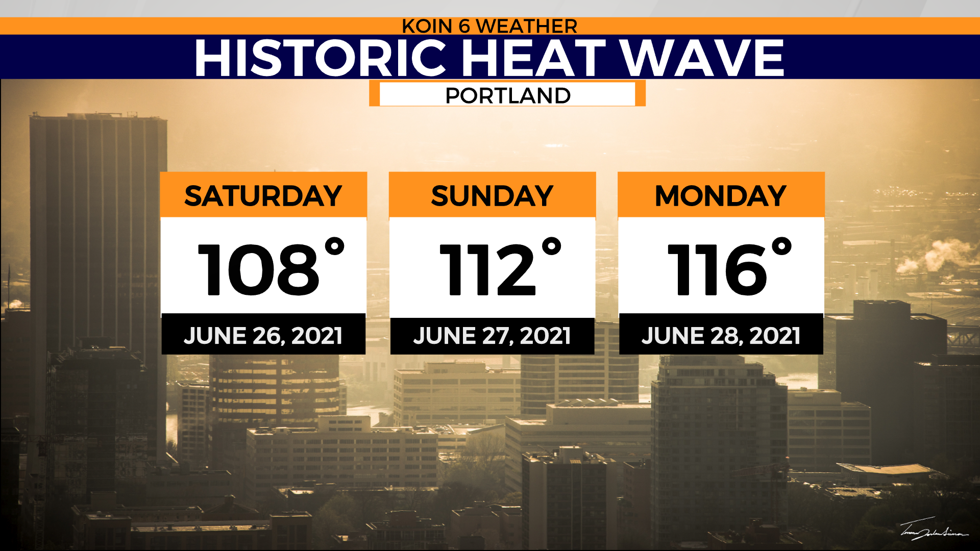
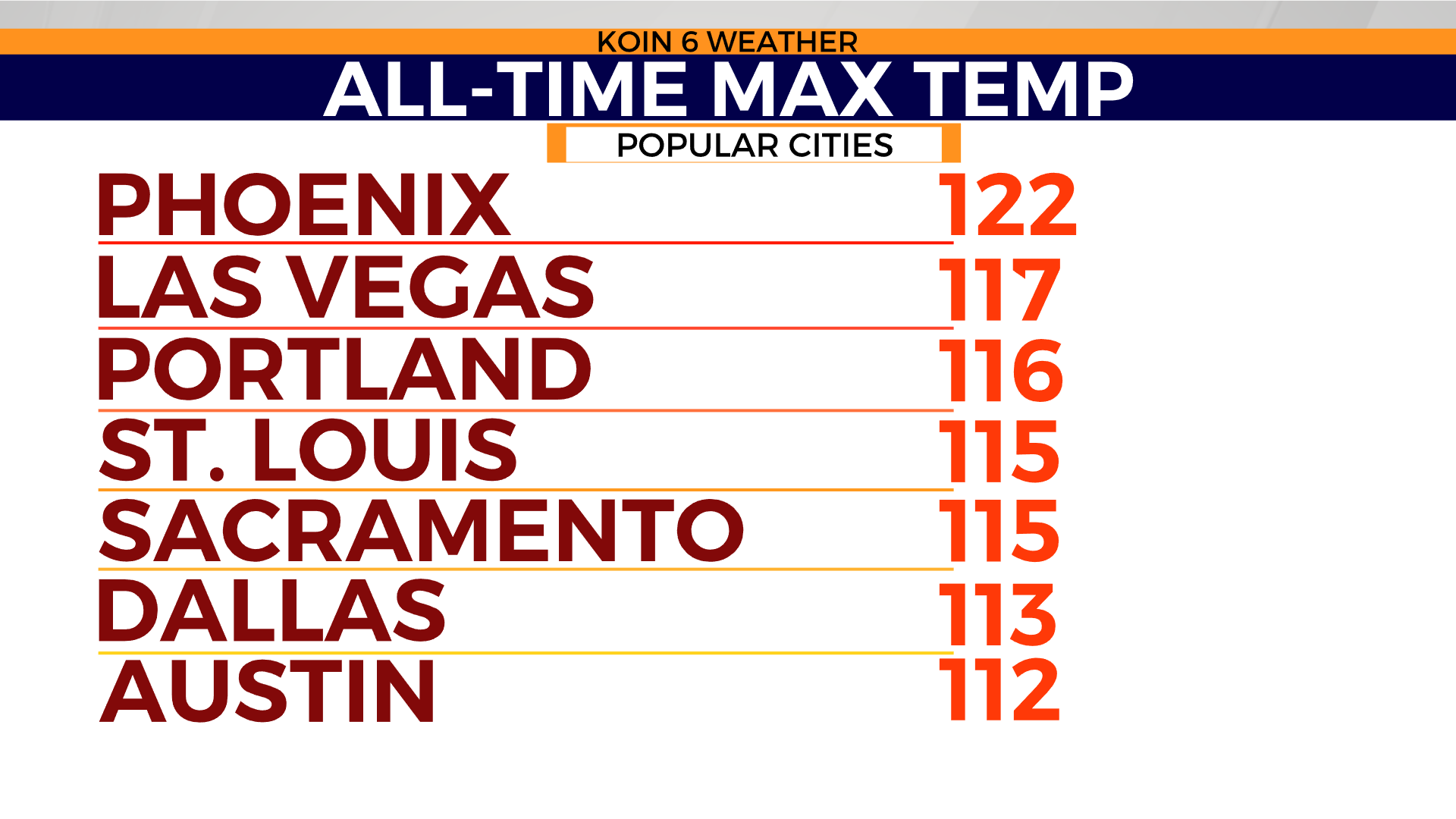
By 6 p.m. on June 26, Portland’s previous all-time record high of 107° had officially cracked. 108º replaced the old record that had last been set in . This marked the beginning of a three-day record-annihilating heat wave. Day two was a slap in the face to the previous day, marking a new all-time high of 112°. Day three – a whopping 116°! When you consider that Las Vegas’ all-time record high stands at 117º, you might say Portland has no business gambling in that club.
How many more of these extreme events will we endure? Could some hellish heat wave knock our current 116° record right out of the trophy cabinet?
Climatologists will tell you chances are good because what seemed impossible has already happened. Dr. Kathie Dello, state climatologist for North Carolina and Director of NCSCO, is intimately familiar with Oregon’s climate. She spent several years as associate director of the Oregon Climate Change Research Institute and Deputy Director of Oregon Climate Service.
Dr. Dello already raised the flag. In 2013 she coauthored History of Pacific Northwest Heat Waves, Synoptic Pattern, and Trends, published in the journal of Applied Meteorology and Climatology.

“If we don’t do anything about climate change, 2021 will be one of Portland’s coolest summers,” she said.
Dello started raising flags after 2009, she recalled to KOIN 6 News, as she and colleagues were in Washington state.
“We were talking about how Western Oregon broke all sorts of temperature records during that heat wave. And maybe it was time to start looking into heat in the Pacific Northwest,” she said. “And I’ll tell you, we went to a meeting in North Carolina where I work now and people laughed at us. They said, the Northwest doesn’t get hot. It’s nice and cool up there.”
Ask any meteorologist what they were thinking a week prior to June 25, and they will tell you forecast models were drinking the Kool-Aid. Forecast high temperatures of 106º, 110º, even 122º in Portland! No way. In June? Not possible. Confidence in forecast model guidance more than seven days out is generally low. Perhaps, intriguing at best but generally taken with a grain of salt. I, for one, was convinced this was forecast model chaos. Even Dr. Dello, in spite of her research on heat waves in the Pacific Northwest, was skeptical of the extreme temperatures advertised by models.
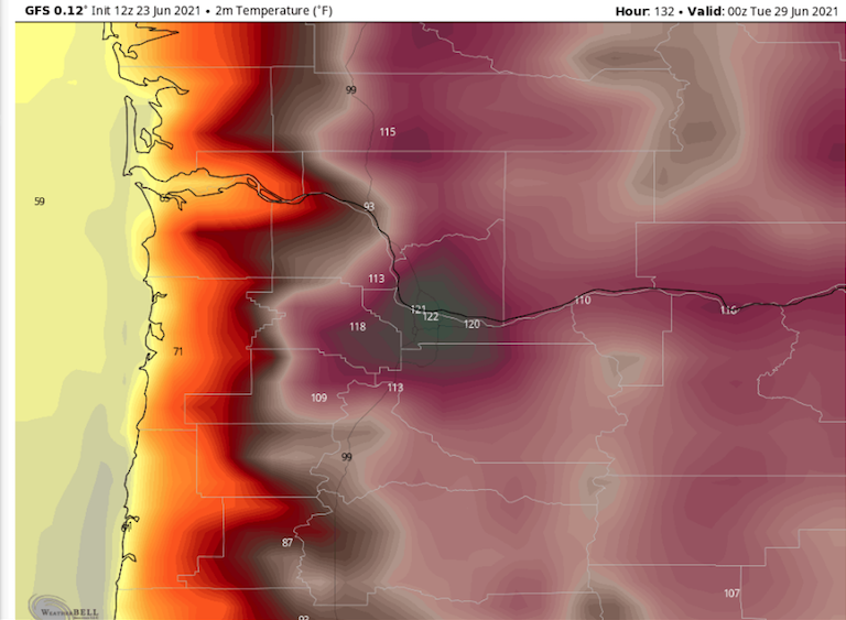
“My first thoughts were disbelief when I saw some of the forecasted numbers because they were so far beyond anything we had seen. And I was thinking back to the 2009 in particular, but as the week went on and the numbers stuck then I started to switch to worrying. You know, is Portland prepared for this? Is Western Oregon prepared for this? And when I was there two years ago, the answer was no. We didn’t have air conditioning in a lot of places. So it was, it was really wild to watch this happen from afar and see Portland hit 116º degrees. It just obliterated the old record,” Dello said.
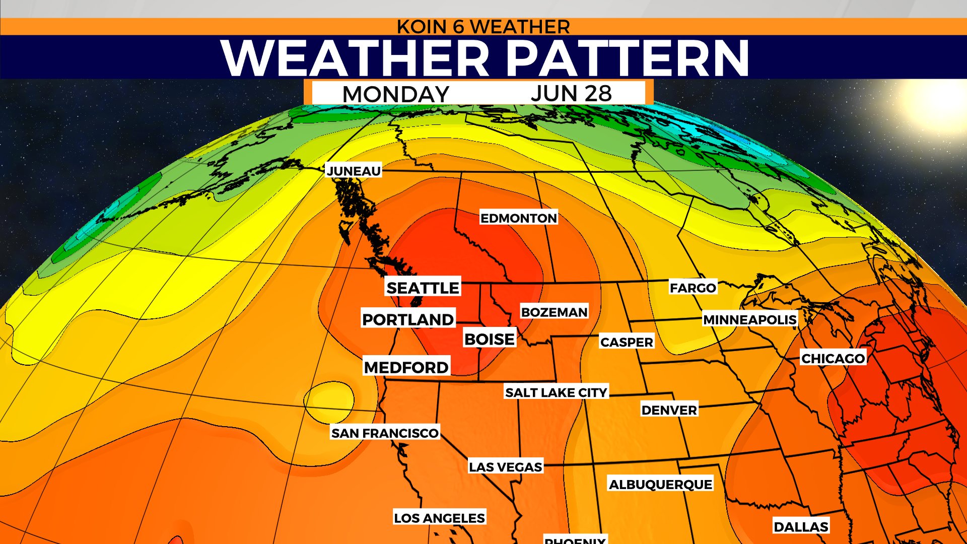
Why did the Pacific Northwest become a heat dome magnet?
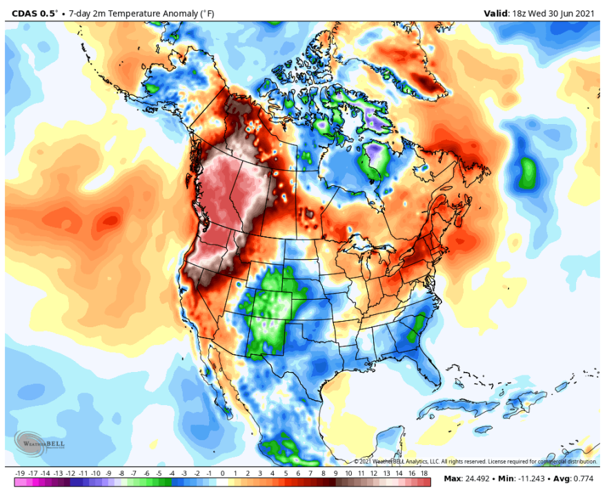
It’s not that heat waves don’t happen. They do, and we have records to prove that. It was the duration of heat, the rapid increase in temperatures beyond anything we ever recorded, and all of this coming together so early in the season. That’s what’s unprecedented, according to Dr. Larry W. O’Neill, a climatologist for the state of Oregon and a professor at Oregon State University.

“The fact that it was so strong, that is an indication I think, of climate change contributing to it,” O’Neill said. “As the climate changes, it changes our weather patterns. It changes the baseline temperature. It changes the conditions from which these heat waves manifest themselves.
“When we have these tropical cyclones that are in the Western Pacific, near Indonesia, Taiwan, it can set off these [Rossby] waves in the atmosphere and we can’t really see them directly, like we can ocean waves, but we can see the effects in things like wind and temperature. So when those waves are set off, after a couple of days, they can cross the Pacific to the Northern Pacific off our coast. They will break and cause these high pressure anomalies to occur somewhere in the Northwest Pacific. So there’ve been studies that have showed that under a specific set of circumstances, these high pressure systems are about three times more common when we have tropical cyclone [activity in the Western Pacific],” he said.
So how do you measure the strength of a dome of high pressure? You measure it with a weather balloon. This balloon is released twice a day across the country and carries specialized equipment that basically takes a samples of all layers of the atmosphere up to about 100,000 feet. In the case of our heat wave, the highest pressure ever for our area was recorded.
“That weather balloon actually measured the highest pressure at that level that we had ever seen before,” O’Neill said. “And so that is indicative of basically the strengths of the Ridge and the amount of heat that was built up in within it.”

Oregon is in a long-term drought. Yes, we’ve had droughts before and we’ve had years without drought. What’s important to note is the big picture trend. Climatologists point to a feedback loop where drought exacerbates heat and heat exacerbates drought. We see the effects of drought all around us. A dramatically reduced snowpack, impacts on recreation, fishing, industry, farming, and environment. When the water goes from a roar to a trickle that has a major trickle down effect.
“Climate change isn’t a rich person’s problem right now. It’s hurting poor people the most. I moved to Oregon right after the 2009 heat wave,” Dello said. “So that was fresh on everybody’s mind, but, you know, I just, I knew the region wasn’t prepared and the death toll is going to be much higher in the coming weeks. And it’s just truly heartbreaking.”
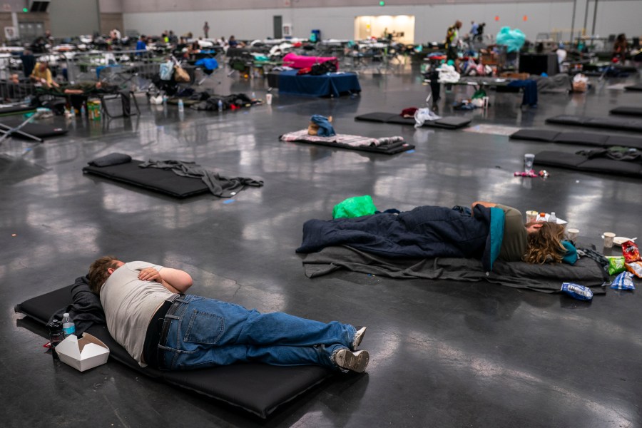
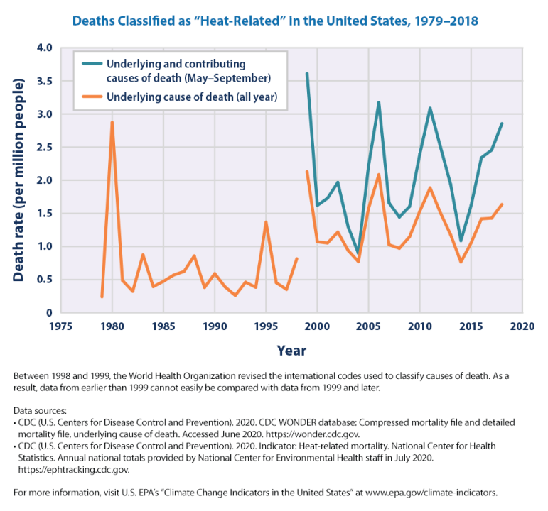
At least 116 deaths are connected to the historic heat wave of late June, according to the Oregon State Medical Examiner’s Office, with 72 of those deaths reported in Multnomah County alone.

