
PORTLAND, Ore. (KOIN) — The Pacific Northwest will face various forms of winter precipitation this week: Rain, snow, freezing rain and sleet.
While rain is fairly straightforward, the difference between snow, sleet and freezing rain is a bit more confusing. In response to this confusion, the National Weather Service has provided the public with some simplified explanations that might bring you some clarity during the frantic holiday season.
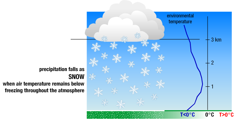
Snow
Did you know? Most precipitation that forms in the wintertime starts out as snow. It’s true. The National Weather Service says that snowflakes are simply groupings of ice crystals that form in freezing atmospheric temperatures. These crystals cling together as they fall toward the ground, and as long as temperatures remain at or below 32 degrees, the crystals should remain snow all the way down.
There are other, special circumstances where snow can form while atmospheric temperatures are not below freezing. But generally, this is how snow is formed. When falling snow encounters warmer temperatures, it begins to change shape.
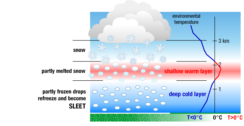
Sleet
When falling snow reaches temperatures warmer than 32 degrees on its way to the ground, it melts. Sometimes that melted snow will remain a liquid and reach the ground as rain. In other cases, the snow can partially melt and then refreeze before hitting the ground as frozen rain. This is known as sleet.
Sleet typically forms when falling snow passes through layers of air between 34 and 38 degrees, and then re-enters freezing conditions. Sleet can typically be identified by its tendency to bounce when it hits the pavement.
Sleet can look like and be mistaken for snow if it begins to accumulate on the ground.
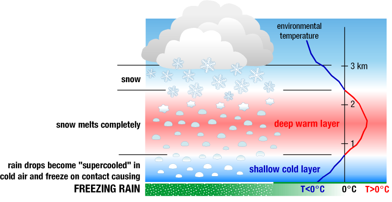
Freezing rain
So, if sleet is frozen raindrops, then what is freezing rain? After falling snow melts, as previously mentioned, it can then reencounter a shallow layer of freezing air at the Earth’s surface. Because the shallow freezing layer doesn’t allow the rain enough time to refreeze into sleet before reaching the Earth’s surface, it freezes on contact with surface objects.
This, the NWS says, can create “very hazardous conditions” like icy roads and heavy, ice-coated tree branches that can snap off and damage cars, power lines or anything else in their path. Portland and much of the Pacific Northwest will be at risk of experiencing freezing rain on Thursday and Friday. A Winter Storm Warning has been issued by NWS starting at 4 p.m. on Thursday and is expected to end at 10 p.m. on Friday.
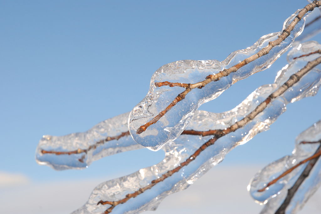
If a significant amount of freezing rain accumulates over a period of a few hours, this nasty form of winter weather is known as an ice storm.