PORTLAND, Ore. (KOIN) — Evacuation notices remain in place near the Cedar Creek Fire Monday as heavy smoke blankets much of the area, with those east of the fire experiencing unhealthy air quality.
An air quality advisory is in effect Monday for multiple counties spanning central, northeast and southeast Oregon. The following counties are among those impacted: Baker, Crook, Deschutes, eastern Lane, Grant, Harney, Klamath, Lake, Malheur, Umatilla, Union, Wallowa and Wheeler.
The Cedar Creek Fire and the Double Mountain Fire prompted the advisory, which the Oregon Department of Environmental Quality expects to last through Wednesday.
With the wind shifted to the northwest, fire officials say Oakridge and Bend are among the areas experiencing poor air quality. Residents in those communities are urged to limit outdoor activities to protect themselves from the smoke.
Cedar Creek Fire officials expect Monday’s fire activity to be creeping and smoldering, with some spotting and torching possible.
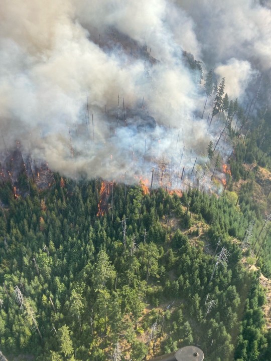
KOIN Complete Coverage: Wildfire Watch 2022
As of Monday morning, fire officials say the blaze has burned 86,734 acres while containment remains at 0%. Firefighters reportedly made some progress on the fire’s west side, however, the lightning-caused wildfire reportedly jumped containment lines over the weekend. Furthermore, mop-up operations are underway for burnouts near Eagle Butte on the western flank.
Meanwhile, fire personnel on the southern portion are reportedly assessing structures and working back burns along Highway 58.
On Monday, evacuation orders were reduced to Level 2 “Be Set” for the High Prairie area, including all of High Prairie Road, Brock Road, Bar BL Ranch Road, Nubian Way, Mountain View Road and Huckleberry Lane. Downgrades in orders were also announced for Westfir-Oakridge Road from Westfir city limits to Roberts Road, McFarland Road and Oakridge north of Laurel Butte Road.
Late Sunday night, evacuation orders were downgraded to Level 2 for some residents in the Westfir and Oakridge areas. Those orders remain in place Monday. Fire officials ask residents to stay away from Level 2 areas if they have mobility issues or sensitivity to smoke.
Those living in the area of the Cedar Creek Fire can view an interactive evacuation map. Residents can also sign up for mobile alerts or contact Lane County Sheriff’s Office at 541-682-4150 or Deschutes County Sheriff’s Office at 541-693-6911 for updates.
The Cascade Lakes Highway is still shut down Monday, while infrastructure protection is in place around Cultus Lake. Trails and campgrounds are also closed at the Deschutes National Forest and Willamette National Forest. Details on Pacific Crest Trail closures can be found here.