PORTLAND, Ore. (KOIN) — Challenge accepted! That’s what the KOIN 6 Weather Team says every time snow returns to Portland’s forecast. That doesn’t mean it comes challenge free.
Meteorologists have the difficult task of breaking down the timing, temperature, moisture and even the size and shape of the snowflake each time the wintery icon returns to the 7-day forecast.
You’ve heard KOIN 6 meteorologists discuss weather models and how they compare to one another, but that is only one part of the forecast. Snow accumulation is at the top of everyone’s mind during the threat of winter weather.
Before a snow event makes its way in to western Oregon and Washington the days leading up to the storm make a big difference. Paved surfaces can store heat for days after the cold moves through. That can make all the difference in snowfall totals. If temperatures don’t cool fast enough or earlier enough before the snow starts falling, then the snow will melt on contact.
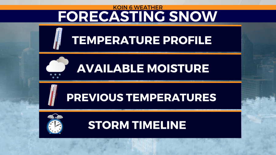
Colder air isn’t able to hold as much moisture as warmer temperatures. So if the cold air is too cold, then the snow potential can also decrease. However, if moisture is still available the temperatures can impact the formation of the ‘snowflake’.

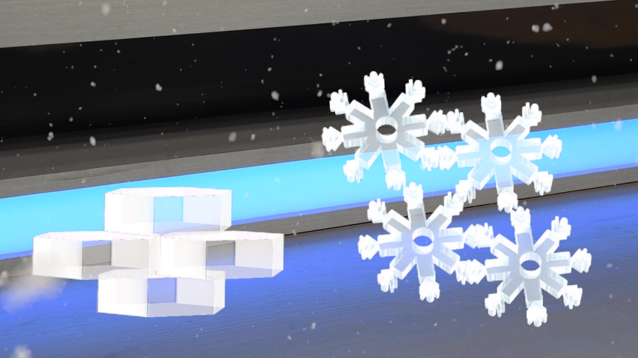
Warmer temperatures usually bring more plate-like icy crystals. These hexagonal ice shapes easily stack nice and flat once they have fallen to the ground. This shape typically has a slightly higher water ratio due to the lack of air between the plates on the ground.
Remember, colder temperatures can’t hold as much water in the atmosphere. So, that helps to give the ice crystal a more classic look. These are known as dendrites.
Dendrites have barbs that stick together when finding their way to the ground. This helps trap air in-between the ice crystals. It might not seem like much, but with many barbs and air spaces stuck together, snow accumulation can add up quickly. This is usually known as light and fluffy snow.
These are just a few obstacles meteorologists have to overcome when snow chances increase. Not to mention if a storm unexpectedly stalls overhead or temperatures are slightly cooler or warmer than expected. That’s why there is always a range given when forecasting snowfall totals. Don’t forget, warmer days prior to the storm can also melt any snow that may fall.